File:StatusMap1008.jpg

Size of this preview: 700 × 600 pixels. Other resolutions: 280 × 240 pixels | 560 × 480 pixels | 896 × 768 pixels | 1,195 × 1,024 pixels | 2,389 × 2,048 pixels | 7,000 × 6,000 pixels.
Original file (7,000 × 6,000 pixels, file size: 1.59 MB, MIME type: image/jpeg)
Captions
Captions
Add a one-line explanation of what this file represents
Summary edit
| Description |
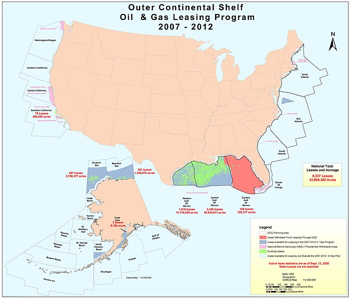
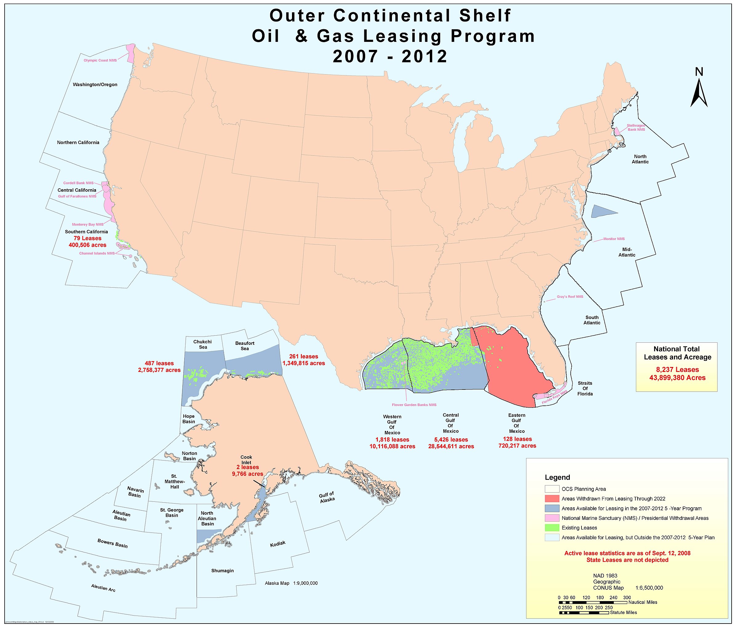
English: Outer continental shelf oil & gas leasing program 2007-2012 |
| Date | |
| Source | http://www.mms.gov/ld/PDFs/OCSstatusMap8e(3).pdf |
| Author | US Minerals Management Service |
| Permission (Reusing this file) |
US federal government |
Licensing edit
| This article or image contains material based on a work of a Minerals Management Service employee, created as part of that person's official duties. As a work of the U.S. federal government, such work is in the public domain in the United States. See MMS Disclaimer. |  |
Original upload log edit
Transferred from en.wikipedia to Commons by Magnus Manske using CommonsHelper.
The original description page was here. All following user names refer to en.wikipedia.
- 2009-01-28 19:18 Plazak 7000×6000× (1670209 bytes) {{Information |Description=Outer continental shelf oil & gas leasing program 2007-2012 |Source=http://www.mms.gov/ld/PDFs/OCSstatusMap8e(3).pdf |Date=September 2008 |Author=US Minerals Management Service |Permission=US federal government |other_versions=
File history
Click on a date/time to view the file as it appeared at that time.
| Date/Time | Thumbnail | Dimensions | User | Comment | |
|---|---|---|---|---|---|
| current | 09:57, 20 February 2011 | | 7,000 × 6,000 (1.59 MB) | File Upload Bot (Magnus Manske) (talk | contribs) | {{BotMoveToCommons|en.wikipedia|year={{subst:CURRENTYEAR}}|month={{subst:CURRENTMONTHNAME}}|day={{subst:CURRENTDAY}}}} {{Information |Description={{en|Outer continental shelf oil & gas leasing program 2007-2012}} |Source=Transferred from [http://en.wikip |
You cannot overwrite this file.
File usage on Commons
There are no pages that use this file.