File:SteeleBayouCSA.jpg
Size of this preview: 380 × 599 pixels. Other resolutions: 152 × 240 pixels | 304 × 480 pixels | 856 × 1,350 pixels.
Original file (856 × 1,350 pixels, file size: 232 KB, MIME type: image/jpeg)
Captions
Captions
Add a one-line explanation of what this file represents
Summary
edit
| Description |
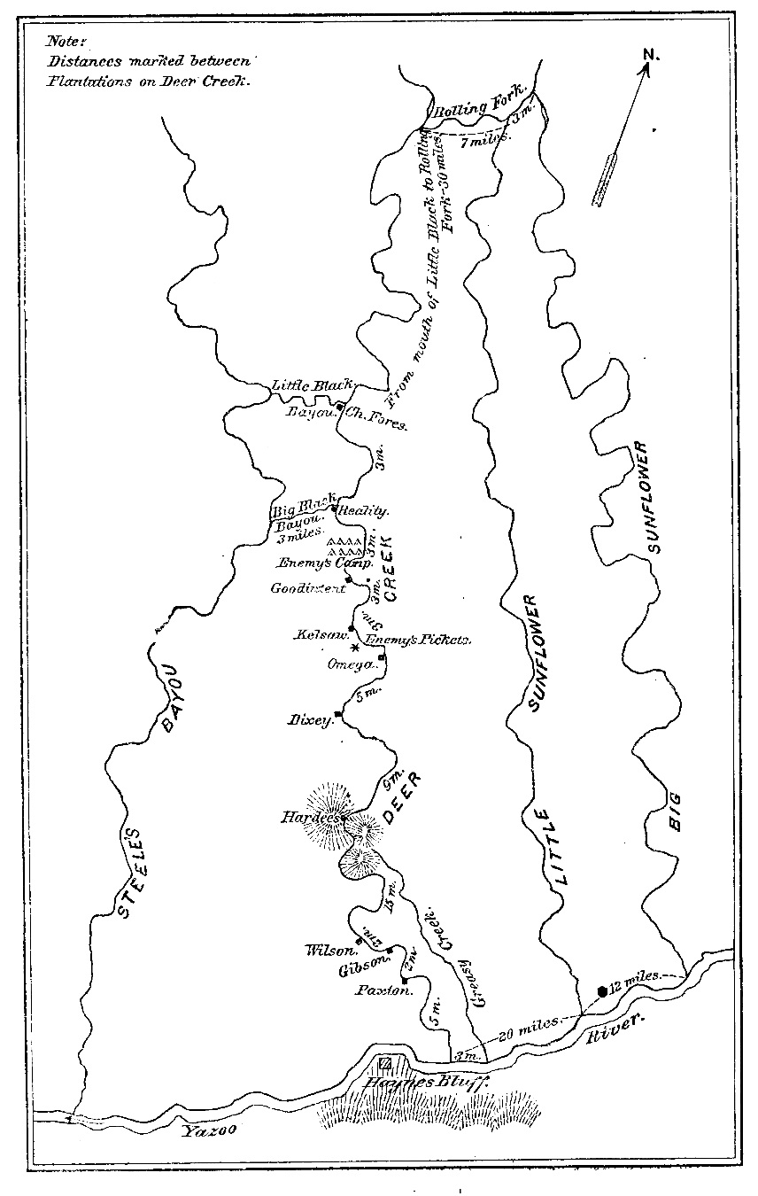
English: Map of the area affected by the Steele's Bayou Expedition of the American Civil War, March 1863, with emphasis on locations of Confederate defenses. |
| Date | |
| Source | War of the Rebellion: a compilation of the official records of the Union and Confederate Armies, ser. I, v 24/1, p. 463. |
| Author | Prepared for Brig. Gen. Stephen D. Lee, CSA |
Licensing
edit
This work is in the public domain in the United States because it is a work prepared by an officer or employee of the United States Government as part of that person’s official duties under the terms of Title 17, Chapter 1, Section 105 of the US Code.
Note: This only applies to original works of the Federal Government and not to the work of any individual U.S. state, territory, commonwealth, county, municipality, or any other subdivision. This template also does not apply to postage stamp designs published by the United States Postal Service since 1978. (See § 313.6(C)(1) of Compendium of U.S. Copyright Office Practices). It also does not apply to certain US coins; see The US Mint Terms of Use.
|
 | |
| This file has been identified as being free of known restrictions under copyright law, including all related and neighboring rights. | ||
File history
Click on a date/time to view the file as it appeared at that time.
| Date/Time | Thumbnail | Dimensions | User | Comment | |
|---|---|---|---|---|---|
| current | 01:55, 16 March 2010 | | 856 × 1,350 (232 KB) | Pkkphysicist (talk | contribs) | {{Information |Description={{en|1=Map of the area affected by the Steele's Bayou Expedition of the American Civil War, March 1863, with emphasis on locations of Confederate defenses. }} |Source=War of the Rebellion: a compilation of the official records o |
You cannot overwrite this file.
File usage on Commons
There are no pages that use this file.
File usage on other wikis
The following other wikis use this file:
- Usage on en.wikipedia.org