File:Steiermark und Kärnten Danckert 1620.jpg

Size of this preview: 644 × 600 pixels. Other resolutions: 258 × 240 pixels | 516 × 480 pixels | 825 × 768 pixels | 1,100 × 1,024 pixels | 2,199 × 2,048 pixels | 6,129 × 5,707 pixels.
Original file (6,129 × 5,707 pixels, file size: 31.8 MB, MIME type: image/jpeg)
Captions
Captions
Add a one-line explanation of what this file represents
Summary
edit
| Description |
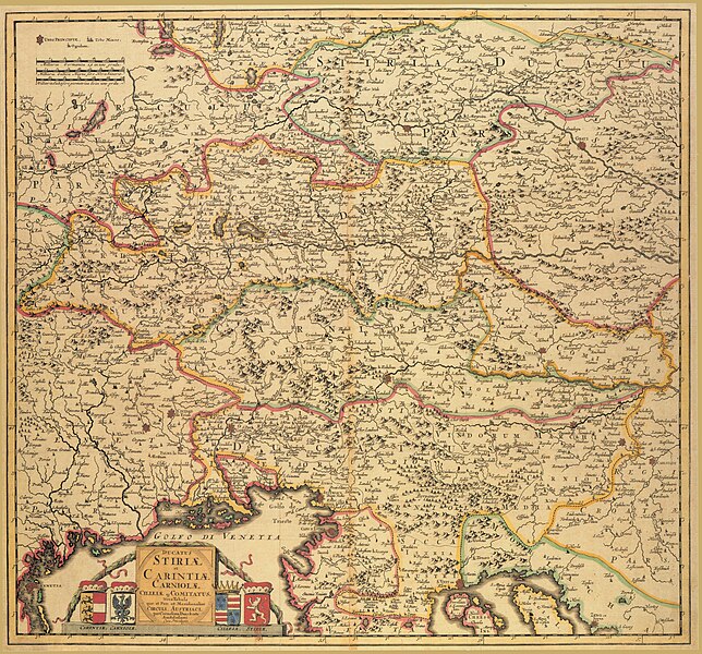
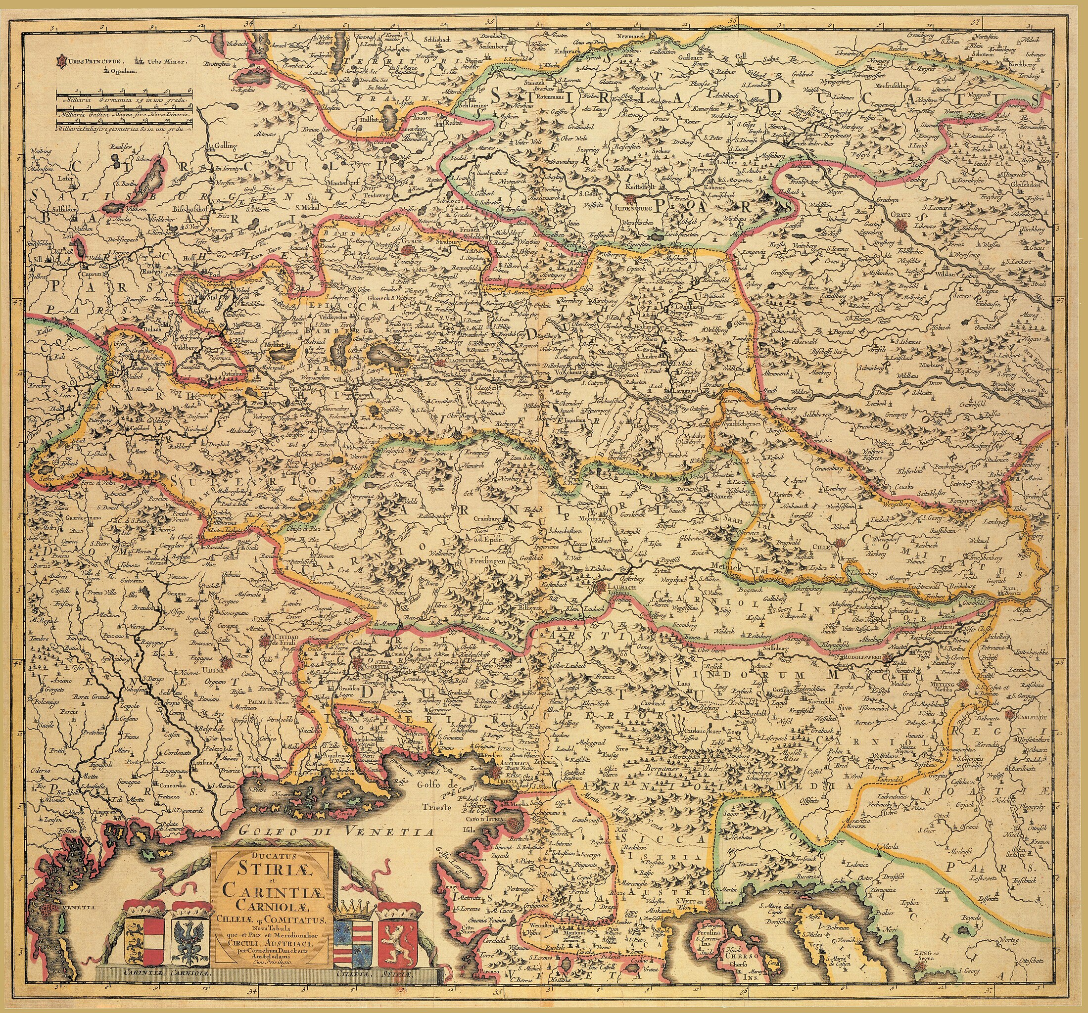
English: Ducatus Stiriae et Carintiae, Carniolae, Cilleiaeque Comitatus Nova Tabula, que et Pars est Meridionalior Circuli Austriace per Cornelium Danckerts Amstelodamie cum Privilegio.
Deutsch: Historische Landkarte von Steiermark, Kärnten, Krain und der Grafschaft Cilli. |
| Date | circa 1620 |
| Source | steiermärkisches Landesarchiv |
| Author | Cornelis Dankert |
| Permission (Reusing this file) |
freies Werk aus dem 17. Jahrhundert |
Licensing
edit
|
This work is in the public domain in its country of origin and other countries and areas where the copyright term is the author's life plus 100 years or fewer. This work is in the public domain in the United States because it was published (or registered with the U.S. Copyright Office) before January 1, 1929. | |
| This file has been identified as being free of known restrictions under copyright law, including all related and neighboring rights. | |
File history
Click on a date/time to view the file as it appeared at that time.
| Date/Time | Thumbnail | Dimensions | User | Comment | |
|---|---|---|---|---|---|
| current | 20:16, 5 July 2010 | | 6,129 × 5,707 (31.8 MB) | Josef Moser (talk | contribs) | {{Information |Description= Ducatus Stiriae et Carintiae, Carniolae, Cilleiaeque Comitatus Nova Tabula, que et Pars est Meridionalior Circuli Austriace per Cornelium Danckerts Amstelodamie cum Privilegio. Historische Landkarte von Steiermark, Kärnten, Kr |
You cannot overwrite this file.
File usage on Commons
The following page uses this file:
- File:Steiermark und Kärnten Danckert 1620 .jpg (file redirect)
File usage on other wikis
The following other wikis use this file:
- Usage on de.wikisource.org