File:Stewart Island map-mk.svg

Size of this PNG preview of this SVG file: 800 × 585 pixels. Other resolutions: 320 × 234 pixels | 640 × 468 pixels | 1,024 × 748 pixels | 1,280 × 936 pixels | 2,560 × 1,871 pixels | 2,237 × 1,635 pixels.
Original file (SVG file, nominally 2,237 × 1,635 pixels, file size: 1.96 MB)
Captions
Captions
Add a one-line explanation of what this file represents
Summary
edit| Description |
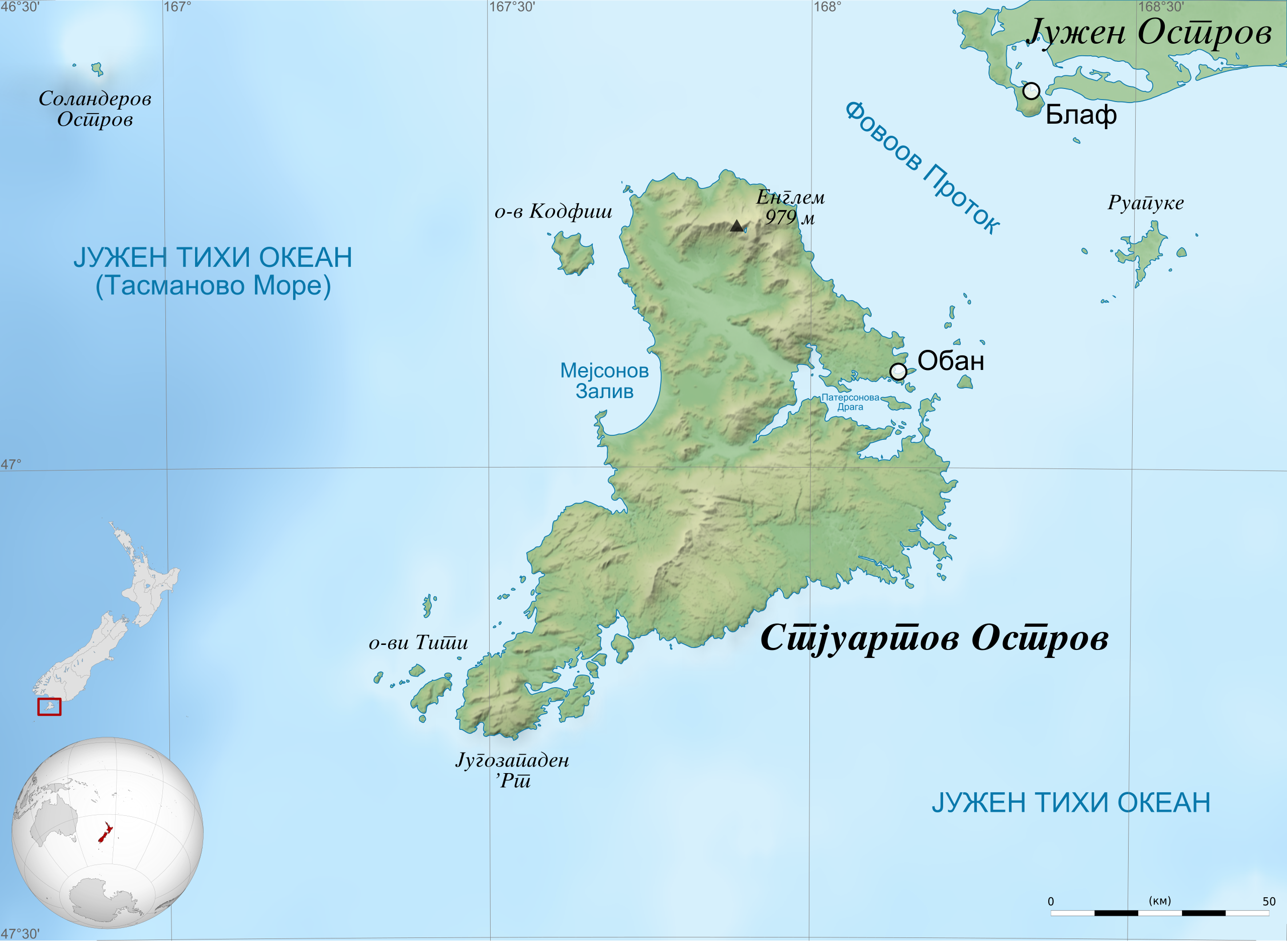
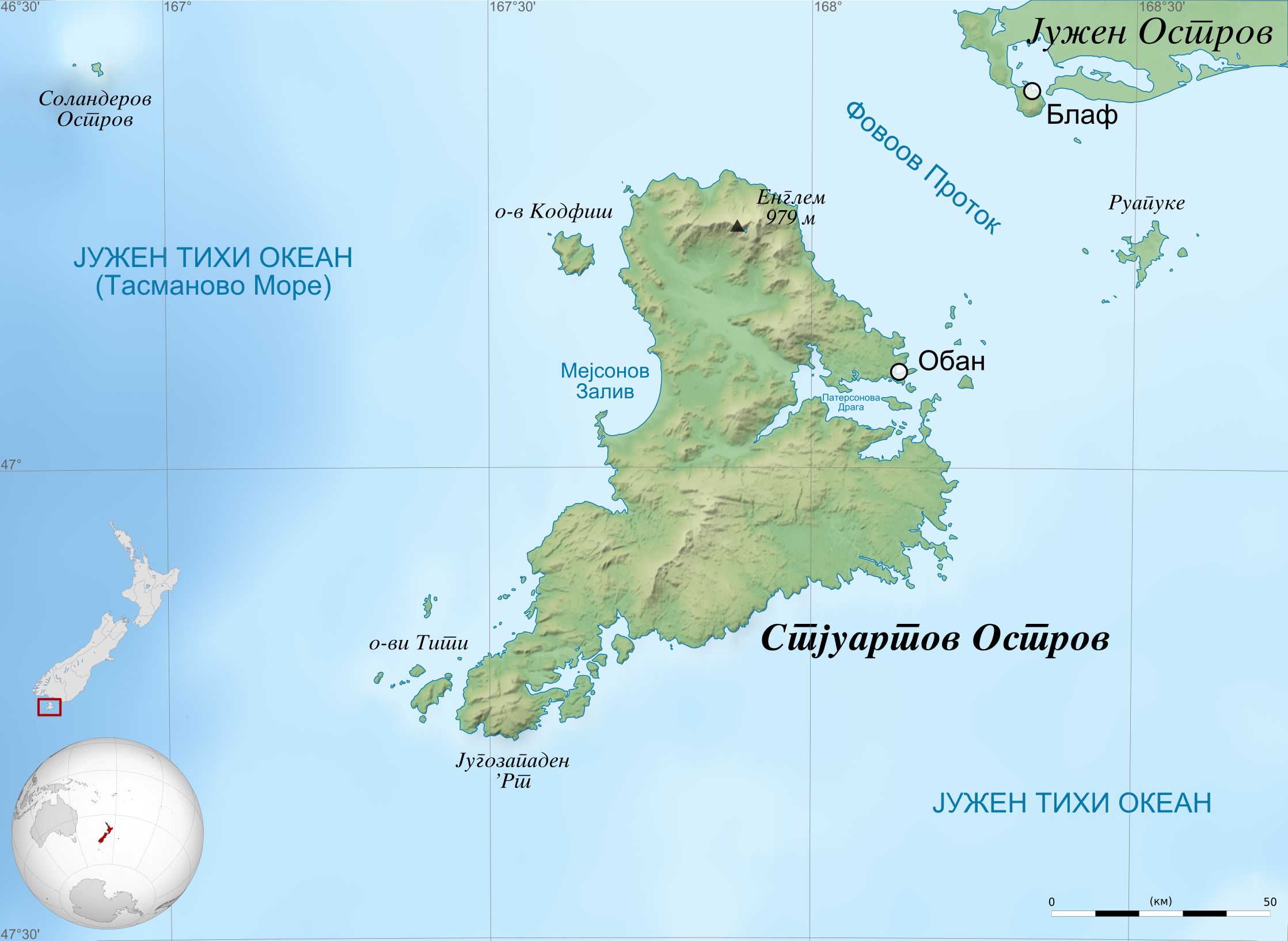
Македонски: Карта на Стјуартовиот Остров (Ракиура).
Географски граници на картата:
English: Map of Stewart Island / Rakiura, New Zealand in Macedonian.
Geographic limits of the map:
|
| Date | (UTC) |
| Source |
This file was derived from: Stewart Island map-en.svg: |
| Author |
|
| Other versions |
|


| This is a retouched picture, which means that it has been digitally altered from its original version. Modifications: Translated into Macedonian. The original can be viewed here: Stewart Island map-en.svg:
|
Licensing
edit
I, the copyright holder of this work, hereby publish it under the following licenses:
This file is licensed under the Creative Commons Attribution-Share Alike 3.0 Unported, 2.5 Generic, 2.0 Generic and 1.0 Generic license.
- You are free:
- to share – to copy, distribute and transmit the work
- to remix – to adapt the work
- Under the following conditions:
- attribution – You must give appropriate credit, provide a link to the license, and indicate if changes were made. You may do so in any reasonable manner, but not in any way that suggests the licensor endorses you or your use.
- share alike – If you remix, transform, or build upon the material, you must distribute your contributions under the same or compatible license as the original.
| Copyleft: This work of art is free; you can redistribute it and/or modify it according to terms of the Free Art License. You will find a specimen of this license on the Copyleft Attitude site as well as on other sites. |
You may select the license of your choice.
Original upload log
edit
This image is a derivative work of the following images:
- File:Stewart_Island_map-en.svg licensed with Cc-by-sa-3.0,2.5,2.0,1.0, FAL
- 2011-04-27T21:22:19Z Sémhur 2237x1635 (1783192 Bytes) == {{int:filedesc}} == {{Information |Description={{Multilingual description |en=Map of [[:en:Stewart Island / Rakiura|]], New Zealand. * Altitude levels: 50 m, 125, 250, 500, etc. (same for bathymetry). * Projection: New Zea
Uploaded with derivativeFX
Licensing
edit
| This file is made available under the Creative Commons CC0 1.0 Universal Public Domain Dedication. | |
| The person who associated a work with this deed has dedicated the work to the public domain by waiving all of their rights to the work worldwide under copyright law, including all related and neighboring rights, to the extent allowed by law. You can copy, modify, distribute and perform the work, even for commercial purposes, all without asking permission.
|
File history
Click on a date/time to view the file as it appeared at that time.
| Date/Time | Thumbnail | Dimensions | User | Comment | |
|---|---|---|---|---|---|
| current | 04:14, 8 December 2012 | | 2,237 × 1,635 (1.96 MB) | Bjankuloski06en (talk | contribs) | Changing scale to only km |
| 11:47, 27 March 2012 |  | 2,237 × 1,635 (1.96 MB) | Bjankuloski06en (talk | contribs) | == {{int:filedesc}} == {{Information |Description={{mk|Карта на Стјуартовиот Остров (Ракиура).}} {{en=Map of Stewart Island / Rakiura, New Zealand ... |
You cannot overwrite this file.
File usage on Commons
The following 4 pages use this file:
File usage on other wikis
The following other wikis use this file:
- Usage on mk.wikipedia.org