File:Stones River Watershed Map.png

Size of this preview: 750 × 600 pixels. Other resolutions: 300 × 240 pixels | 600 × 480 pixels | 960 × 768 pixels | 1,249 × 999 pixels.
Original file (1,249 × 999 pixels, file size: 163 KB, MIME type: image/png)
Captions
Captions
Add a one-line explanation of what this file represents
Summary edit
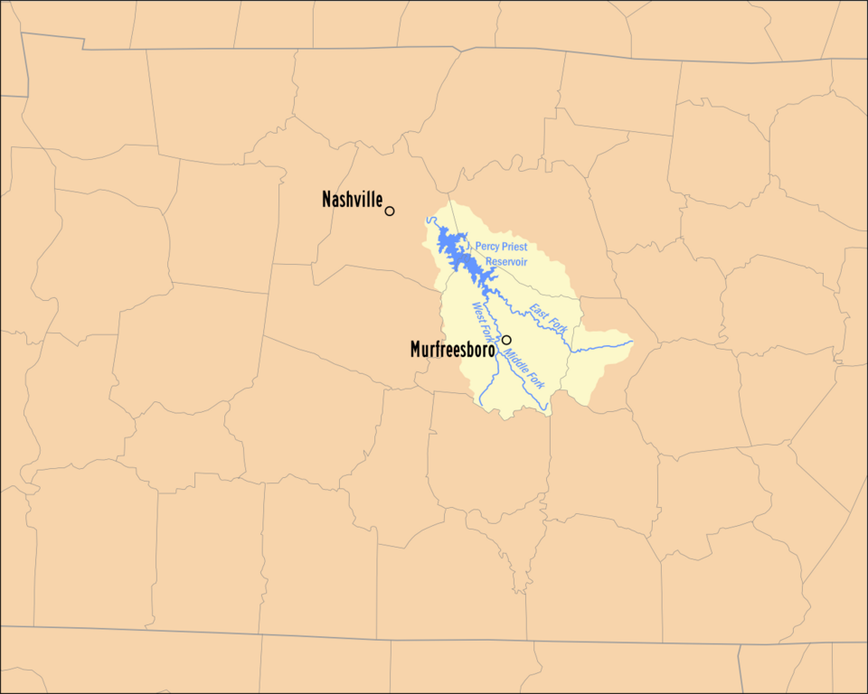
| Description | Map of Stones River Watershed (traced over watershed map from TDEC) |
| Date | |
| Source | Own work |
| Author | Taliesin duomo |
| Permission (Reusing this file) |
Public Domain |
Licensing edit
| I, the copyright holder of this work, release this work into the public domain. This applies worldwide. In some countries this may not be legally possible; if so: I grant anyone the right to use this work for any purpose, without any conditions, unless such conditions are required by law. |
File history
Click on a date/time to view the file as it appeared at that time.
| Date/Time | Thumbnail | Dimensions | User | Comment | |
|---|---|---|---|---|---|
| current | 07:44, 20 November 2007 | | 1,249 × 999 (163 KB) | Taliesin duomo (talk | contribs) | == Summary == {{Information |Description=Map of Caney Fork Watershed (traced over watershed map from [http://www.state.tn.us/environment/wpc/watershed/wsmplans/stones/ TDEC]) |Source=Own Work |Date=November 20, 2007 |Author=[[w:User:Taliesin duomo|Taliesi |
You cannot overwrite this file.
File usage on Commons
The following page uses this file:
File usage on other wikis
The following other wikis use this file:
- Usage on ceb.wikipedia.org
- Usage on en.wikipedia.org
- Usage on www.wikidata.org