File:Straßenbrunnen190 Waidmannslust JeanJaures-Cyclopstraße Nimrodstraße (1).jpg
Size of this preview: 800 × 450 pixels. Other resolutions: 320 × 180 pixels | 640 × 360 pixels | 1,024 × 576 pixels | 1,280 × 720 pixels | 3,264 × 1,836 pixels.
Original file (3,264 × 1,836 pixels, file size: 2.7 MB, MIME type: image/jpeg)
Captions
Captions
Add a one-line explanation of what this file represents
Summary edit
.jpg&action=edit§ion=1)
| Description |
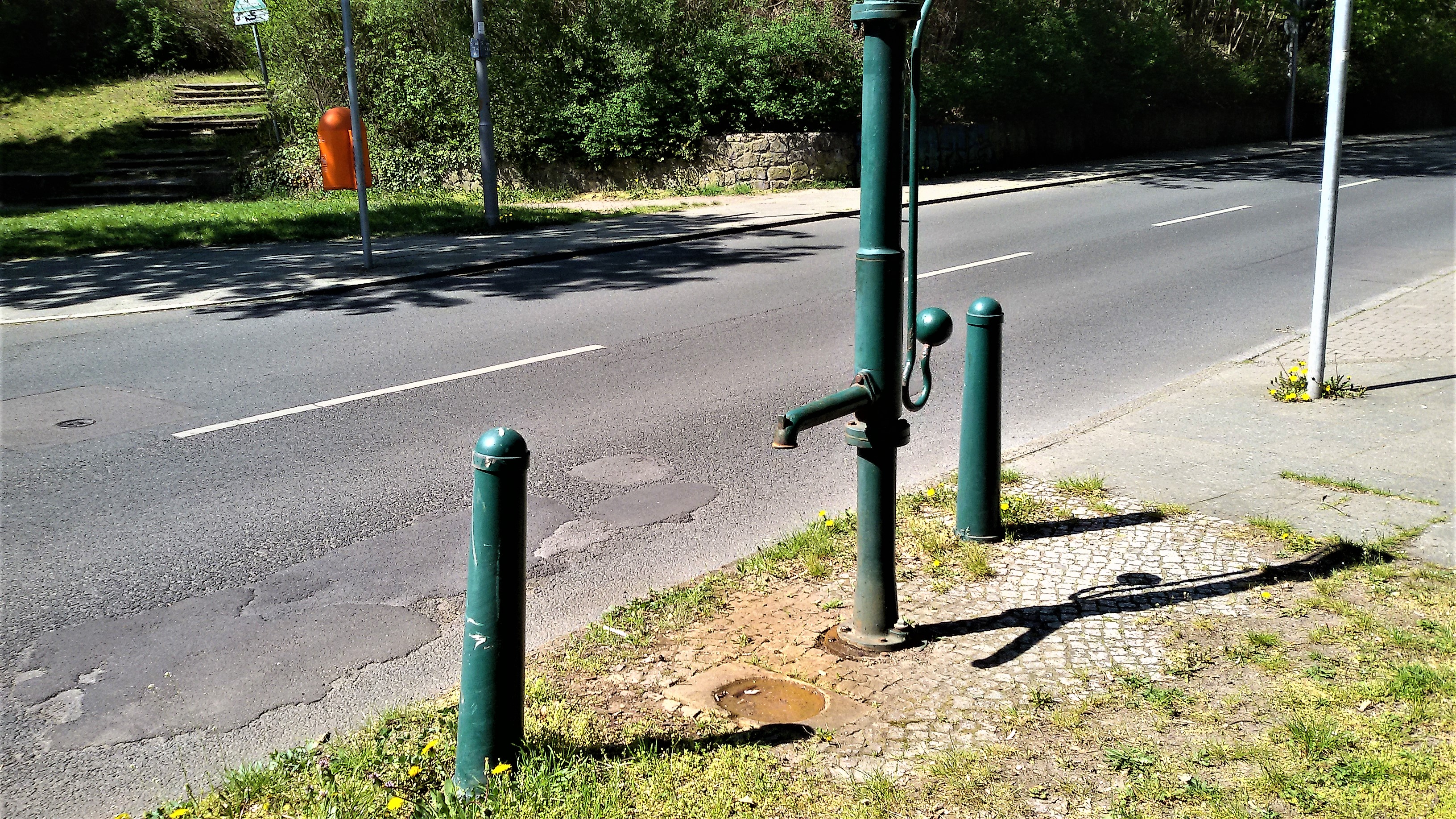
Deutsch: Laut Antwortliste für das Abgeordnetenhaus (Drucksache 17-15418) existiert im Postleitzahlbereich 13469 ein „Brunnen Cyclopstraße“. Die Postleitzahl verweist auf den Abschnitt der Cyclopstraße nördlich der die alten Bahnführung,[1] der seit 1987 nördlich der Hermsdorfer Straße Jean-Jarrès-Straße heißt. Die Cyclopstraße ist nach der 1872 gegründeten Maschinenfabrik Cyclop benannt.[2] Der Straßenbrunnen befindet sich an der Bahnseite(Ostseite) der Jean-Jarrès-Straße, 50 Meter nördlich vom Fußgängertunnel und der Ortsteilgrenze Wittenau/ Waidmannslust am Packereigraben.[3] gegenüber der Nimrodstraße. Für den Wasserabfluss befindet sich seitlich am Brunnenfuß der Muldenstein im Kleinpflasterfeld am Gehwegrand. Die Rinne entwässert in die Grünfläche. Das Austrittrohr gegenüber vom Schwengel am Säulenrohr mit einer langen Hülse angeflanscht. Wegen der Parkmöglichkeit am Straßenrand befinden sich zwei Straßenpfosten an der Brunnenseite. Der Fußflansch mit einem Zugang zum Frosthahn ist auf dem Sockelrohr aufgeflanscht. |
| Date | |
| Source | Own work |
| Author | Boonekamp (Günter Haase) |
| Camera location | | View this and other nearby images on: OpenStreetMap |
|---|
.jpg¶ms=052.605484_N_0013.321644_E_globe:Earth_type:camera__&language=en)
Licensing edit
.jpg&action=edit§ion=2)
I, the copyright holder of this work, hereby publish it under the following license:
This file is licensed under the Creative Commons Attribution-Share Alike 4.0 International license.
- You are free:
- to share – to copy, distribute and transmit the work
- to remix – to adapt the work
- Under the following conditions:
- attribution – You must give appropriate credit, provide a link to the license, and indicate if changes were made. You may do so in any reasonable manner, but not in any way that suggests the licensor endorses you or your use.
- share alike – If you remix, transform, or build upon the material, you must distribute your contributions under the same or compatible license as the original.
- ↑ Karte von Berlin 1:5000: Jean-Jarrès-Straße (Cyclopstraße). Dazu auch histomapberlin.de: Karte 4441 aus 1936 bis 1993.
- ↑ Das Firmengelände der ehemaligen „Maschinenfabrik Cyclop“ wurde in den 1920er Jahren zum Hauptlager der BVG für Straßenbahnen. Template:Berliner Adressbuch
- ↑ An der Westseite der Jean-Jarrès-Straße befindet sich auf Grundstück Nimrodstraße 4/14 eine Kita und ein Jugendfreizeitheim. Noch auf der Karte von 1992 ein Jugendwerkheim, am Waidmannsluster Damm 174 der Jugendgesundheitsdienst. 2019: Jugendamt-Nord Numrodstraße // In den 1970er Jahren befindet sich auf dem Gelände an der Cyclopstraße der Sammelklassenhort und die Gesundheitsfürsorge. Bis 1958 trug der Waidmannsluster Abschnitt zwischen Nimrodstraße und Waidmannsluster Damm den Namen Parallelstraße.
File history
Click on a date/time to view the file as it appeared at that time.
| Date/Time | Thumbnail | Dimensions | User | Comment | |
|---|---|---|---|---|---|
| current | 09:45, 24 April 2019 | | 3,264 × 1,836 (2.7 MB) | Boonekamp (talk | contribs) | User created page with UploadWizard |
You cannot overwrite this file.
File usage on Commons
There are no pages that use this file.
.jpg&oldid=457059479)