File:Straßenbrunnen 22 Mitte Fischerinsel -Süd (6).jpg

Size of this preview: 476 × 599 pixels. Other resolutions: 191 × 240 pixels | 381 × 480 pixels | 610 × 768 pixels | 813 × 1,024 pixels | 1,627 × 2,048 pixels | 2,730 × 3,437 pixels.
Original file (2,730 × 3,437 pixels, file size: 2.81 MB, MIME type: image/jpeg)
Captions
Captions
Add a one-line explanation of what this file represents
Summary edit
.jpg&action=edit§ion=1)
| Description |
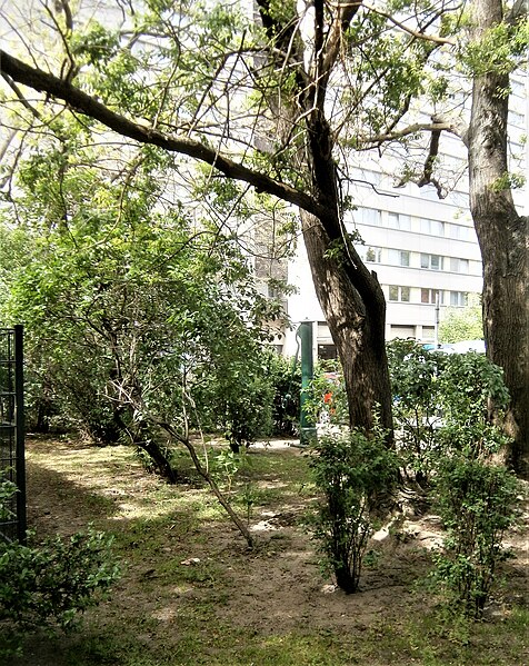
Deutsch: Fischerinsel ist der (Neubau-)Kiez zwischen Spree und Spreekanal (Kupfergraben) östlich vom Mühlendamm, als Straße (historisch: Roßstraße) die Verbindung zwischen Breite Straße/Mühlendamm und Neue Roßstraßenbrücke (Neue Roßstraße). Der Brunnen steht im Süden (zwischen Getrauden- und Neue Gertraudenbrücke) zwischen den beiden Doppel-Wohnhhochhäusern 9 und 10[1] innerhalb eines kleinen Parks an der Zufahrtsstraße hinter der Schwimmhalle Fischerinsel 11. Die Grundplatte der Neuen Krause ist mit vier Schrauben auf dem Sockelrohr angflanscht. Einschließlich des Straßeneinlasses ist diese auf einem etwa fünf Zentimeter erhöhten Betonviereck aufgebracht.Schwengel und Wasserausritt liegen sich gegenüber parallel zur Straße, der Hinweis „Kein Trinkwasser“ ist zweisprachig. Nach der historischen Grunstücksaufteilung 45 Meter vom Spreekanal befindet sich der Standort zwischen den bestehenden Wohnhochhäusern. Altbauhäuser bis um 1970 unter Grünstraße 6[2] (vormals linker Seitenflügel Nummer 6). |
| Date | |
| Source | Own work |
| Author | Boonekamp (Günter Haase) |
| Camera location | | View this and other nearby images on: OpenStreetMap |
|---|
.jpg¶ms=052.512772_N_0013.404737_E_globe:Earth_type:camera__&language=en)
Licensing edit
.jpg&action=edit§ion=2)
I, the copyright holder of this work, hereby publish it under the following license:
This file is licensed under the Creative Commons Attribution-Share Alike 4.0 International license.
- You are free:
- to share – to copy, distribute and transmit the work
- to remix – to adapt the work
- Under the following conditions:
- attribution – You must give appropriate credit, provide a link to the license, and indicate if changes were made. You may do so in any reasonable manner, but not in any way that suggests the licensor endorses you or your use.
- share alike – If you remix, transform, or build upon the material, you must distribute your contributions under the same or compatible license as the original.
- ↑ Die Baufreiheit wurde im Altbaubestand Ende der 1960er Jahre geschaffen, die Wohnhochhäuser wurden 1970/1971 in Plattenbauweise errichet.
- ↑ Template:Berliner Adressbuch
File history
Click on a date/time to view the file as it appeared at that time.
| Date/Time | Thumbnail | Dimensions | User | Comment | |
|---|---|---|---|---|---|
| current | 10:17, 3 June 2019 | | 2,730 × 3,437 (2.81 MB) | Boonekamp (talk | contribs) | User created page with UploadWizard |
You cannot overwrite this file.
File usage on Commons
There are no pages that use this file.
.jpg&oldid=596213864)