File:Strait of Gibraltar (MODIS 2019-03-14).jpg

Size of this preview: 681 × 600 pixels. Other resolutions: 273 × 240 pixels | 545 × 480 pixels | 872 × 768 pixels | 1,163 × 1,024 pixels | 2,325 × 2,048 pixels | 3,206 × 2,824 pixels.
Original file (3,206 × 2,824 pixels, file size: 1.03 MB, MIME type: image/jpeg)
Captions
Captions
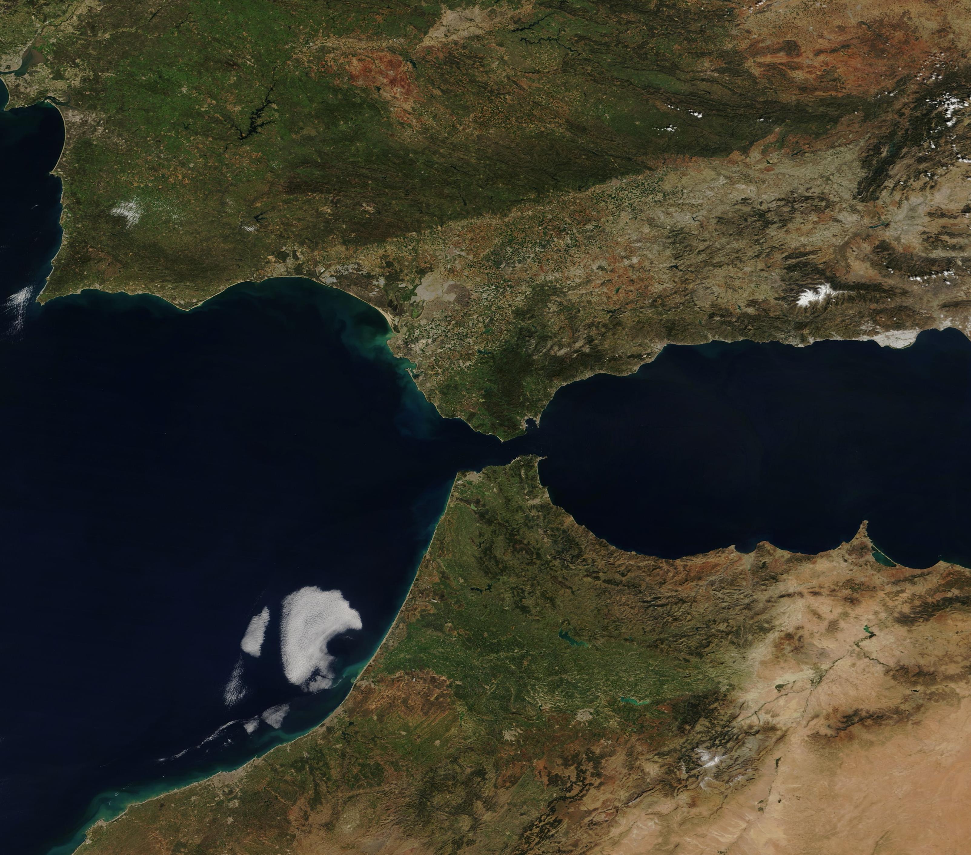
The Moderate Resolution Imaging Spectroradiometer (MODIS) on board NASA’s Terra satellite acquired a true-color image of Europe (north), Africa (south), and the Strait of Gibraltar on March 11, 2019.
Summary edit
.jpg&action=edit§ion=1)
| Description |
English: The narrow Strait of Gibraltar is the gatekeeper for water exchange between the Atlantic Ocean and Mediterranean Sea. The Strait is only about 8 miles (12.9 km) wide and 36 miles (58 km) long. The waters separate Gibraltar and Peninsular Spain in the north from Morocco and Ceuta in the south.
Gibraltar is a British Overseas Territory on Spain’s south coast and home to a tall limestone ridge known as the Rock of Gibraltar. Ceuta is a Spanish autonomous city on the north coast of Africa. The Moderate Resolution Imaging Spectroradiometer (MODIS) on board NASA’s Terra satellite acquired a true-color image of Europe (north), Africa (south), and the Strait of Gibraltar on March 11, 2019. |
||
| Date | Taken on 11 March 2019 | ||
| Source |
Strait of Gibraltar (direct link)
|
||
| Author | MODIS Land Rapid Response Team, NASA GSFC |
| This media is a product of the Terra mission Credit and attribution belongs to the mission team, if not already specified in the "author" row |
Licensing edit
.jpg&action=edit§ion=2)
| This file is in the public domain in the United States because it was solely created by NASA. NASA copyright policy states that "NASA material is not protected by copyright unless noted". (See Template:PD-USGov, NASA copyright policy page or JPL Image Use Policy.) | ||
 |
Warnings:
|
File history
Click on a date/time to view the file as it appeared at that time.
| Date/Time | Thumbnail | Dimensions | User | Comment | |
|---|---|---|---|---|---|
| current | 03:27, 17 February 2024 | | 3,206 × 2,824 (1.03 MB) | OptimusPrimeBot (talk | contribs) | #Spacemedia - Upload of http://modis.gsfc.nasa.gov/gallery/images/image03142019_250m.jpg via Commons:Spacemedia |
You cannot overwrite this file.
File usage on Commons
There are no pages that use this file.
.jpg&oldid=852806029)