File:Strasbourg Ancienne Commanderie Saint-Jean 08.JPG
Original file (3,642 × 1,714 pixels, file size: 1.77 MB, MIME type: image/jpeg)
Captions
Captions
|
This building is inscrit au titre des monuments historiques de la France. It is indexed in the base Mérimée, a database of architectural heritage maintained by the French Ministry of Culture, under the reference PA00085021
|

|
This image was uploaded as part of Wiki Loves Monuments 2012.
|
Summary edit
| Description |
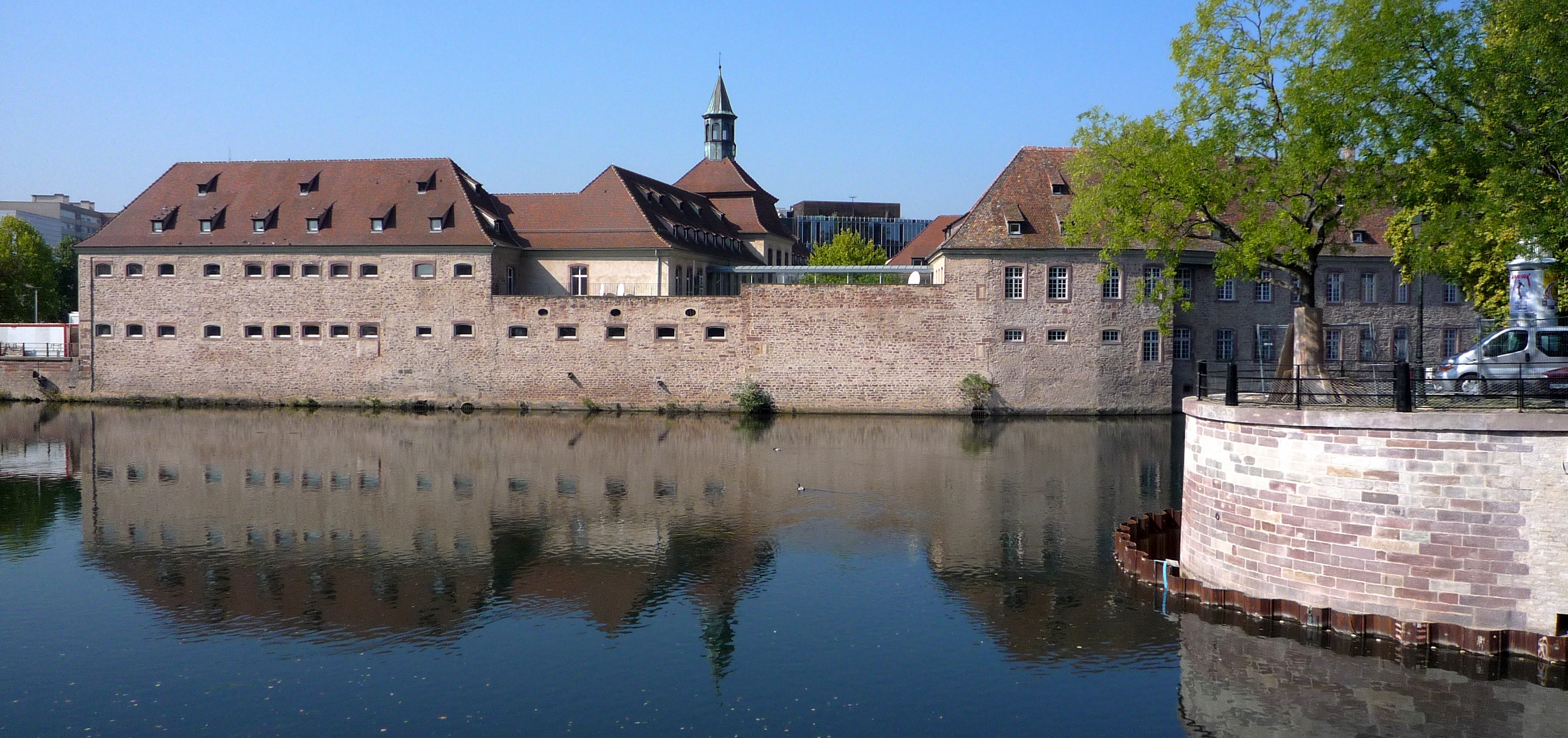
Français : La commanderie des Hospitaliers de Saint-Jean de Jérusalem – dite Commanderie Saint-Jean –, est un bâtiment de la ville de Strasbourg, situé au 1, rue Sainte-Marguerite et dont la construction s’est échelonnée de la première moitié du XIVe siècle à la première moitié du XVIIIe siècle. Il est classé Monument historique depuis 1971. La commanderie fut successivement un lieu de commerce et de diplomatie, un hôpital puis entre 1740 et 1989, la maison d’arrêt Sainte Marguerite. Après restauration et restructuration, elle accueille l’École nationale d’administration (ENA) depuis 1991. |
| Date | |
| Source | Own work |
| Author | Claude TRUONG-NGOC |
| Permission (Reusing this file) |
Cette photo de l’ancienne commanderie de l’Ordre des hospitaliers de Saint-Jean est l’œuvre de Claude TRUONG-NGOC (User:Ctruongngoc). Exemple : © Claude Truong-Ngoc / Wikimedia Commons Par ailleurs, j’apprécierai que vous me l’indiquiez par courriel ( |
| Camera location | | View this and other nearby images on: OpenStreetMap |
|---|
Licensing edit
- You are free:
- to share – to copy, distribute and transmit the work
- to remix – to adapt the work
- Under the following conditions:
- attribution – You must give appropriate credit, provide a link to the license, and indicate if changes were made. You may do so in any reasonable manner, but not in any way that suggests the licensor endorses you or your use.
- share alike – If you remix, transform, or build upon the material, you must distribute your contributions under the same or compatible license as the original.
File history
Click on a date/time to view the file as it appeared at that time.
| Date/Time | Thumbnail | Dimensions | User | Comment | |
|---|---|---|---|---|---|
| current | 08:25, 15 September 2012 | | 3,642 × 1,714 (1.77 MB) | Ctruongngoc (talk | contribs) | User created page with UploadWizard |
You cannot overwrite this file.
File usage on Commons
The following page uses this file:
File usage on other wikis
The following other wikis use this file:
- Usage on fr.wikipedia.org