File:Stuttgart Schleuse Mühlhausen - 1.jpg
Size of this preview: 800 × 533 pixels. Other resolutions: 320 × 213 pixels | 640 × 427 pixels | 1,024 × 683 pixels | 1,280 × 853 pixels | 2,560 × 1,707 pixels | 3,378 × 2,252 pixels.
Original file (3,378 × 2,252 pixels, file size: 5.49 MB, MIME type: image/jpeg)
Captions
Captions
Add a one-line explanation of what this file represents
Summary edit
| Description |
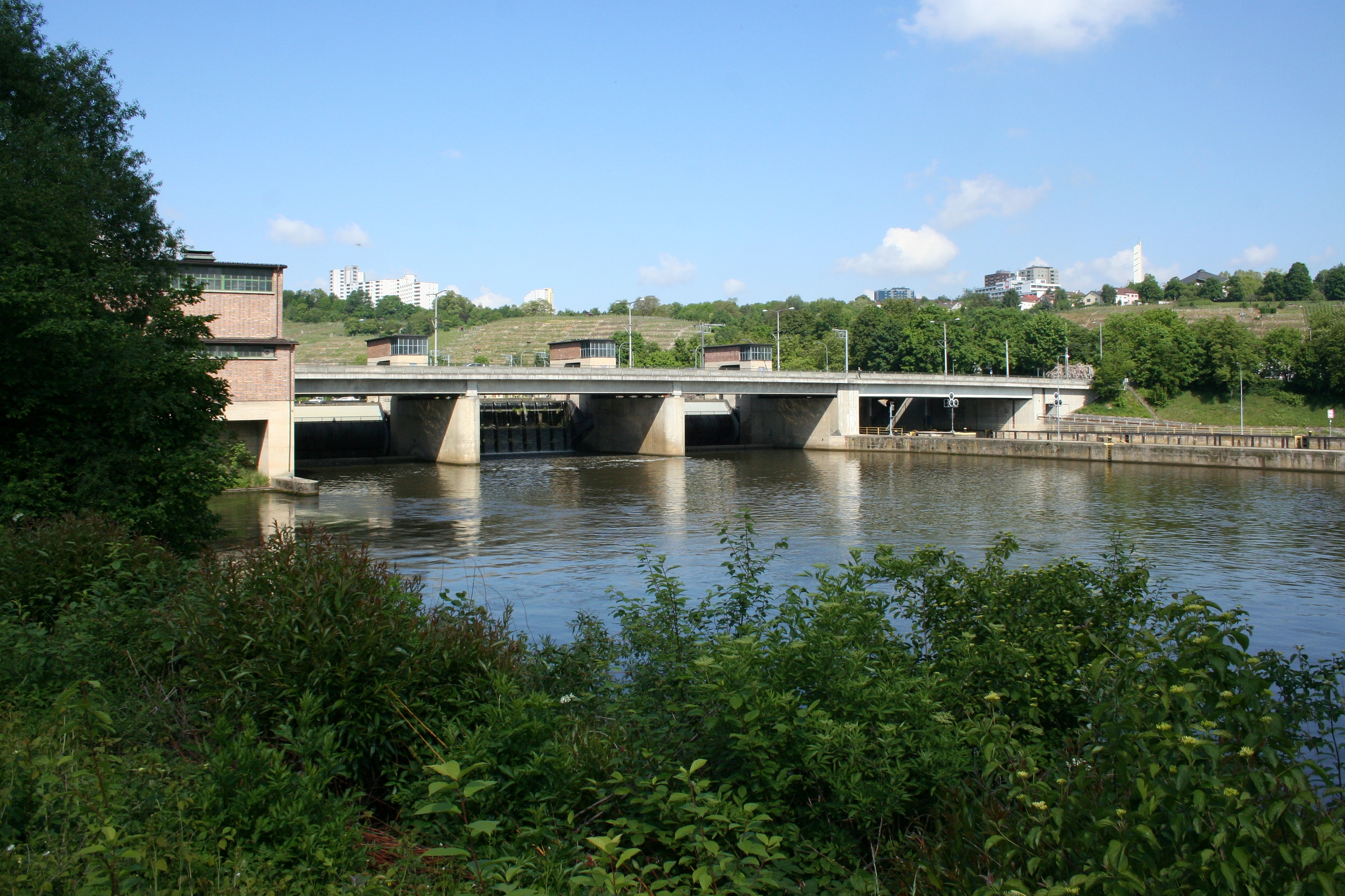
Deutsch: Wehr Kraftwerk und Schleuse mit Straßenbrücke Mühlhausen in Stuttgart. Erbaut 1927 bis 1935 im Bauhausstil und Stil des Neuen Bauens, erweitert 1955 bis 1957 im Internationalen Stil von Otto Konz und Paul Bonatz. Stadtbezirk Stuttgart-Mühlhausen, Baden-Württemberg, Deutschland. English: Weir power station and sluice with street bridge Mulhouse in Stuttgart. Builds from 1927 to 1935 in the construction house style and style of the new construction, extends from 1955 to 1957 in the international style of Otto Konz and Paul Bonatz. Town district Stuttgart-Mulhouse, Baden-Wurttemberg, Germany. Français : Défense la centrale électrique et écluse avec le pont de rues Mühlhausen à Stuttgart. Construit de 1927 à 1935 dans le style de Bauhaus et style de nouveau Bauens, élargit de 1955 à 1957 dans le style international d'Otto Konz et Paul Bonatz. Arrondissement de ville Stuttgart-Mühlhausen, le Baden-Wurtemberg, l'Allemagne. Español: Defensa la central eléctrica y esclusa con el puente de calles Mühlhausen en Stuttgart. Construye de 1927 a 1935 en el estilo de casa de construcción y estilo de nuevo Bauens, amplía de 1955 a 1957 en el estilo internacional de Otto Konz y Paul Bonatz. Distrito municipal de Stuttgart-Mühlhausen, el Baden-Wurtemberg, Alemania. Русский: Сопротивление электростанцию и шлюз при помощи уличного моста Мюльхаузен в Штутгарте. Строит с 1927 по 1935 в строительном стиле дома и стиле Нового Bauens, расширяет с 1955 по 1957 в Международном стиле Отто Конца и Пауля Бонаца. Городской район Штутгарт-Мюльхаузен, Баден-Вюртемберг, Германию.
| ||
| Address |
|
||
| Date | |||
| Source | Own work | ||
| Author | MSeses | ||
| Attribution (required by the license) | © MSeses / Wikimedia Commons / | ||
| Object location | | View this and other nearby images on: OpenStreetMap |
|---|
Licensing edit
I, the copyright holder of this work, hereby publish it under the following license:
This file is licensed under the Creative Commons Attribution-Share Alike 3.0 Unported license.
- You are free:
- to share – to copy, distribute and transmit the work
- to remix – to adapt the work
- Under the following conditions:
- attribution – You must give appropriate credit, provide a link to the license, and indicate if changes were made. You may do so in any reasonable manner, but not in any way that suggests the licensor endorses you or your use.
- share alike – If you remix, transform, or build upon the material, you must distribute your contributions under the same or compatible license as the original.

|
This image was uploaded as part of Wiki Loves Monuments 2012.
|
File history
Click on a date/time to view the file as it appeared at that time.
| Date/Time | Thumbnail | Dimensions | User | Comment | |
|---|---|---|---|---|---|
| current | 07:18, 2 September 2012 | | 3,378 × 2,252 (5.49 MB) | MSeses (talk | contribs) | User created page with UploadWizard |
You cannot overwrite this file.
File usage on Commons
The following page uses this file:
File usage on other wikis
The following other wikis use this file:
- Usage on de.wikipedia.org