File:Sunda strait map v3.png
No higher resolution available.
Sunda_strait_map_v3.png (489 × 600 pixels, file size: 310 KB, MIME type: image/png)
Captions
Captions
Add a one-line explanation of what this file represents
Summary
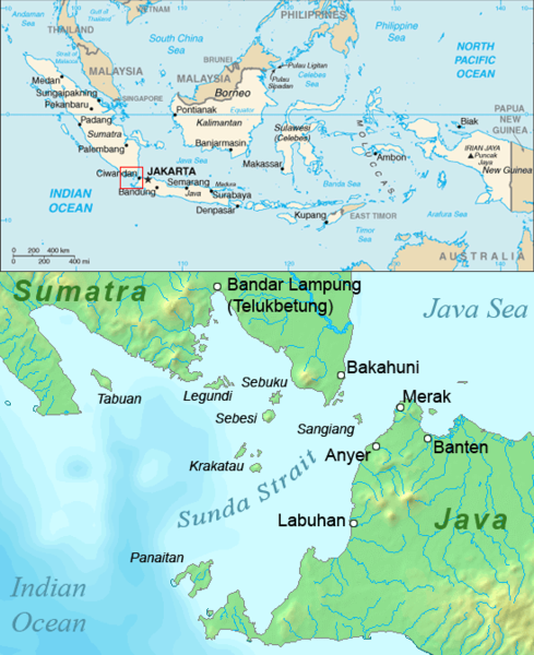
edit| Description |
English: Map of the Sunda Strait, Indonesia. |
|||||||
| Date | ||||||||
| Source | Combination of CIA World Factbook map and Demis Map Server (http://www2.demis.nl/mapserver/mapper.asp) data with additional annotations and modifications by self. | |||||||
| Author | ChrisO | |||||||
| Permission (Reusing this file) |
|
|||||||
| Other versions | lower part (demis map) only: File:Sunda strait map v4.png |

File history
Click on a date/time to view the file as it appeared at that time.
| Date/Time | Thumbnail | Dimensions | User | Comment | |
|---|---|---|---|---|---|
| current | 10:39, 2 December 2006 | | 489 × 600 (310 KB) | Burgundo (talk | contribs) | Caricato da en.wiki |
You cannot overwrite this file.
File usage on Commons
The following page uses this file:
File usage on other wikis
The following other wikis use this file:
- Usage on ar.wikipedia.org
- Usage on ast.wikipedia.org
- Usage on ban.wikipedia.org
- Usage on ba.wikipedia.org
- Usage on bcl.wikipedia.org
- Usage on bew.wikipedia.org
- Usage on bg.wikipedia.org
- Usage on br.wikipedia.org
- Usage on ca.wikipedia.org
- Usage on cs.wikipedia.org
- Usage on da.wikipedia.org
- Usage on el.wikipedia.org
- Usage on en.wikipedia.org
- Usage on en.wikinews.org
- Usage on es.wikipedia.org
- Usage on fa.wikipedia.org
- Usage on fr.wikipedia.org
- Usage on fy.wikipedia.org
- Usage on gl.wikipedia.org
- Usage on hak.wikipedia.org
- Usage on hi.wikipedia.org
- Usage on hu.wikipedia.org
- Usage on hy.wikipedia.org
- Usage on id.wikipedia.org
- Usage on incubator.wikimedia.org
- Usage on it.wikipedia.org
- Usage on ja.wikipedia.org
View more global usage of this file.