File:Sur2.gif

Size of this preview: 800 × 494 pixels. Other resolutions: 320 × 197 pixels | 640 × 395 pixels | 1,024 × 632 pixels | 1,280 × 790 pixels | 2,560 × 1,580 pixels | 3,855 × 2,379 pixels.
Original file (3,855 × 2,379 pixels, file size: 707 KB, MIME type: image/gif, 0.1 s)
Captions
Captions
Add a one-line explanation of what this file represents
| Description |
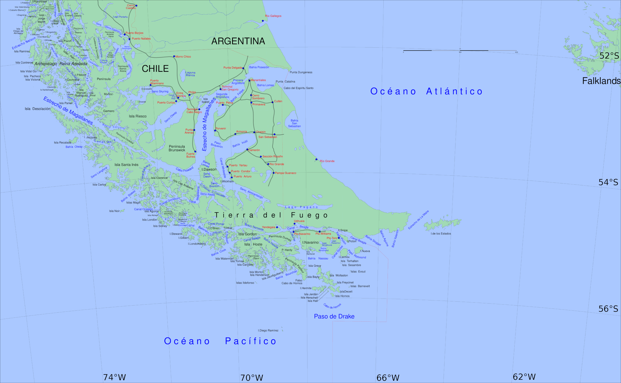
English: Big Map of southern Chile: From Straits of Magellan to Cape Horn |
||||||||||
| Date | |||||||||||
| Source | Own work | ||||||||||
| Author | Createaccount | ||||||||||
| Permission (Reusing this file) |
|
||||||||||
| Other versions | Derivative works of this file: Sur2-KDS444.gif |

File history
Click on a date/time to view the file as it appeared at that time.
| Date/Time | Thumbnail | Dimensions | User | Comment | |
|---|---|---|---|---|---|
| current | 18:59, 6 August 2016 | | 3,855 × 2,379 (707 KB) | Keysanger (talk | contribs) | spelling Vidal Gormaz, Rennell |
| 22:31, 1 April 2013 |  | 3,855 × 2,379 (707 KB) | Keysanger (talk | contribs) | deleted road from P.Williams to P.Toro | |
| 21:13, 1 April 2013 |  | 3,855 × 2,379 (707 KB) | Keysanger (talk | contribs) | internationalized | |
| 13:40, 5 March 2013 |  | 3,855 × 2,379 (709 KB) | Keysanger (talk | contribs) | coordinates added, "Estrecho Nelson" added | |
| 19:03, 14 January 2013 |  | 3,855 × 2,379 (703 KB) | Keysanger (talk | contribs) | transparent margin erased | |
| 20:22, 7 May 2011 |  | 3,894 × 2,441 (718 KB) | Keysanger (talk | contribs) | Reverted to version as of 00:40, 5 September 2008 | |
| 06:17, 25 April 2011 |  | 3,414 × 2,359 (1.95 MB) | KDS444 (talk | contribs) | revised w tierra highlighted | |
| 05:38, 25 April 2011 |  | 3,414 × 2,359 (1.43 MB) | KDS444 (talk | contribs) | Uploaded wrong file in previous upload. Sorries. | |
| 05:35, 25 April 2011 |  | 3,894 × 2,441 (718 KB) | KDS444 (talk | contribs) | Made clearer the international distinctions between Chile and Argentina, and darkened the oceans in order to make the Straight stand out more. | |
| 03:06, 25 April 2011 |  | 3,414 × 2,359 (1.41 MB) | KDS444 (talk | contribs) | Original author gave permission for revisions/ remixes under image's original Creative Commons Attribution-Share Alike 3.0 Unported license. Have revised image slightly making the actual Straight of Magellan identifiable on the map. Also cropped to rem |
You cannot overwrite this file.
File usage on Commons
The following 2 pages use this file:
File usage on other wikis
The following other wikis use this file:
- Usage on eu.wikipedia.org
- Usage on fr.wikipedia.org
- Usage on ka.wikipedia.org