File:Suriname border rivers true names.png
Size of this preview: 800 × 566 pixels. Other resolutions: 320 × 226 pixels | 640 × 453 pixels | 1,024 × 724 pixels | 1,280 × 905 pixels | 2,560 × 1,810 pixels | 5,656 × 4,000 pixels.
Original file (5,656 × 4,000 pixels, file size: 1.09 MB, MIME type: image/png)
Captions
Captions
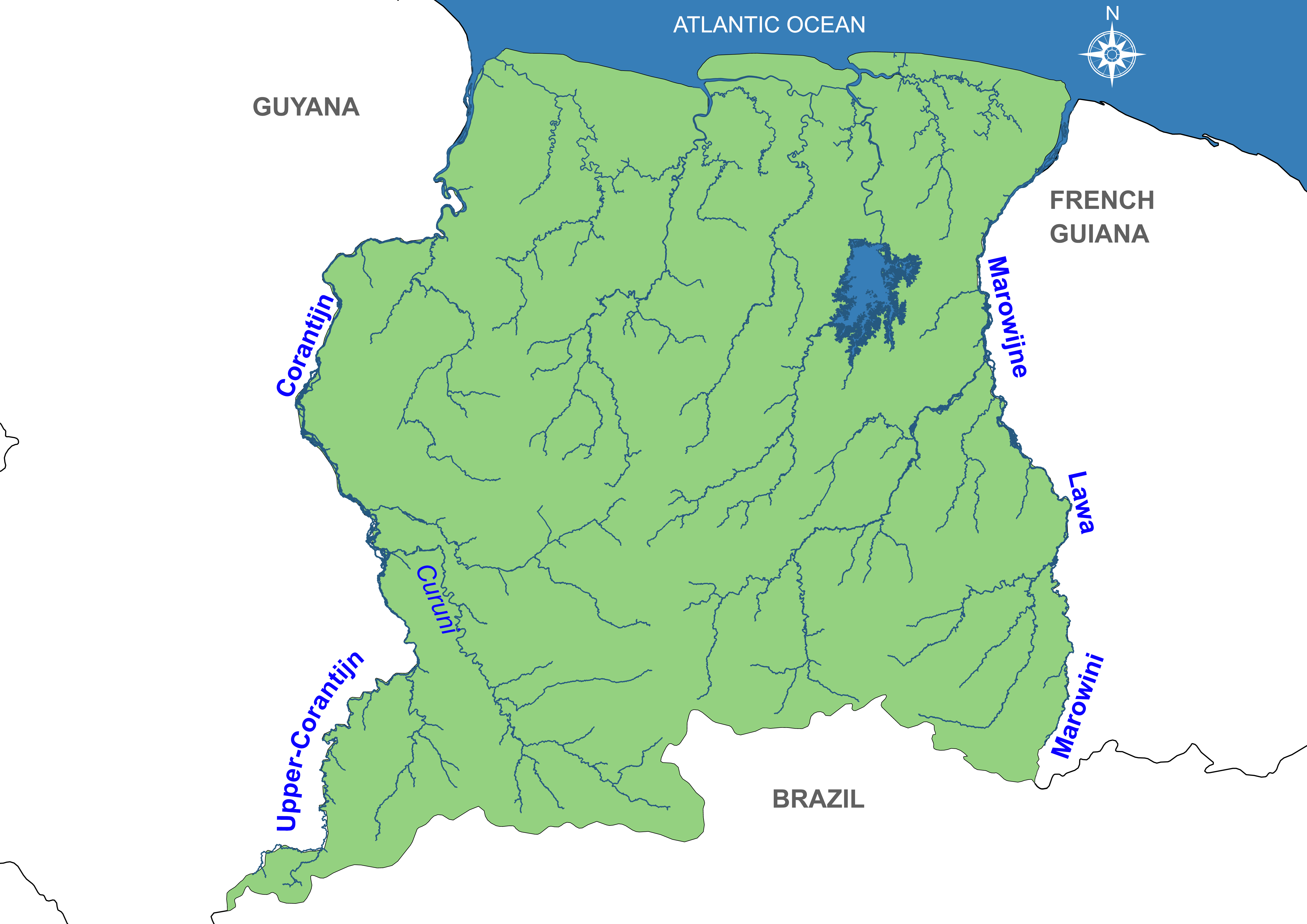
Map showing the correct border river names between Guyana - Suriname and French Guiana
Summary
edit
| Description |
English: Map showing the correct border river names between Guyana-Suriname-French Guiana. The Guyanese maps show the wrong names, they show the upper corantijn river as the "new river" and the Curuni River as the Corantijn river. |
| Date | |
| Source | Own work |
| Author | SurinameCentral |
Licensing
edit
I, the copyright holder of this work, hereby publish it under the following license:
This file is licensed under the Creative Commons Attribution-Share Alike 4.0 International license.
- You are free:
- to share – to copy, distribute and transmit the work
- to remix – to adapt the work
- Under the following conditions:
- attribution – You must give appropriate credit, provide a link to the license, and indicate if changes were made. You may do so in any reasonable manner, but not in any way that suggests the licensor endorses you or your use.
- share alike – If you remix, transform, or build upon the material, you must distribute your contributions under the same or compatible license as the original.
File history
Click on a date/time to view the file as it appeared at that time.
| Date/Time | Thumbnail | Dimensions | User | Comment | |
|---|---|---|---|---|---|
| current | 23:19, 12 January 2024 | | 5,656 × 4,000 (1.09 MB) | SurinameCentral (talk | contribs) | Several minor errors corrected |
| 19:28, 18 December 2022 |  | 5,656 × 4,000 (1.09 MB) | SurinameCentral (talk | contribs) | Uploaded own work with UploadWizard |
You cannot overwrite this file.
File usage on Commons
The following page uses this file:
File usage on other wikis
The following other wikis use this file:
- Usage on nl.wikipedia.org