File:Survey of Palestine, Locust map - Jerusalem centre (FL147408849 2673920).jpg

Size of this preview: 800 × 535 pixels. Other resolutions: 320 × 214 pixels | 640 × 428 pixels | 1,024 × 685 pixels | 1,280 × 856 pixels | 2,560 × 1,712 pixels | 17,973 × 12,017 pixels.
Original file (17,973 × 12,017 pixels, file size: 202.12 MB, MIME type: image/jpeg)
Captions
Captions
Add a one-line explanation of what this file represents
Summary
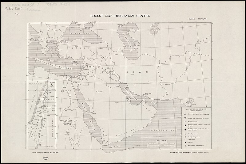
edit| Survey of Palestine: Locust map - Jerusalem centre
( |
||||||||||||||||||||||||
|---|---|---|---|---|---|---|---|---|---|---|---|---|---|---|---|---|---|---|---|---|---|---|---|---|
| Artist |
|
|||||||||||||||||||||||
| Title |
Locust map - Jerusalem centre |
|||||||||||||||||||||||
| Publisher |
Dept. of Agriculture and FisheriesPalestine |
|||||||||||||||||||||||
| Description |
Locust map - Jerusalem centre. Drawn, reproduced and printed by S. of P. |
|||||||||||||||||||||||
| Language | English | |||||||||||||||||||||||
| Publication date | 1942 | |||||||||||||||||||||||
| Medium | 1 map ; | |||||||||||||||||||||||
| Dimensions | height: 39 cm (15.3 in); width: 56 cm (22 in) | |||||||||||||||||||||||
| Collection |
|
|||||||||||||||||||||||
| Current location |
|
|||||||||||||||||||||||
| Place of publication | unknown | |||||||||||||||||||||||
| search Merhav catalog | unknown | |||||||||||||||||||||||
| Notes | Includes conventional signs for locust report.; Inset map, Palestien and environs, 1:3,000,000 | |||||||||||||||||||||||
| scale | 1:10,000,000 cm | |||||||||||||||||||||||
| IE PID | IE147408847 | |||||||||||||||||||||||
| Rosetta filename | FL147408849 | |||||||||||||||||||||||
| NNL item ID (P3959) | 990026739200205171 | |||||||||||||||||||||||
| search Merhav catalog | English, Survey of Palestine | |||||||||||||||||||||||
| search Merhav catalog | Locusts ControlDept. of Agriculture and FisheriesPalestine | |||||||||||||||||||||||
| Source/Photographer |
|
|||||||||||||||||||||||
| Other versions | ||||||||||||||||||||||||
| Jpg / Tif version |
|
|||||||||||||||||||||||

.jpg)

.jpg&action=edit§ion=1)
Licensing
edit.jpg&action=edit§ion=2)
This work created by the United Kingdom Government is in the public domain.
This is because it is one of the following:
HMSO has declared that the expiry of Crown Copyrights applies worldwide (ref: HMSO Email Reply)
|
 |
File history
Click on a date/time to view the file as it appeared at that time.
| Date/Time | Thumbnail | Dimensions | User | Comment | |
|---|---|---|---|---|---|
| current | 03:41, 6 August 2023 | | 17,973 × 12,017 (202.12 MB) | Geagea (talk | contribs) | pattypan 22.03 |
You cannot overwrite this file.
File usage on Commons
The following 2 pages use this file:
.jpg&oldid=790635846)