File:Survey of Palestine, Petah Tiqva, Ein Ganim, Al Mirr, Mahne Yehuda (FL60915895 3520667).jpg

Size of this preview: 696 × 599 pixels. Other resolutions: 279 × 240 pixels | 558 × 480 pixels | 892 × 768 pixels | 1,190 × 1,024 pixels | 2,379 × 2,048 pixels | 16,764 × 14,432 pixels.
Original file (16,764 × 14,432 pixels, file size: 225.57 MB, MIME type: image/jpeg)
Captions
Captions
Add a one-line explanation of what this file represents
Summary
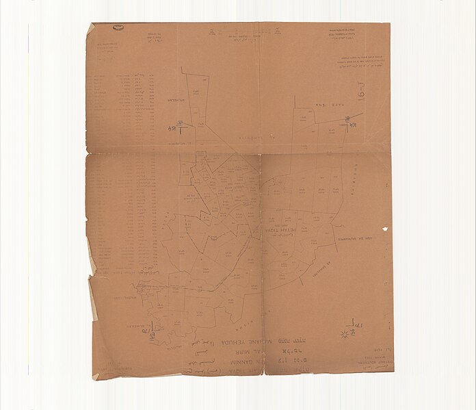
edit| Survey of Palestine: Petah Tiqva, Ein Ganim, Al Mirr, Mahne Yehuda
( |
||||||||||||||||||||||||
|---|---|---|---|---|---|---|---|---|---|---|---|---|---|---|---|---|---|---|---|---|---|---|---|---|
| Artist |
|
|||||||||||||||||||||||
| Title |
Petah Tiqva, Ein Ganim, Al Mirr, Mahne Yehuda |
|||||||||||||||||||||||
| Publisher |
Survey of Palestine |
|||||||||||||||||||||||
| Description |
Petah Tiqva, Ein Ganim, Al Mirr, Mahne Yehuda. Sub-district Jaffa . Survey of Palestine. |
|||||||||||||||||||||||
| Language | English, Arabic, Hebrew | |||||||||||||||||||||||
| Publication date | 1934 | |||||||||||||||||||||||
| Medium | 1 sheet ; | |||||||||||||||||||||||
| Dimensions | 53 × 45 cm (20.8 × 17.7 in) | |||||||||||||||||||||||
| Collection |
|
|||||||||||||||||||||||
| Current location |
|
|||||||||||||||||||||||
| Place of publication | unknown | |||||||||||||||||||||||
| search Merhav catalog | unknown | |||||||||||||||||||||||
| Notes | Cadastral map.; Includes list of blocks and their names in English, Arabic and Hebrew. | |||||||||||||||||||||||
| scale | 1:20,000 cm | |||||||||||||||||||||||
| IE PID | IE60915893 | |||||||||||||||||||||||
| Rosetta filename | FL60915895 | |||||||||||||||||||||||
| NNL item ID (P3959) | 990035206670205171 | |||||||||||||||||||||||
| search Merhav catalog | English, Arabic, Hebrew, Survey of Palestine | |||||||||||||||||||||||
| search Merhav catalog | للخريطة عنوان ثان بالعربية:بتح تقوا (ملبس)، عين غنيم، المر، محني يهودا - مجموعة ترتيب للوح القطعقضاء يافا، اللواء الجنوبيפתח תקוהעין גניםאל מרמחנה יהודהمساحة فلسطينSurvey of Palestine | |||||||||||||||||||||||
| Source/Photographer |
|
|||||||||||||||||||||||
| Other versions | ||||||||||||||||||||||||
| Jpg / Tif version |
|
|||||||||||||||||||||||

.jpg)

.jpg&action=edit§ion=1)
Licensing
edit.jpg&action=edit§ion=2)
This work created by the United Kingdom Government is in the public domain.
This is because it is one of the following:
HMSO has declared that the expiry of Crown Copyrights applies worldwide (ref: HMSO Email Reply)
|
 |
File history
Click on a date/time to view the file as it appeared at that time.
| Date/Time | Thumbnail | Dimensions | User | Comment | |
|---|---|---|---|---|---|
| current | 12:52, 7 August 2023 | | 16,764 × 14,432 (225.57 MB) | Geagea (talk | contribs) | pattypan 22.03 |
You cannot overwrite this file.
File usage on Commons
The following 2 pages use this file:
.jpg&oldid=797014526)