File:Svaty Jur Mestske hradby.jpg

Size of this preview: 800 × 511 pixels. Other resolutions: 320 × 205 pixels | 640 × 409 pixels | 1,024 × 654 pixels | 1,280 × 818 pixels | 2,560 × 1,636 pixels | 4,874 × 3,115 pixels.
Original file (4,874 × 3,115 pixels, file size: 16.96 MB, MIME type: image/jpeg)
Captions
Captions
Add a one-line explanation of what this file represents
Summary edit
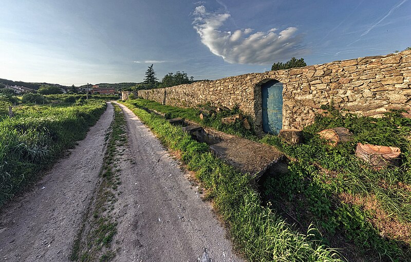
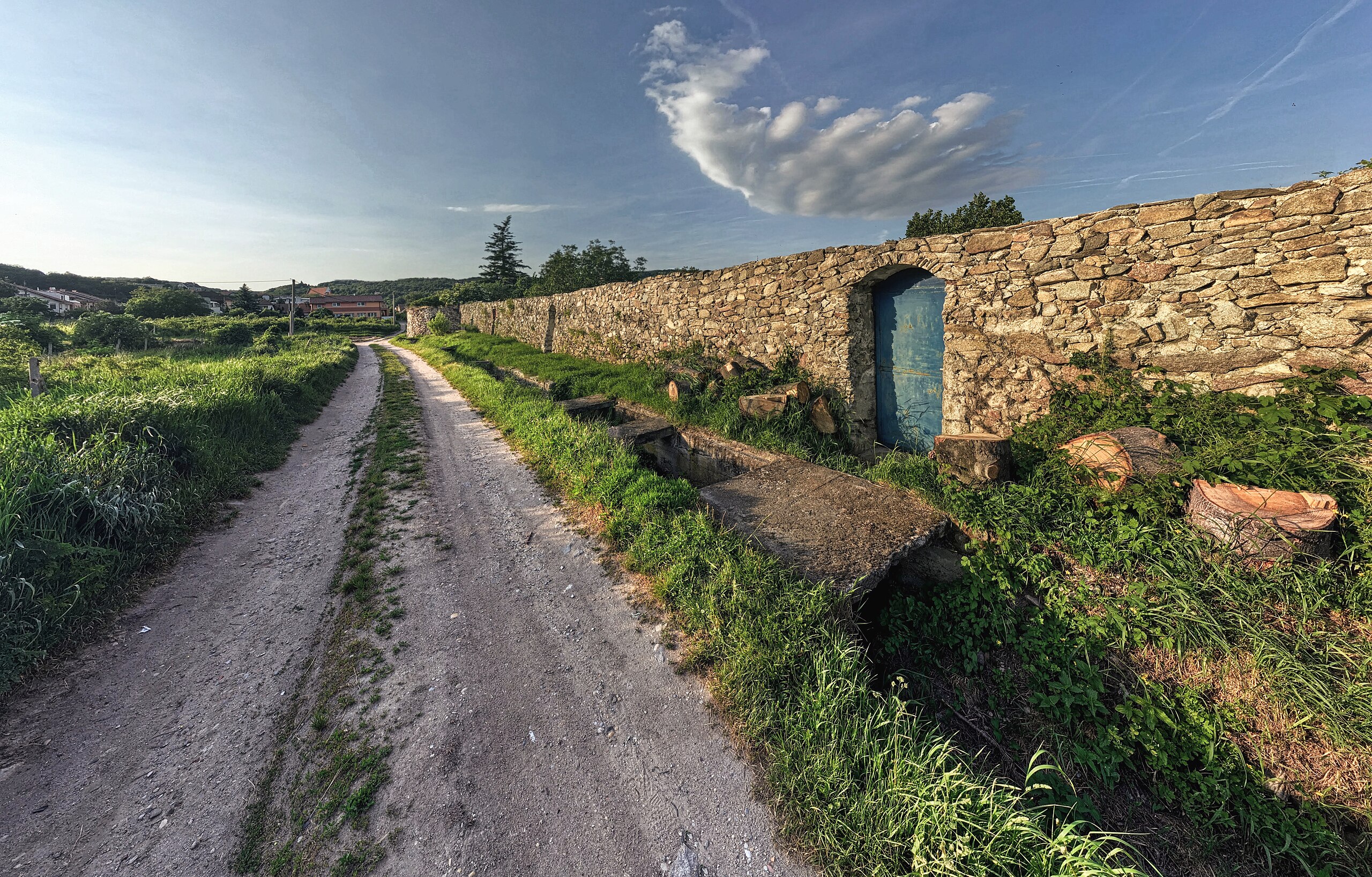
| Description |
Slovenčina: Hradbový múr, Svätý Jur
English: Svätý Jur city walls |
|||
| Date | ||||
| Source | Own work | |||
| Author | Tomáš Bartovič | |||
| Permission (Reusing this file) |
|

| Camera location | | View this and other nearby images on: OpenStreetMap |
|---|
Licensing edit
I, the copyright holder of this work, hereby publish it under the following license:
This file is licensed under the Creative Commons Attribution-Share Alike 4.0 International license.
- You are free:
- to share – to copy, distribute and transmit the work
- to remix – to adapt the work
- Under the following conditions:
- attribution – You must give appropriate credit, provide a link to the license, and indicate if changes were made. You may do so in any reasonable manner, but not in any way that suggests the licensor endorses you or your use.
- share alike – If you remix, transform, or build upon the material, you must distribute your contributions under the same or compatible license as the original.
File history
Click on a date/time to view the file as it appeared at that time.
| Date/Time | Thumbnail | Dimensions | User | Comment | |
|---|---|---|---|---|---|
| current | 02:25, 8 October 2023 | | 4,874 × 3,115 (16.96 MB) | Tbartovic (talk | contribs) | New version of the photo |
| 11:34, 23 May 2017 |  | 2,000 × 1,278 (2.87 MB) | Tbartovic (talk | contribs) | == {{int:filedesc}} == {{Information |Description = {{Cultural Heritage Slovakia|1=107-417/1}} {{sk|Múr hradbový, Svätý Jur}} {{en|Svätý Jur city walls}} |Source = {{own}} |Date = 2017-05-21 |Author = Tomáš Pír ([[User talk:314r|<span class="... |
You cannot overwrite this file.
File usage on Commons
The following page uses this file:
File usage on other wikis
The following other wikis use this file:
- Usage on cs.wikipedia.org
- Usage on en.wikipedia.org
- Usage on fr.wikipedia.org
- Usage on sk.wikipedia.org
- Usage on sl.wikipedia.org