File:Swabia Creek.JPG
No higher resolution available.
Swabia_Creek.JPG (568 × 509 pixels, file size: 68 KB, MIME type: image/jpeg)
Captions
Captions
Add a one-line explanation of what this file represents
Summary
edit
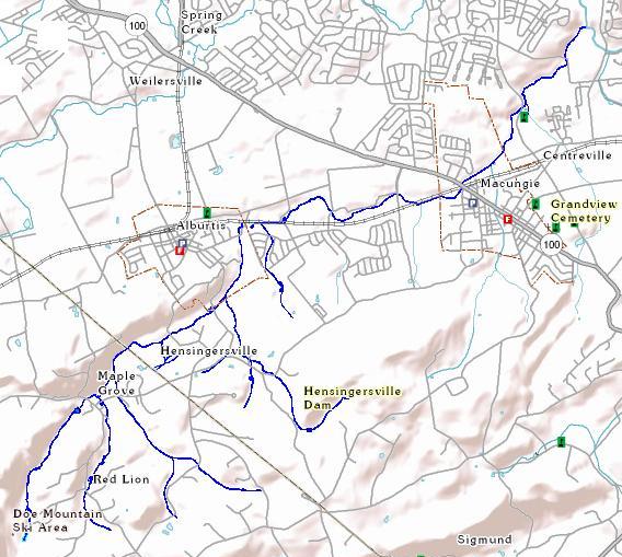
| Description |
English: General Course of Swabia Creek (tributary of Little Lehigh Creek) |
| Date | 17:14, 30 August 2011 (UTC) |
| Source | USGS National Map Viewer |
| Author | w:User:Rpclod modified NMV output to indicate creek course |
Licensing
edit
This image is in the public domain in the United States because it only contains materials that originally came from the United States Geological Survey, an agency of the United States Department of the Interior. For more information, see the official USGS copyright policy.
|
File history
Click on a date/time to view the file as it appeared at that time.
| Date/Time | Thumbnail | Dimensions | User | Comment | |
|---|---|---|---|---|---|
| current | 17:21, 30 August 2011 | | 568 × 509 (68 KB) | Rpclod (talk | contribs) | Removed white space from bottom and right side.~~~~ |
| 17:14, 30 August 2011 |  | 711 × 813 (74 KB) | Rpclod (talk | contribs) | {{Information |Description = General Course of Swabia Creek (tributary of Little Lehigh Creek) |Source = USGS National Map Viewer |Date = ~~~~~ |Author = User:Rpclod modified NMV output to indicate creek course |Permi |
You cannot overwrite this file.
File usage on Commons
There are no pages that use this file.
File usage on other wikis
The following other wikis use this file:
- Usage on en.wikipedia.org