File:Szczytna (gmina) location map.png

Original file (1,958 × 2,021 pixels, file size: 1.05 MB, MIME type: image/png)
Captions
Captions
Summary
edit_location_map.png&action=edit§ion=1)
| Description |
English: Location map. |
| Date | |
| Source | Own work |
| Author | Smat |
| Description |
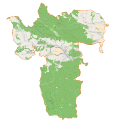
Polski: Mapa gminy Szczytna, Polska
English: Map of Szczytna (gmina), Poland |
|||||||||
| Date | ||||||||||
| Source | You may find a page on the OpenStreetMap wiki page for Szczytna (gmina) | |||||||||
| Creator |
OpenStreetMap contributors OpenStreetMap contributors |
|||||||||
| Permission (Reusing this file) |
OpenStreetMap data is available under the Open Database License (details). Map tiles are licensed under the Creative Commons Attribution-ShareAlike 2.0 license (CC-BY-SA 2.0).
This file is licensed under the Creative Commons Attribution-Share Alike 2.0 Generic license.
|
|||||||||
| Geotemporal data | ||||||||||
| Bounding box |
|
|||||||||
| Georeferencing | If inappropriate please set warp_status = skip to hide. | |||||||||
Licensing
edit_location_map.png&action=edit§ion=2)
| This work contains information from OpenStreetMap, which is made available under the Open Database License (ODbL).
The ODbL does not require any particular license for maps produced from ODbL data. Prior to 1 August 2020, map tiles produced by the OpenStreetMap Foundation were licensed under the CC-BY-SA-2.0 license. Maps produced by other people may be subject to other licences. |
File history
Click on a date/time to view the file as it appeared at that time.
| Date/Time | Thumbnail | Dimensions | User | Comment | |
|---|---|---|---|---|---|
| current | 10:09, 10 December 2016 | | 1,958 × 2,021 (1.05 MB) | Smat (talk | contribs) | User created page with UploadWizard |
You cannot overwrite this file.
File usage on Commons
There are no pages that use this file.
File usage on other wikis
The following other wikis use this file:
- Usage on de.wikipedia.org
- Usage on pl.wikipedia.org
- Szczytna (gmina)
- Szczytna
- Chocieszów (Polska)
- Słoszów
- Studzienno
- Złotno
- Dolina (województwo dolnośląskie)
- Łężyce (województwo dolnośląskie)
- Niwa (województwo dolnośląskie)
- Wolany (województwo dolnośląskie)
- Rezerwat przyrody Torfowisko pod Zieleńcem
- Zamek Leśna
- Batorów
- Batorówek
- Białka (dopływ Dzikiej Orlicy)
- Parafia św. Wita w Niwie
- Parafia Matki Bożej Królowej Pokoju w Szczytnej
- Parafia św. Jana Chrzciciela w Szczytnej
- Szczytna (przystanek kolejowy)
- Borowina (Szczytna)
- Borek (Szczytna)
- Bobrowniki (Szczytna)
- Bukowa (Szczytna)
- Bystra (Szczytna)
- Ocieszów
- Szczytnik (Szczytna)
- Piekielna Góra (Szczytna)
- Szklana Góra (Szczytna)
- Pałac w Wolanach
- Fort na Szczytniku
- Kościół św. Jana Chrzciciela w Szczytnej
- Moduł:Mapa/dane/Szczytna
- Moduł:Mapa/dane/Szczytna (gmina)
- Usage on pl.wikibooks.org
_location_map.png&oldid=607601073)