File:Töpen, Kilometerstein 114,121 Klm.jpg
Size of this preview: 800 × 600 pixels. Other resolutions: 320 × 240 pixels | 640 × 480 pixels | 1,024 × 768 pixels | 1,280 × 960 pixels | 2,560 × 1,920 pixels | 4,608 × 3,456 pixels.
Original file (4,608 × 3,456 pixels, file size: 6.3 MB, MIME type: image/jpeg)
Captions
Captions
Add a one-line explanation of what this file represents
Summary edit
| Description |
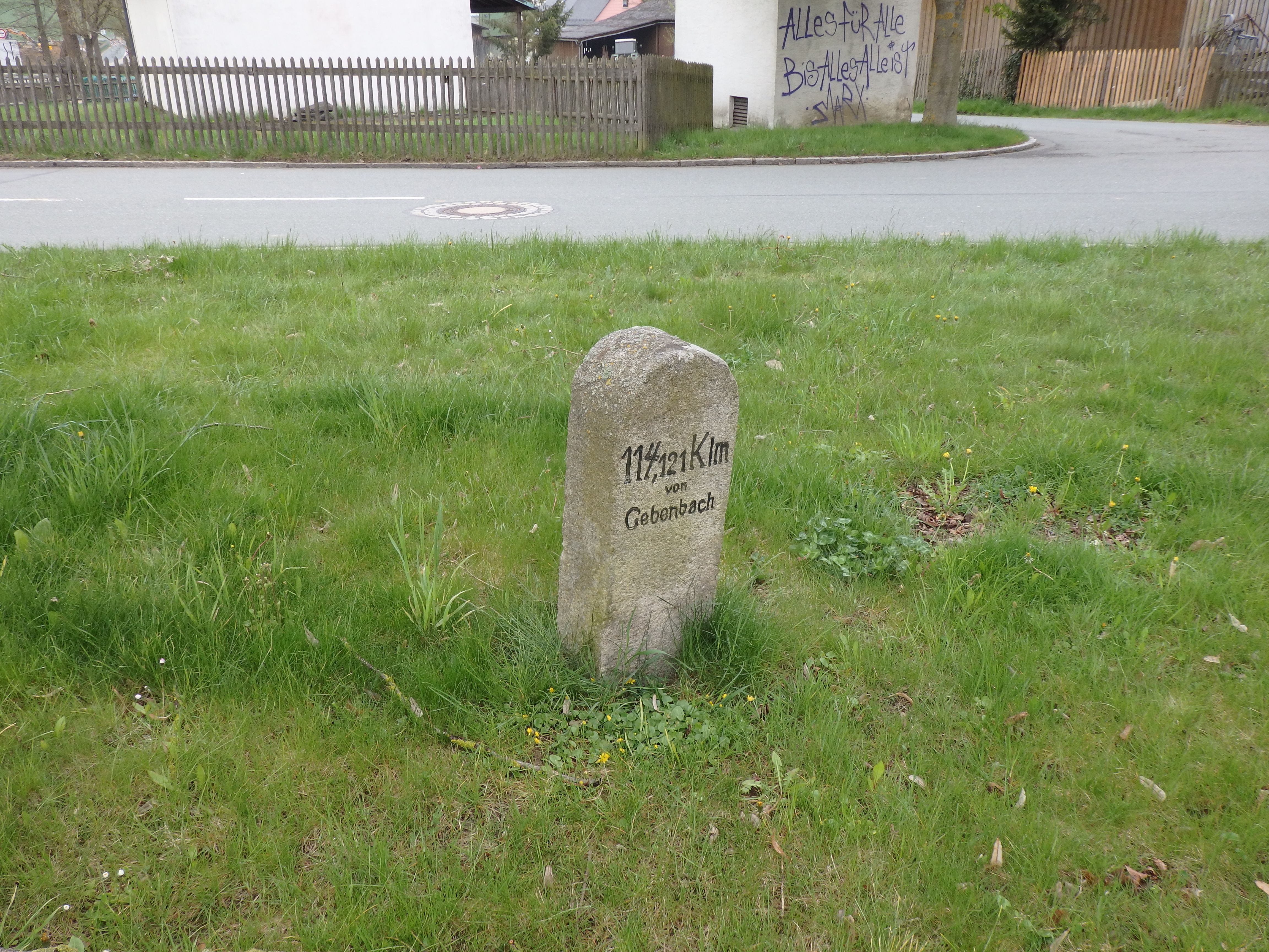
Deutsch: Kilometerstein an der Hofer Straße in Töpen (B 2), bezeichnet mit „114,121 Klm von Gebenbach“. Dieser Straßenstein stand auf der Brücke an der Bayerischen Grenze vor Töpen und wurde als Festlegungs-Knopf (F. K.) von der Königl. Preußischen Landesaufnahme benutzt. (siehe Heft VIII „Die Nivellements-Ergebnisse der Trigonometrischen Abteilung der Königl. Preußischen Landesaufnahme“ 2. Nachtrag)
|
|||
| Date | Taken on 5 May 2022, 10:31 | |||
| Source | Self-photographed | |||
| Author | Manfred Schröter, Berga |
| Object location | | View this and other nearby images on: OpenStreetMap |
|---|
Licensing edit
Manfred Schröter, Berga, the copyright holder of this work, hereby publishes it under the following license:
This file is licensed under the Creative Commons Attribution-Share Alike 4.0 International license.
Attribution: Manfred Schröter, Berga
- You are free:
- to share – to copy, distribute and transmit the work
- to remix – to adapt the work
- Under the following conditions:
- attribution – You must give appropriate credit, provide a link to the license, and indicate if changes were made. You may do so in any reasonable manner, but not in any way that suggests the licensor endorses you or your use.
- share alike – If you remix, transform, or build upon the material, you must distribute your contributions under the same or compatible license as the original.
File history
Click on a date/time to view the file as it appeared at that time.
| Date/Time | Thumbnail | Dimensions | User | Comment | |
|---|---|---|---|---|---|
| current | 10:26, 13 August 2022 | | 4,608 × 3,456 (6.3 MB) | Manfred Schröter, Berga (talk | contribs) | == {{int:filedesc}} == {{Information |Description={{de|1=Rückseite des Kilometersteins an der Hofer Straße in Töpen (B 2), bezeichnet mit „114,121 Klm von Gebenbach“. Dieser Straßenstein stand auf der Brücke an der Bayerischen Grenze vor Töpen und wurde als Festlegungs-Knopf (F. K.) von der Königl. Preußischen Landesaufnahme benutzt. <small>(siehe Heft VIII „Die [[:de:Ur-Nivellement|Nivel... |
You cannot overwrite this file.
File usage on Commons
The following page uses this file: