File:Türmle Untermberg LSG vO Web.jpg
Size of this preview: 579 × 599 pixels. Other resolutions: 232 × 240 pixels | 464 × 480 pixels | 955 × 988 pixels.
Original file (955 × 988 pixels, file size: 1.12 MB, MIME type: image/jpeg)
Captions
Captions
Add a one-line explanation of what this file represents
Summary edit
| Description |
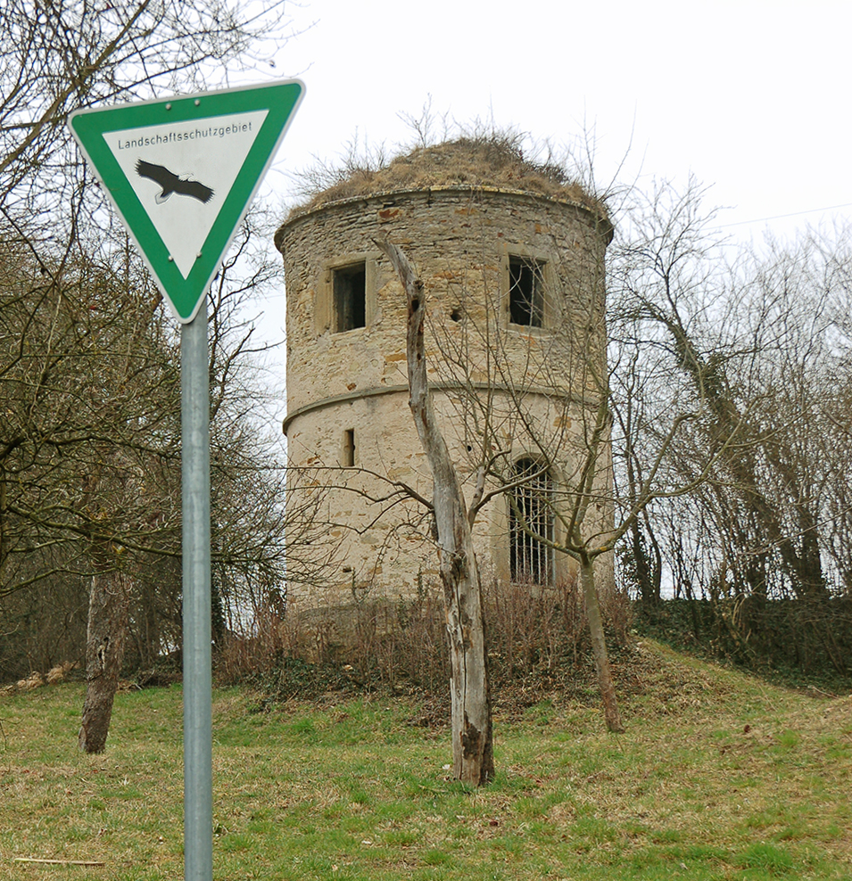
Deutsch: Türmle, auch Mäusetürmle genannt, westl. von Untermberg – 1571 erbaut oder renoviert (Datum überm Eingang). Der Turm gehört zur denkmalgeschützten Sachgesamtheit Burgruine Altsachsenheim und liegt am Rande des Landschaftsschutzgebiets Enztal zwischen dem Leinfelder Hof und Bietigheim-Bissingen im Gewann Ochsental. |
| Date | |
| Source | Own work |
| Author | P. Fendrich |
| Camera location | | View this and other nearby images on: OpenStreetMap |
|---|
Licensing edit
I, the copyright holder of this work, hereby publish it under the following license:
This file is licensed under the Creative Commons Attribution 3.0 Unported license.
- You are free:
- to share – to copy, distribute and transmit the work
- to remix – to adapt the work
- Under the following conditions:
- attribution – You must give appropriate credit, provide a link to the license, and indicate if changes were made. You may do so in any reasonable manner, but not in any way that suggests the licensor endorses you or your use.
File history
Click on a date/time to view the file as it appeared at that time.
| Date/Time | Thumbnail | Dimensions | User | Comment | |
|---|---|---|---|---|---|
| current | 15:45, 14 March 2015 | | 955 × 988 (1.12 MB) | P. Fendrich (talk | contribs) | {{Information |Description ={{de|1=Türmle westl. von Untermberg – 1571 erbaut oder renoviert (Datum überm Eingang)}} |Source ={{own}} |Author =P. Fendrich |Date =2015-03-14 |Permission = |other_... |
You cannot overwrite this file.
File usage on Commons
There are no pages that use this file.
File usage on other wikis
The following other wikis use this file:
- Usage on de.wikipedia.org