File:Talas 2017-07-16 0610Z.jpg

Size of this preview: 478 × 599 pixels. Other resolutions: 191 × 240 pixels | 383 × 480 pixels | 613 × 768 pixels | 817 × 1,024 pixels | 1,634 × 2,048 pixels | 6,367 × 7,980 pixels.
Original file (6,367 × 7,980 pixels, file size: 7.51 MB, MIME type: image/jpeg)
Captions
Captions
Add a one-line explanation of what this file represents
Summary
edit
| Description |
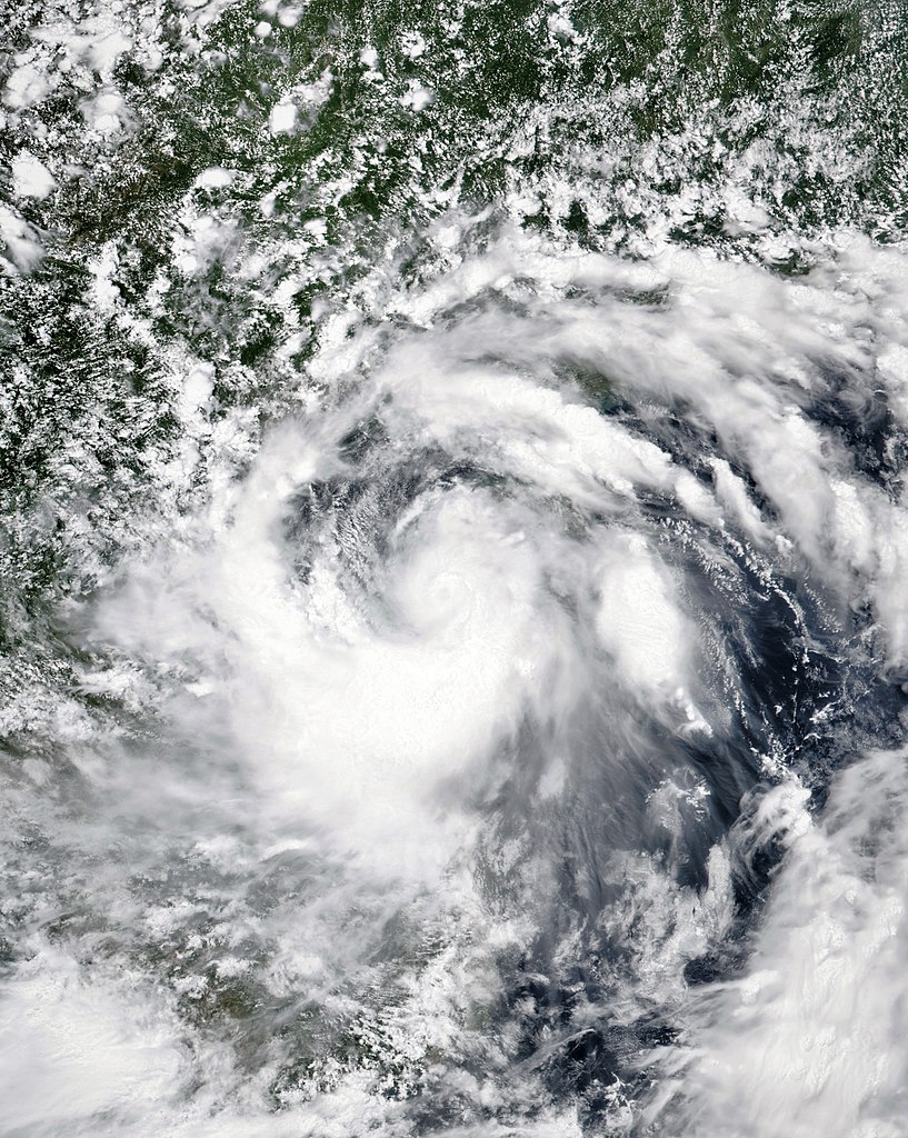
English: A satellite image of Tropical Storm Talas over the southeastern part of the Gulf of Tonkin at 06:10 UTC on 16 July 2017. The cyclone's sustained winds are 45 knots (gusting to 65 knots), and central pressure is 990 hPa. The cyclone is only three hours away from intensifying into a severe tropical storm, and a faint depression where the eye or circulation centre would be is just visible in the image. |
| Date | |
| Source | NASA Worldview |
| Author | National Aeronautics and Space Administration (NASA) - 'Suomi NPP' satellite |
| Camera location | | View this and other nearby images on: OpenStreetMap |
|---|
Licensing
edit
| This file is in the public domain in the United States because it was solely created by NASA. NASA copyright policy states that "NASA material is not protected by copyright unless noted". (See Template:PD-USGov, NASA copyright policy page or JPL Image Use Policy.) | ||
 |
Warnings:
|
File history
Click on a date/time to view the file as it appeared at that time.
| Date/Time | Thumbnail | Dimensions | User | Comment | |
|---|---|---|---|---|---|
| current | 12:57, 16 July 2017 | | 6,367 × 7,980 (7.51 MB) | ChocolateTrain (talk | contribs) | Thin, unintended black border removed |
| 10:59, 16 July 2017 |  | 6,469 × 8,103 (6.38 MB) | ChocolateTrain (talk | contribs) | User created page with UploadWizard |
You cannot overwrite this file.
File usage on Commons
There are no pages that use this file.
File usage on other wikis
The following other wikis use this file:
- Usage on vi.wikipedia.org
- Usage on zh.wikipedia.org