File:Tambosee and the two lakes above.jpg

Size of this preview: 800 × 199 pixels. Other resolutions: 320 × 80 pixels | 640 × 159 pixels | 1,024 × 255 pixels | 3,630 × 904 pixels.
Original file (3,630 × 904 pixels, file size: 1.48 MB, MIME type: image/jpeg)
Captions
Captions
Add a one-line explanation of what this file represents
Summary
edit| Description |
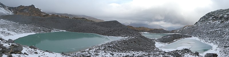
English: Lake Tambosee and the two lakes above the Tambosee (Lake Tambo, Splügen, Grison, Switzerland)
Deutsch: Tambosee und zwei Seen, die sich oberhalb vom Tambosee befinden (Splügen, Graubünden, Schweiz)
Rumantsch: Tambosee ed dus lais tgi sa cattan sur igl Tambosee (Lai digl Tambo, Spleia, Grischun, Svizra)
Italiano: Tambosee e due laghi sopra Tambosee (Lago dal Tambo, Spluga, Grigioni, Svizzera) |
||
| Date | |||
| Source |
Own work
|
||
| Author | Capricorn4049 | ||
| Permission (Reusing this file) |
|

| Object location | | View this and other nearby images on: OpenStreetMap |
|---|
| Camera location | | View this and other nearby images on: OpenStreetMap |
|---|
Licensing
edit
I, the copyright holder of this work, hereby publish it under the following license:
This file is licensed under the Creative Commons Attribution-Share Alike 4.0 International license.
- You are free:
- to share – to copy, distribute and transmit the work
- to remix – to adapt the work
- Under the following conditions:
- attribution – You must give appropriate credit, provide a link to the license, and indicate if changes were made. You may do so in any reasonable manner, but not in any way that suggests the licensor endorses you or your use.
- share alike – If you remix, transform, or build upon the material, you must distribute your contributions under the same or compatible license as the original.
File history
Click on a date/time to view the file as it appeared at that time.
| Date/Time | Thumbnail | Dimensions | User | Comment | |
|---|---|---|---|---|---|
| current | 20:21, 5 November 2017 | 3,630 × 904 (1.48 MB) | Capricorn4049 (talk | contribs) | Cropped 15 % horizontally and 6 % vertically using CropTool with lossless mode. | |
| 19:38, 5 November 2017 | 4,256 × 960 (2.35 MB) | Capricorn4049 (talk | contribs) | User created page with UploadWizard |
You cannot overwrite this file.
File usage on Commons
There are no pages that use this file.
File usage on other wikis
The following other wikis use this file:
- Usage on de.wikipedia.org