File:Tarawa 1951 map 20157364658 d8596088db o.jpg
Size of this preview: 526 × 599 pixels. Other resolutions: 211 × 240 pixels | 421 × 480 pixels | 674 × 768 pixels | 899 × 1,024 pixels | 2,242 × 2,554 pixels.
Original file (2,242 × 2,554 pixels, file size: 588 KB, MIME type: image/jpeg)
Captions
Captions
Add a one-line explanation of what this file represents
Summary
edit
| Description |
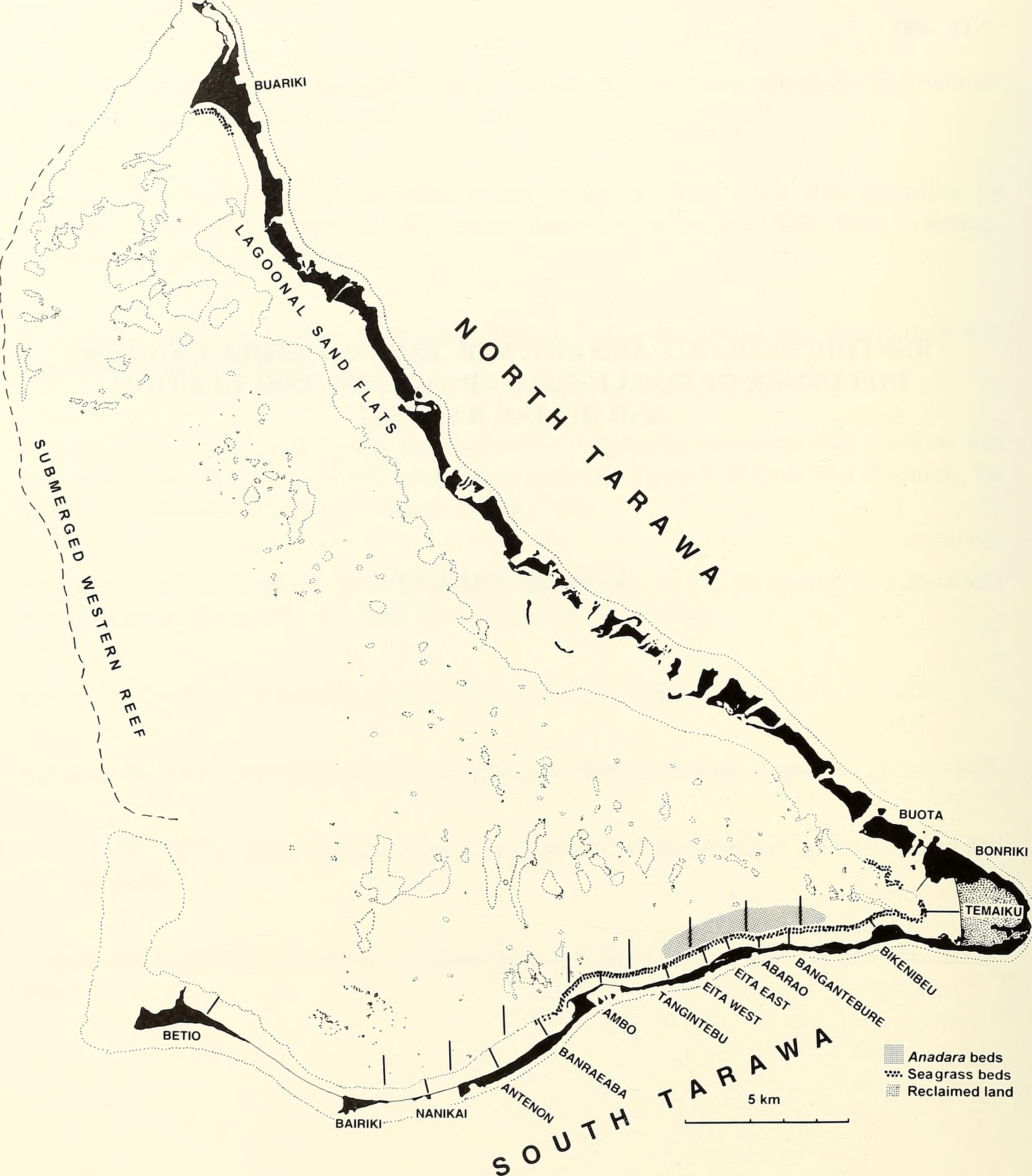
English: map of Tarawa Atoll, Gilbert Islands, Kiribati, Central Pacific Ocean |
| Date | |
| Source | https://www.flickr.com/photos/internetarchivebookimages/20157364658 |
| Author | Smithsonian Institution. Press; National Research Council (U. S. ). Pacific Science Board; Smithsonian Institution; National Museum of Natural History (U. S. ); United States. Bureau of Sport Fisheries and Wildlife |
Licensing
edit
This image was taken from Flickr's The Commons. The uploading organization may have various reasons for determining that no known copyright restrictions exist, such as:
More information can be found at https://flickr.com/commons/usage/. Please add additional copyright tags to this image if more specific information about copyright status can be determined. See Commons:Licensing for more information. |
File history
Click on a date/time to view the file as it appeared at that time.
| Date/Time | Thumbnail | Dimensions | User | Comment | |
|---|---|---|---|---|---|
| current | 06:21, 7 October 2016 | | 2,242 × 2,554 (588 KB) | Ratzer (talk | contribs) | User created page with UploadWizard |
You cannot overwrite this file.
File usage on Commons
There are no pages that use this file.