File:Tectonic map of Ireland.svg

Size of this PNG preview of this SVG file: 481 × 599 pixels. Other resolutions: 192 × 240 pixels | 385 × 480 pixels | 616 × 768 pixels | 822 × 1,024 pixels | 1,643 × 2,048 pixels | 1,450 × 1,807 pixels.
Original file (SVG file, nominally 1,450 × 1,807 pixels, file size: 1.21 MB)
Captions
Captions
Add a one-line explanation of what this file represents
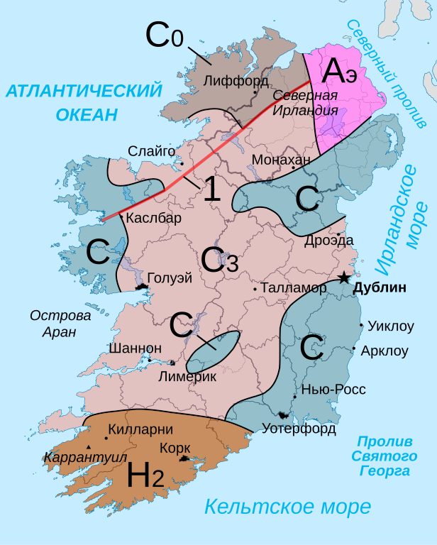
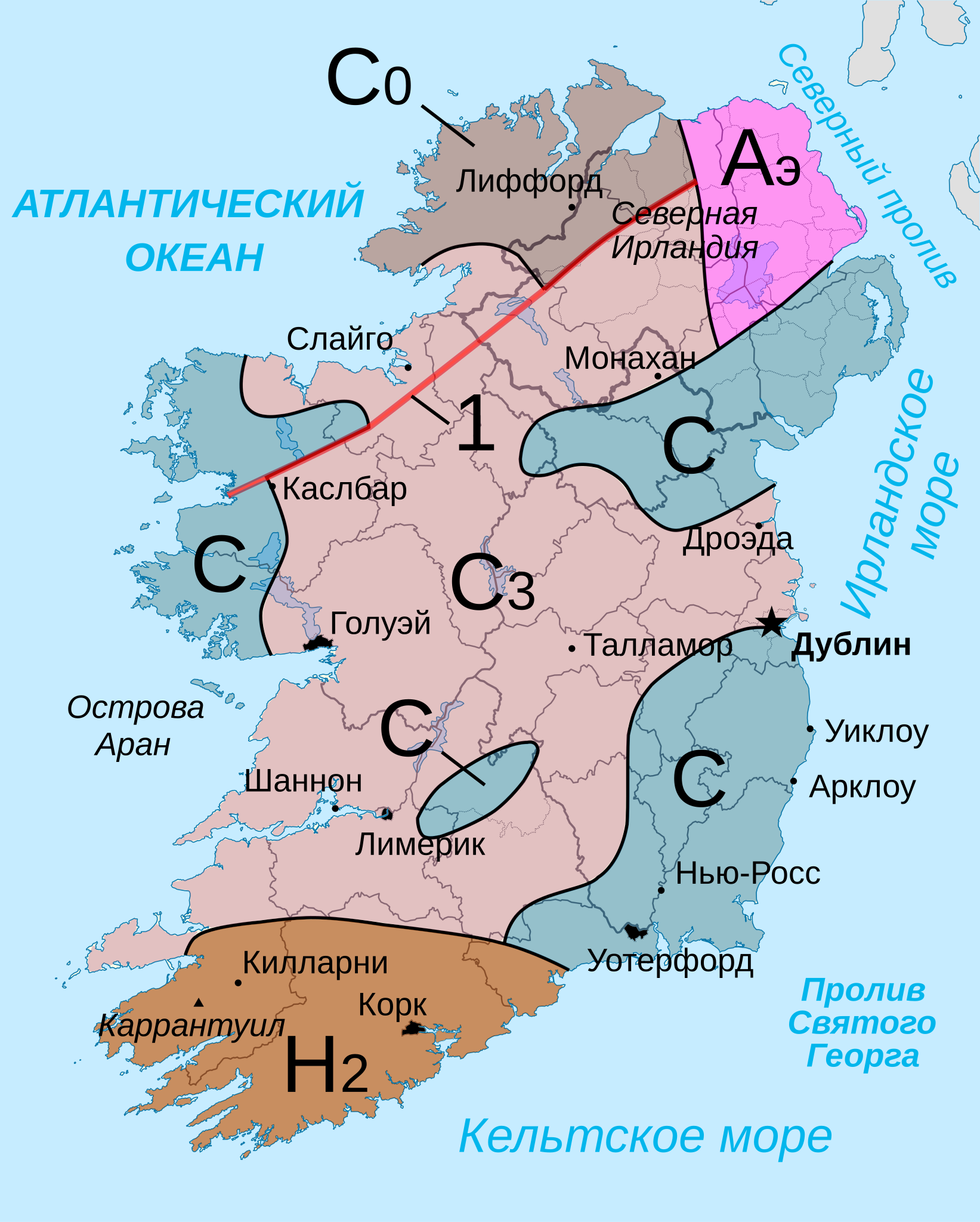
| Description | Тектоническая карта острова Ирландия. Данные из "Физико-географического атласа мира" 1964 года Академии Наук СССР |
| Date | (UTC) |
| Source | |
| Author |
|
| Other versions | Derivative works of this file: Tectonic map of Ireland-IT.svg |
| This is a retouched picture, which means that it has been digitally altered from its original version. The original can be viewed here: Island of Ireland location map.svg:
|
I, the copyright holder of this work, hereby publish it under the following license:
This file is licensed under the Creative Commons Attribution-Share Alike 3.0 Unported license.
- You are free:
- to share – to copy, distribute and transmit the work
- to remix – to adapt the work
- Under the following conditions:
- attribution – You must give appropriate credit, provide a link to the license, and indicate if changes were made. You may do so in any reasonable manner, but not in any way that suggests the licensor endorses you or your use.
- share alike – If you remix, transform, or build upon the material, you must distribute your contributions under the same or compatible license as the original.
Original upload log edit
This image is a derivative work of the following images:
- File:Island_of_Ireland_location_map.svg licensed with Cc-by-sa-3.0
- 2010-03-06T20:43:33Z Rannpháirtí anaithnid 1450x1807 (679207 Bytes) Fix incorrectly coloured isands.
- 2010-03-03T22:19:29Z Rannpháirtí anaithnid 1450x1807 (679744 Bytes) {{Information |Description={{de|Positionskarte von [[:de:Irland|Irland]]}} Quadratische Plattkarte, N-S-Streckung 170 %. Geographische Begrenzung der Karte: * N: 55.6° N * S: 51.2° N * W: 11.0° W * O: 5.0° W {{en|Location
Uploaded with derivativeFX
File history
Click on a date/time to view the file as it appeared at that time.
| Date/Time | Thumbnail | Dimensions | User | Comment | |
|---|---|---|---|---|---|
| current | 13:03, 2 July 2011 | | 1,450 × 1,807 (1.21 MB) | Das steinerne Herz (talk | contribs) | <flowRoot> fix |
| 22:58, 2 December 2010 |  | 1,450 × 1,807 (1.21 MB) | Das steinerne Herz (talk | contribs) | {{Information |Description=Тектоническая карта острова Ирландия. Данные из "Физико-географического атласа мира" 1964 года Академии Наук СССР |Source=*[[:File:Islan |
You cannot overwrite this file.
File usage on Commons
The following page uses this file:
File usage on other wikis
The following other wikis use this file:
- Usage on ba.wikipedia.org
- Usage on kk.wikipedia.org
- Usage on ru.wikipedia.org