File:Telecommunications towers of Bukit Nyabau, Bintulu.jpg

Size of this preview: 450 × 600 pixels. Other resolutions: 180 × 240 pixels | 360 × 480 pixels | 576 × 768 pixels | 768 × 1,024 pixels | 1,536 × 2,048 pixels | 3,120 × 4,160 pixels.
Original file (3,120 × 4,160 pixels, file size: 1.95 MB, MIME type: image/jpeg)
Captions
Captions
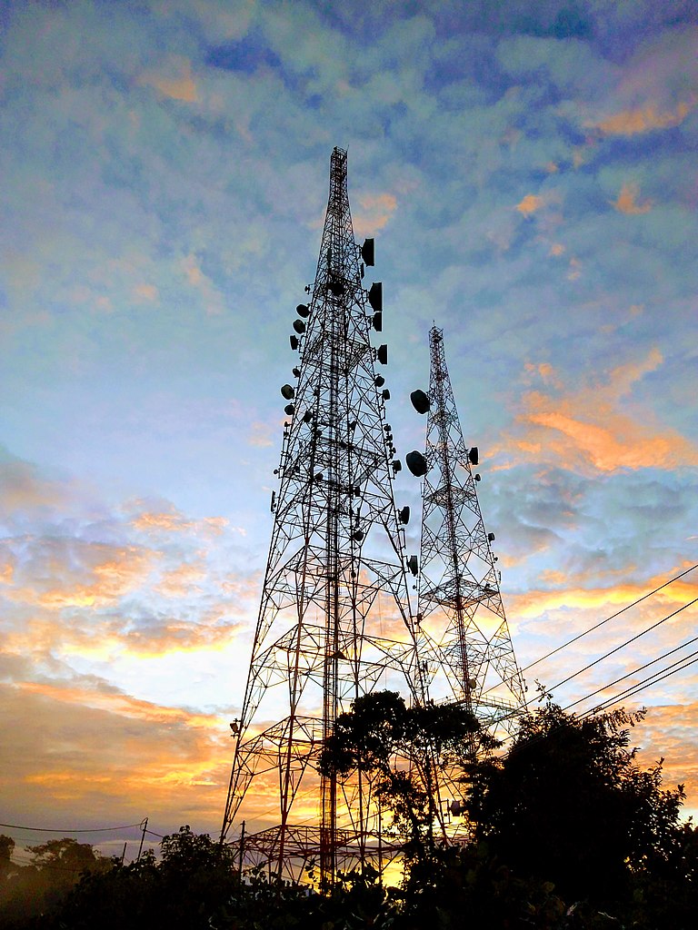
The telecommunications towers on Nyabau mountain, various of flora and fauna could be seen at the mountain.
Summary
edit
| Description |
English: Nyabau mountain is a hill station of Bintulu's telecommunications towers. The area is partially belongs to UPM Bintulu Campus. The hill station is surrounded by forest, there are various of flora and fauna could be found on the mountain, include the hornbills. Nyabau mountain is a recreational place where residents frequently jogging on the mountain especially on weekends. |
| Date | |
| Source | Own work |
| Author | Wee Hong |
| Camera location | | View this and other nearby images on: OpenStreetMap |
|---|
Licensing
edit
I, the copyright holder of this work, hereby publish it under the following license:
This file is licensed under the Creative Commons Attribution-Share Alike 4.0 International license.
- You are free:
- to share – to copy, distribute and transmit the work
- to remix – to adapt the work
- Under the following conditions:
- attribution – You must give appropriate credit, provide a link to the license, and indicate if changes were made. You may do so in any reasonable manner, but not in any way that suggests the licensor endorses you or your use.
- share alike – If you remix, transform, or build upon the material, you must distribute your contributions under the same or compatible license as the original.
This image was uploaded as part of Wiki Loves Earth 2020.
|
 |
File history
Click on a date/time to view the file as it appeared at that time.
| Date/Time | Thumbnail | Dimensions | User | Comment | |
|---|---|---|---|---|---|
| current | 19:09, 9 June 2020 | | 3,120 × 4,160 (1.95 MB) | Wee Hong (talk | contribs) | Uploaded own work with UploadWizard |
You cannot overwrite this file.
File usage on Commons
The following page uses this file:
File usage on other wikis
The following other wikis use this file:
- Usage on en.wikipedia.org