File:Terra Nova e Labrador 03.jpg

Size of this preview: 800 × 597 pixels. Other resolutions: 320 × 239 pixels | 640 × 477 pixels | 1,024 × 764 pixels | 1,280 × 954 pixels | 1,600 × 1,193 pixels.
Original file (1,600 × 1,193 pixels, file size: 664 KB, MIME type: image/jpeg)
Captions
Captions
Map of Newfoundland and Labrador
Summary
edit
| Description |
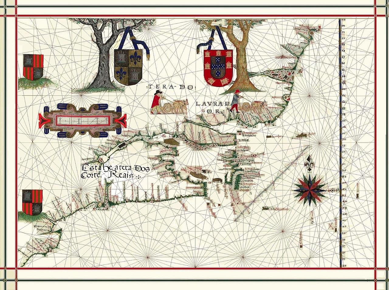
Português: Mapa da Terra Nova e Labrador feito pelo cartografo português Fernão Vaz Dourado em 1576.
English: Map of Newfoundland and Labrador made by the Portuguese cartographer Fernão Vaz Dourado in 1576.
Español: Mapa de Terranova y Labrador realizado por el cartógrafo portugués Fernão Vaz Dourado en 1576.
Français : Carte de Terre-Neuve-et-Labrador réalisée par le cartographe portugais Fernão Vaz Dourado en 1576. |
| Date | |
| Source | Atlas Universal. 1576. |
| Author | Fernão Vaz Dourado |
Licensing
edit
| This file is made available under the Creative Commons CC0 1.0 Universal Public Domain Dedication. | |
| The person who associated a work with this deed has dedicated the work to the public domain by waiving all of their rights to the work worldwide under copyright law, including all related and neighboring rights, to the extent allowed by law. You can copy, modify, distribute and perform the work, even for commercial purposes, all without asking permission.
|
File history
Click on a date/time to view the file as it appeared at that time.
| Date/Time | Thumbnail | Dimensions | User | Comment | |
|---|---|---|---|---|---|
| current | 21:42, 2 August 2021 | | 1,600 × 1,193 (664 KB) | Jhonatan Gomes Diniz (talk | contribs) | Uploaded a work by Fernão Vaz Dourado from Atlas Universal. 1576. with UploadWizard |
You cannot overwrite this file.
File usage on Commons
There are no pages that use this file.