File:TerritoriosPartisanosOtoñoDe1941.svg

Size of this PNG preview of this SVG file: 421 × 525 pixels. Other resolutions: 192 × 240 pixels | 385 × 480 pixels | 616 × 768 pixels | 821 × 1,024 pixels | 1,642 × 2,048 pixels.
Original file (SVG file, nominally 421 × 525 pixels, file size: 101 KB)
Captions
Captions
Add a one-line explanation of what this file represents
Summary
edit| Description |
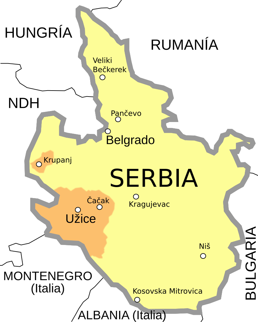
English: a map of the territory controlled by the partisans of Užice
Español: Territorios controlados por los partisanos yugoslavos en el otoño de 1941 (República de Užice |
| Date | (UTC) |
| Source | |
| Author |
|
| Other versions |
[]
PNG:
|


| This is a retouched picture, which means that it has been digitally altered from its original version. Modifications: turned into svg and Spanish. The original can be viewed here: Uzicka republika2.png:
|
This file is licensed under the Creative Commons Attribution-Share Alike 3.0 Unported license.
- You are free:
- to share – to copy, distribute and transmit the work
- to remix – to adapt the work
- Under the following conditions:
- attribution – You must give appropriate credit, provide a link to the license, and indicate if changes were made. You may do so in any reasonable manner, but not in any way that suggests the licensor endorses you or your use.
- share alike – If you remix, transform, or build upon the material, you must distribute your contributions under the same or compatible license as the original.
Original upload log
edit
This image is a derivative work of the following images:
- File:Uzicka_republika2.png licensed with PD-self
- 2010-09-08T16:02:19Z DIREKTOR 421x525 (50624 Bytes) Crop
- 2007-10-27T18:15:50Z George D. Bozovic 447x551 (50600 Bytes)
- 2007-10-26T14:07:55Z George D. Bozovic 447x599 (53656 Bytes) {{Information |Description=a map of the territory controlled by the partisans of Užice |Source=self-made |Date=26 October 2007 |Author= [[w:User:Ђорђе Д. Божовић|George D. Božović]] }}
Uploaded with derivativeFX
File history
Click on a date/time to view the file as it appeared at that time.
| Date/Time | Thumbnail | Dimensions | User | Comment | |
|---|---|---|---|---|---|
| current | 07:25, 10 July 2021 | | 421 × 525 (101 KB) | Rowanwindwhistler (talk | contribs) | Minor corrections. Fake text added |
| 08:55, 22 April 2013 |  | 421 × 525 (23 KB) | Rowanwindwhistler (talk | contribs) | The good one | |
| 08:52, 22 April 2013 |  | 421 × 525 (62 KB) | Rowanwindwhistler (talk | contribs) | Slight changes following the source map. | |
| 20:39, 4 August 2011 |  | 421 × 525 (17 KB) | Rowanwindwhistler (talk | contribs) | Base png removed | |
| 20:38, 4 August 2011 |  | 421 × 525 (17 KB) | Rowanwindwhistler (talk | contribs) | {{Information |Description={{en|a map of the territory controlled by the partisans of Užice}} {{es|1=Territorios controlados por los partisanos yugoslavos en el otoño de 1941 (República de Užice}} |
You cannot overwrite this file.
File usage on Commons
The following 8 pages use this file:
File usage on other wikis
The following other wikis use this file:
- Usage on ast.wikipedia.org
- Usage on es.wikipedia.org
- Usage on sv.wikipedia.org