File:Territorium Burgergemeinde Biel Stand 2020.jpg

Original file (1,500 × 908 pixels, file size: 669 KB, MIME type: image/jpeg)
Captions
Captions
Summary
edit
| Description |
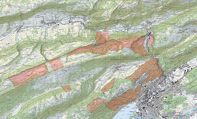
Deutsch: Karte des Eigentums der Burgergemeinde Biel, Stand 2020. Gezeichnet von Kuno Moser. Beim Kartenhintergrund handelt es sich um die Landeskarte 1:25'000, Quelle: Bundesamt für Landestopografie, swisstopo. |
| Date | |
| Source | Own work |
| Author | QNoMo |
Licensing
edit
The data made publicly available by swisstopo may be used, distributed and made accessible. Furthermore, they may be enriched and processed and also used commercially. A reference to the source is mandatory. In the case of digital or analogue representations and publications, as well as in the case of dissemination, one of the following source references must be attached in any case:
Terms of use for free geodata and geoservices (OGD) from swisstopo
|
.svg) |
File history
Click on a date/time to view the file as it appeared at that time.
| Date/Time | Thumbnail | Dimensions | User | Comment | |
|---|---|---|---|---|---|
| current | 13:58, 19 April 2021 | | 1,500 × 908 (669 KB) | QNoMo (talk | contribs) | Cross-wiki upload from de.wikipedia.org |
You cannot overwrite this file.
File usage on Commons
There are no pages that use this file.
File usage on other wikis
The following other wikis use this file:
- Usage on de.wikipedia.org