File:Tertia Africae Tabula.jpg

Size of this preview: 800 × 533 pixels. Other resolutions: 320 × 213 pixels | 640 × 427 pixels | 1,024 × 683 pixels | 1,280 × 853 pixels | 2,560 × 1,706 pixels | 3,200 × 2,133 pixels.
Original file (3,200 × 2,133 pixels, file size: 1.09 MB, MIME type: image/jpeg)
Captions
Captions
Add a one-line explanation of what this file represents
Summary
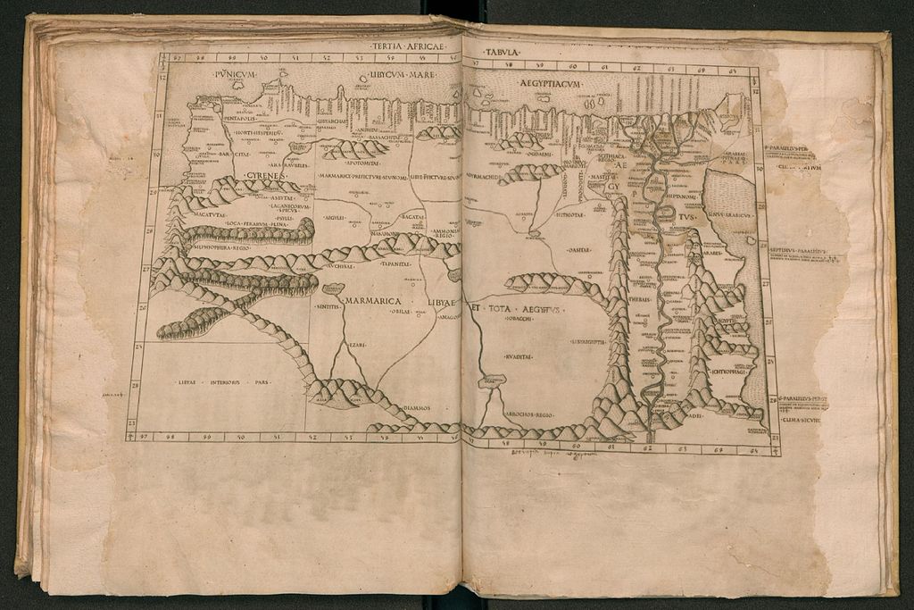
edit| Description |
English: The Third Map of Africa (Tertia Africae Tabula), depicting Cyrenaica (Cyrenes), Libya (Marmarica Libyae et Tota Aegyptus), and Egypt (Aegyptus), from the edition of Ptolemy's Geography (Cosmographia) printed at Rome. Latina: Tertia Africae Tabula: Cyrenaica quę et pentapolis[,] Marmarica[,] Libya[,] Aegiptus inferior[,] Aegiptus Thebais. |
| Date | |
| Source | Rome Ptolemy |
| Author | Ptolemy |
| Other versions |
|

Licensing
edit
|
This work is in the public domain in its country of origin and other countries and areas where the copyright term is the author's life plus 70 years or fewer. This work is in the public domain in the United States because it was published (or registered with the U.S. Copyright Office) before January 1, 1929. | |
| This file has been identified as being free of known restrictions under copyright law, including all related and neighboring rights. | |
File history
Click on a date/time to view the file as it appeared at that time.
| Date/Time | Thumbnail | Dimensions | User | Comment | |
|---|---|---|---|---|---|
| current | 15:29, 7 September 2016 | | 3,200 × 2,133 (1.09 MB) | LlywelynII (talk | contribs) | User created page with UploadWizard |
You cannot overwrite this file.
File usage on Commons
The following page uses this file: