File:The Amazing Race 8 map.png
Size of this preview: 736 × 599 pixels. Other resolutions: 295 × 240 pixels | 589 × 480 pixels | 846 × 689 pixels.
Original file (846 × 689 pixels, file size: 27 KB, MIME type: image/png)
Captions
Captions
Add a one-line explanation of what this file represents
| The Amazing Race maps |
| Original U.S. version |
| Countries visited · US states |
| Route maps |
| Seasons: 1 · 2 · 3 · 4 · 5 · 6 · 7 · 8 · 9 · 10 · 11 · 12 · 13 · 14 · 15 · 16 · 17 · 18 · 19 (svg) · 20 (svg) · 21 · 22 · 23 · 24 · 25 · 26 · 27 · 28 ˑ 29 ˑ 30 ˑ 31 ˑ 32 ˑ 33 ˑ 34 ˑ 35 ˑ 36 |

|
This map image could be re-created using vector graphics as an SVG file. This has several advantages; see Commons:Media for cleanup for more information. If an SVG form of this image is available, please upload it and afterwards replace this template with
{{vector version available|new image name}}.
It is recommended to name the SVG file “The Amazing Race 8 map.svg”—then the template Vector version available (or Vva) does not need the new image name parameter. |
Summary edit
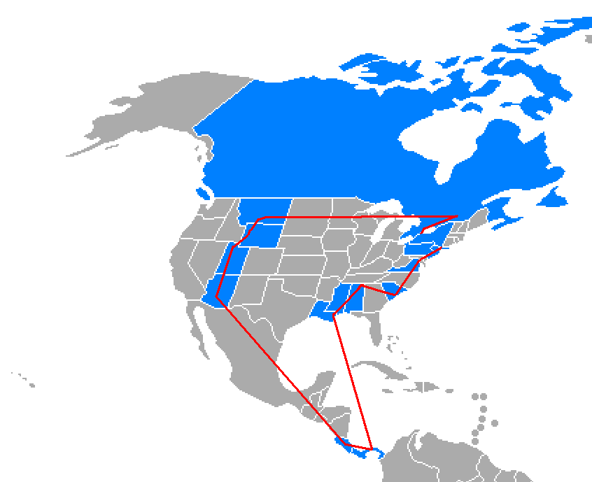
The Amazing Race 8 route map, US states and other countries visited colored in blue. (only includes places that fielded actual route markers, challenges or finish mats)
Licensing edit

|
Permission is granted to copy, distribute and/or modify this document under the terms of the GNU Free Documentation License, Version 1.2 or any later version published by the Free Software Foundation; with no Invariant Sections, no Front-Cover Texts, and no Back-Cover Texts. A copy of the license is included in the section entitled GNU Free Documentation License. |
| This file is licensed under the Creative Commons Attribution-Share Alike 3.0 Unported license. | ||
| ||
| This licensing tag was added to this file as part of the GFDL licensing update. |
File history
Click on a date/time to view the file as it appeared at that time.
| Date/Time | Thumbnail | Dimensions | User | Comment | |
|---|---|---|---|---|---|
| current | 04:01, 22 January 2007 | | 846 × 689 (27 KB) | Roke~commonswiki (talk | contribs) | |
| 10:28, 1 May 2006 |  | 846 × 689 (27 KB) | Roke~commonswiki (talk | contribs) | +s.carolina | |
| 04:46, 1 May 2006 |  | 846 × 689 (27 KB) | Roke~commonswiki (talk | contribs) | The Amazing Race 8 route map, US states and other countries visited colored in blue. (only includes places that fielded actual route markers, challenges or finish mats) Category: TV world maps |
You cannot overwrite this file.
File usage on Commons
The following 2 pages use this file:
- The Amazing Race
- File:Amazing race 8 map.PNG (file redirect)
File usage on other wikis
The following other wikis use this file:
- Usage on en.wikipedia.org
- Usage on es.wikipedia.org
- Usage on fr.wikipedia.org
- Usage on id.wikipedia.org
- Usage on it.wikipedia.org
- Usage on no.wikipedia.org
- Usage on pl.wikipedia.org
- Usage on th.wikipedia.org
- Usage on zh.wikipedia.org