File:The B1248 road to Cherry Burton - geograph.org.uk - 238067.jpg
No higher resolution available.
The_B1248_road_to_Cherry_Burton_-_geograph.org.uk_-_238067.jpg (640 × 480 pixels, file size: 130 KB, MIME type: image/jpeg)
Captions
Captions
Add a one-line explanation of what this file represents
Summary edit
| Description |
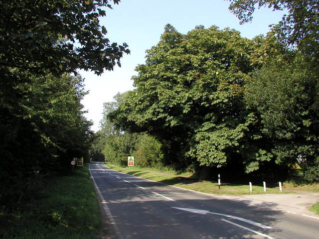
English: The B1248 road to Cherry Burton, East Riding of Yorkshire, England. This is the B1248 (the 'binary road' perhaps?!) from Beverley to Malton. The turning to Cherry Burton is just a little further up the road from here on the left. The road in the seventies was very 'quiet', but is now far more heavily used due to far more people living out in this area now. The tree is a marvellous horse chestnut which has been here for many, many years. |
| Date | |
| Source | From geograph.org.uk |
| Author | Andy Beecroft |
| Permission (Reusing this file) |
Creative Commons Attribution Share-alike license 2.0 |
| Attribution (required by the license) | Andy Beecroft / The B1248 road to Cherry Burton / |
| Camera location | | View this and other nearby images on: OpenStreetMap |
|---|
_heading:315.00&language=en)
| Object location | | View this and other nearby images on: OpenStreetMap |
|---|
_heading:315.00&language=en)
Licensing edit

|
This image was taken from the Geograph project collection. See this photograph's page on the Geograph website for the photographer's contact details. The copyright on this image is owned by Andy Beecroft and is licensed for reuse under the Creative Commons Attribution-ShareAlike 2.0 license.
|
This file is licensed under the Creative Commons Attribution-Share Alike 2.0 Generic license.
Attribution: Andy Beecroft
- You are free:
- to share – to copy, distribute and transmit the work
- to remix – to adapt the work
- Under the following conditions:
- attribution – You must give appropriate credit, provide a link to the license, and indicate if changes were made. You may do so in any reasonable manner, but not in any way that suggests the licensor endorses you or your use.
- share alike – If you remix, transform, or build upon the material, you must distribute your contributions under the same or compatible license as the original.
File history
Click on a date/time to view the file as it appeared at that time.
| Date/Time | Thumbnail | Dimensions | User | Comment | |
|---|---|---|---|---|---|
| current | 02:25, 1 February 2010 | | 640 × 480 (130 KB) | GeographBot (talk | contribs) | == {{int:filedesc}} == {{Information |description={{en|1=The B1248 road to Cherry Burton. This is the B1248 (the 'binary road' perhaps?!) from Beverley to Malton. The turning to Cherry Burton is just a little further up the road from here on the left. T |
You cannot overwrite this file.
File usage on Commons
There are no pages that use this file.