File:The Berlin Wall (6058525242).jpg
Original file (2,209 × 3,802 pixels, file size: 3.77 MB, MIME type: image/jpeg)
Captions
Captions
Summary edit
.jpg&action=edit§ion=1)
| Description |
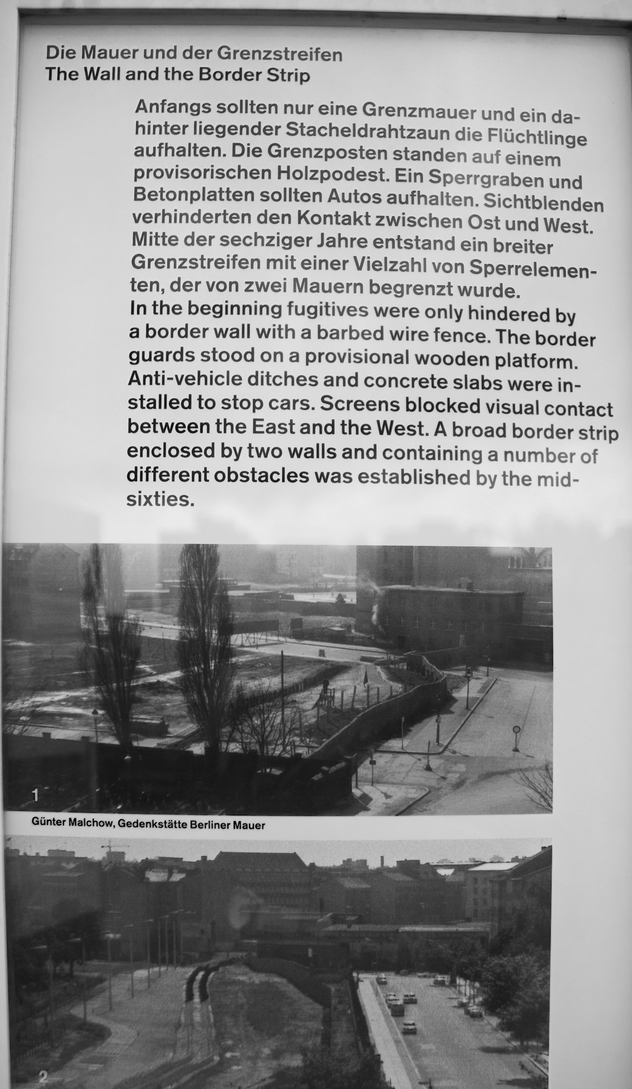
The Berlin Wall Construction began on The Berlin Wall early in the morning of Sunday, August 13, 1961. It was a desperate – and effective - move by the GDR (German Democratic Republic) to stop East Berliners escaping from the Soviet-controlled East German state into the West of the city, which was then occupied by the Americans, British and French. Berlin's unique situation as a city half-controlled by Western forces, in the middle of the Soviet Occupation Zone of Germany, made it a focal point for tensions between the Allies and the Soviets and a place where conflicting ideologies were enforced side-by-side. However, as more and more people in the Soviet-controlled East grew disillusioned with communism and the increasingly oppressive economic and political conditions, an increasing number began defecting to the West. By 1961 an estimated 1,500 people a day were fleeing to the West, damaging both the credibility and - more importantly - the workforce of the GDR. Soon rumours began to spread about a wall, and it wasn’t long after that those rumours were made a concrete reality. In a masterfully-planned operation, spanning just 24 hours, the streets of Berlin were torn up, barricades of paving stones were erected, tanks were gathered at crucial places and subways and local railway services were interrupted, so that within a day the West of Berlin was completely sealed off from the East. As of that same day inhabitants of East Berlin and the GDR were no longer allowed to enter the West of the city (including the 60,000 who had been commuters). In response to international criticism that such drastic measures inevitably drew, the GDR claimed that the barricade had been raised as an ‘anti-fascist protection wall’, and that they had moved to prevent a third world war. |
| Date | |
| Source | The Berlin Wall |
| Author | Berit from Redhill/Surrey, UK |
| Camera location | | View this and other nearby images on: OpenStreetMap |
|---|
.jpg¶ms=052.508691_N_0013.381519_E_globe:Earth_type:camera_source:Flickr_&language=en)
Licensing edit
.jpg&action=edit§ion=2)
- You are free:
- to share – to copy, distribute and transmit the work
- to remix – to adapt the work
- Under the following conditions:
- attribution – You must give appropriate credit, provide a link to the license, and indicate if changes were made. You may do so in any reasonable manner, but not in any way that suggests the licensor endorses you or your use.
| This image, originally posted to Flickr, was reviewed on 6 February 2013 by the administrator or reviewer File Upload Bot (Magnus Manske), who confirmed that it was available on Flickr under the stated license on that date. |
File history
Click on a date/time to view the file as it appeared at that time.
| Date/Time | Thumbnail | Dimensions | User | Comment | |
|---|---|---|---|---|---|
| current | 12:31, 6 February 2013 | | 2,209 × 3,802 (3.77 MB) | File Upload Bot (Magnus Manske) (talk | contribs) | Transferred from Flickr by User:russavia |
You cannot overwrite this file.
File usage on Commons
There are no pages that use this file.
.jpg&oldid=648739310)