File:The Black Linn Reservoir - geograph.org.uk - 1654859.jpg
No higher resolution available.
The_Black_Linn_Reservoir_-_geograph.org.uk_-_1654859.jpg (640 × 480 pixels, file size: 84 KB, MIME type: image/jpeg)
Captions
Captions
Add a one-line explanation of what this file represents
Summary edit
| Description |
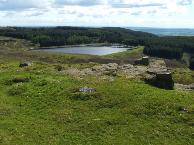
English: The Black Linn Reservoir The photograph was taken from the trig point on Doughnot Hill (which appears as "Douennet hil" on the Pont/Blaeu map of the Lennox, surveyed in the 1580s-90s). The reservoir was built in the late nineteenth century; it is shown on the 1:10560 OS map of 1899, but not on the equivalent map from 1864.
According to the booklet "Off the Main Road" (I.M.M.MacPhail, 1976), it was "the oldest Dumbarton reservoir, constructed in 1874-75". The same work notes that Doughnot (see above) was formerly pronounced "Deochnay". The Black Linn, the waterfall that gave the reservoir its name, is shown on the 1864 map, and is located only a short distance from the western side of the reservoir; see https://www.geograph.org.uk/snippet/805 for photographs of the falls. |
| Date | |
| Source | From geograph.org.uk |
| Author | Lairich Rig |
| Attribution (required by the license) | Lairich Rig / The Black Linn Reservoir / |
| Camera location | | View this and other nearby images on: OpenStreetMap |
|---|
_heading:180.00&language=en)
| Object location | | View this and other nearby images on: OpenStreetMap |
|---|
_heading:180.00&language=en)
Licensing edit

|
This image was taken from the Geograph project collection. See this photograph's page on the Geograph website for the photographer's contact details. The copyright on this image is owned by Lairich Rig and is licensed for reuse under the Creative Commons Attribution-ShareAlike 2.0 license.
|
This file is licensed under the Creative Commons Attribution-Share Alike 2.0 Generic license.
Attribution: Lairich Rig
- You are free:
- to share – to copy, distribute and transmit the work
- to remix – to adapt the work
- Under the following conditions:
- attribution – You must give appropriate credit, provide a link to the license, and indicate if changes were made. You may do so in any reasonable manner, but not in any way that suggests the licensor endorses you or your use.
- share alike – If you remix, transform, or build upon the material, you must distribute your contributions under the same or compatible license as the original.
File history
Click on a date/time to view the file as it appeared at that time.
| Date/Time | Thumbnail | Dimensions | User | Comment | |
|---|---|---|---|---|---|
| current | 22:23, 4 March 2011 | | 640 × 480 (84 KB) | GeographBot (talk | contribs) | == {{int:filedesc}} == {{Information |description={{en|1=The Black Linn Reservoir The photograph was taken from the trig point on Doughnot Hill (which appears as "Douennet hil" on the Pont/Blaeu map of the Lennox, surveyed in the 1580s-90s). The reservoir |
You cannot overwrite this file.
File usage on Commons
There are no pages that use this file.