File:The Brick Well in Minato-no-Mieru Oka Park IMG 0480.jpg

Size of this preview: 800 × 600 pixels. Other resolutions: 320 × 240 pixels | 640 × 480 pixels | 1,024 × 768 pixels | 1,280 × 960 pixels | 2,560 × 1,920 pixels | 5,152 × 3,864 pixels.
Original file (5,152 × 3,864 pixels, file size: 6.48 MB, MIME type: image/jpeg)
Captions
Captions
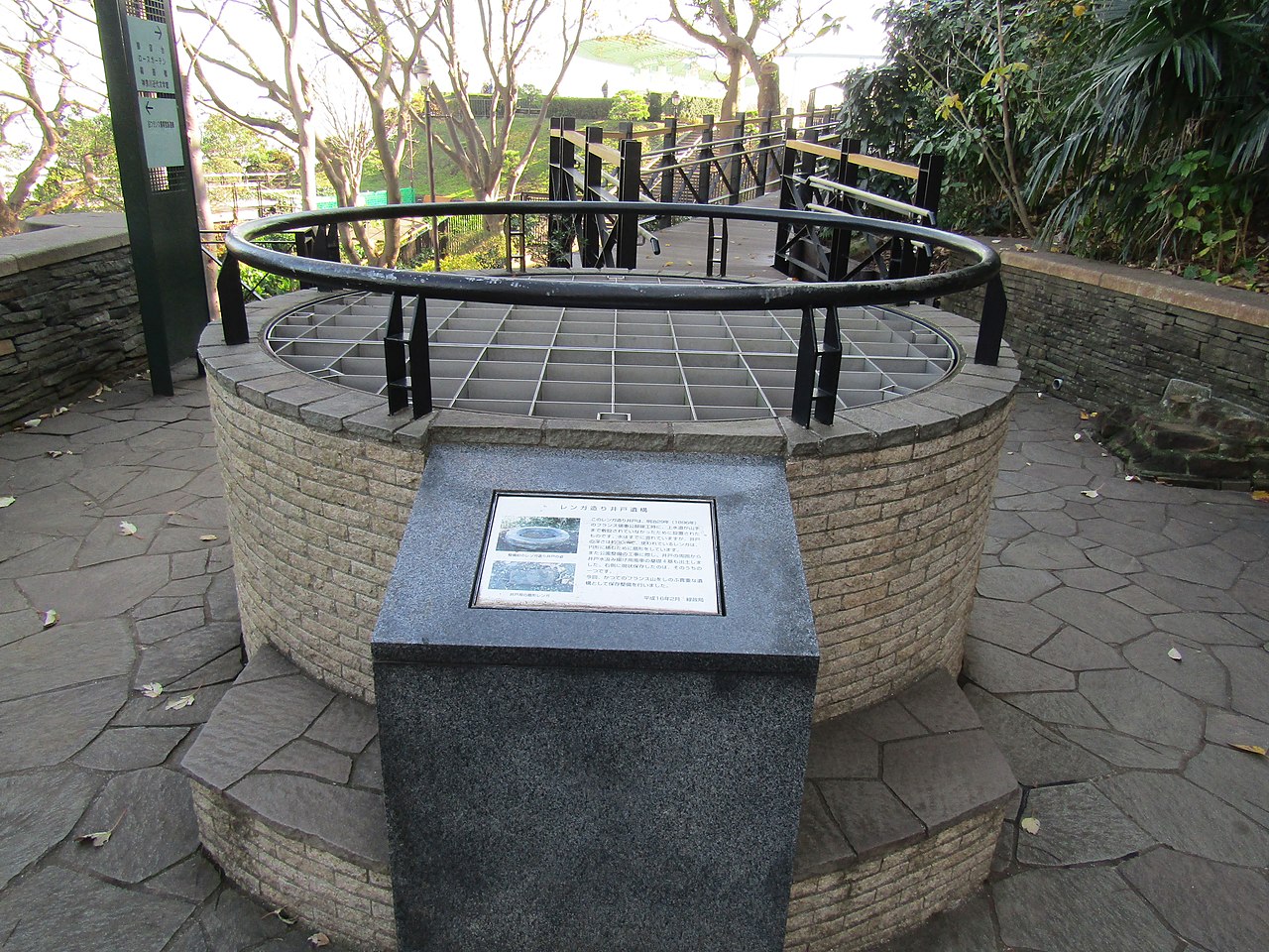
The brick well at a former French Consulate in Yamate-cho, Yokohama
Summary
edit
| Description |
English: This brick well was installed when the French Consulate was completed on the French Hill in 1896. When the land was handed over from France to Yokohama City in 1971, it became a valuable part of Minato-no-Mieru Oka Koen (Harbor View Park). During the construction of the park, four foundations of windmill to pump water from the well were excavated around the park. Currently, the park is seriously considering preserving and maintaining archeological sites.
日本語: このレンガの井戸は、フランス領事館が1896年にフレンチヒルに完成したときに設置されました。1971年にフランスから横浜に土地が引き渡されたとき、見える丘公園「ハーバービューパーク」の貴重な部分になりました。公園の建設中に、井戸から水を汲み出すための風車の4つの基礎が公園の周りで掘削されました。現在、公園では遺跡の保存と維持が真剣に検討されています。 |
| Date | |
| Source | Own work |
| Author | Dandy1022 |
| Camera location | | View this and other nearby images on: OpenStreetMap |
|---|
Licensing
edit
I, the copyright holder of this work, hereby publish it under the following license:
This file is licensed under the Creative Commons Attribution-Share Alike 4.0 International license.
- You are free:
- to share – to copy, distribute and transmit the work
- to remix – to adapt the work
- Under the following conditions:
- attribution – You must give appropriate credit, provide a link to the license, and indicate if changes were made. You may do so in any reasonable manner, but not in any way that suggests the licensor endorses you or your use.
- share alike – If you remix, transform, or build upon the material, you must distribute your contributions under the same or compatible license as the original.
File history
Click on a date/time to view the file as it appeared at that time.
| Date/Time | Thumbnail | Dimensions | User | Comment | |
|---|---|---|---|---|---|
| current | 14:52, 8 January 2020 | | 5,152 × 3,864 (6.48 MB) | Dandy1022 (talk | contribs) | User created page with UploadWizard |
You cannot overwrite this file.
File usage on Commons
There are no pages that use this file.