File:The East Woahink Lake day use area.jpg
Size of this preview: 800 × 530 pixels. Other resolutions: 320 × 212 pixels | 640 × 424 pixels | 1,024 × 678 pixels | 1,280 × 847 pixels | 2,560 × 1,694 pixels | 4,608 × 3,050 pixels.
Original file (4,608 × 3,050 pixels, file size: 5.97 MB, MIME type: image/jpeg)
Captions
Captions
Add a one-line explanation of what this file represents
Summary
edit
| Description |
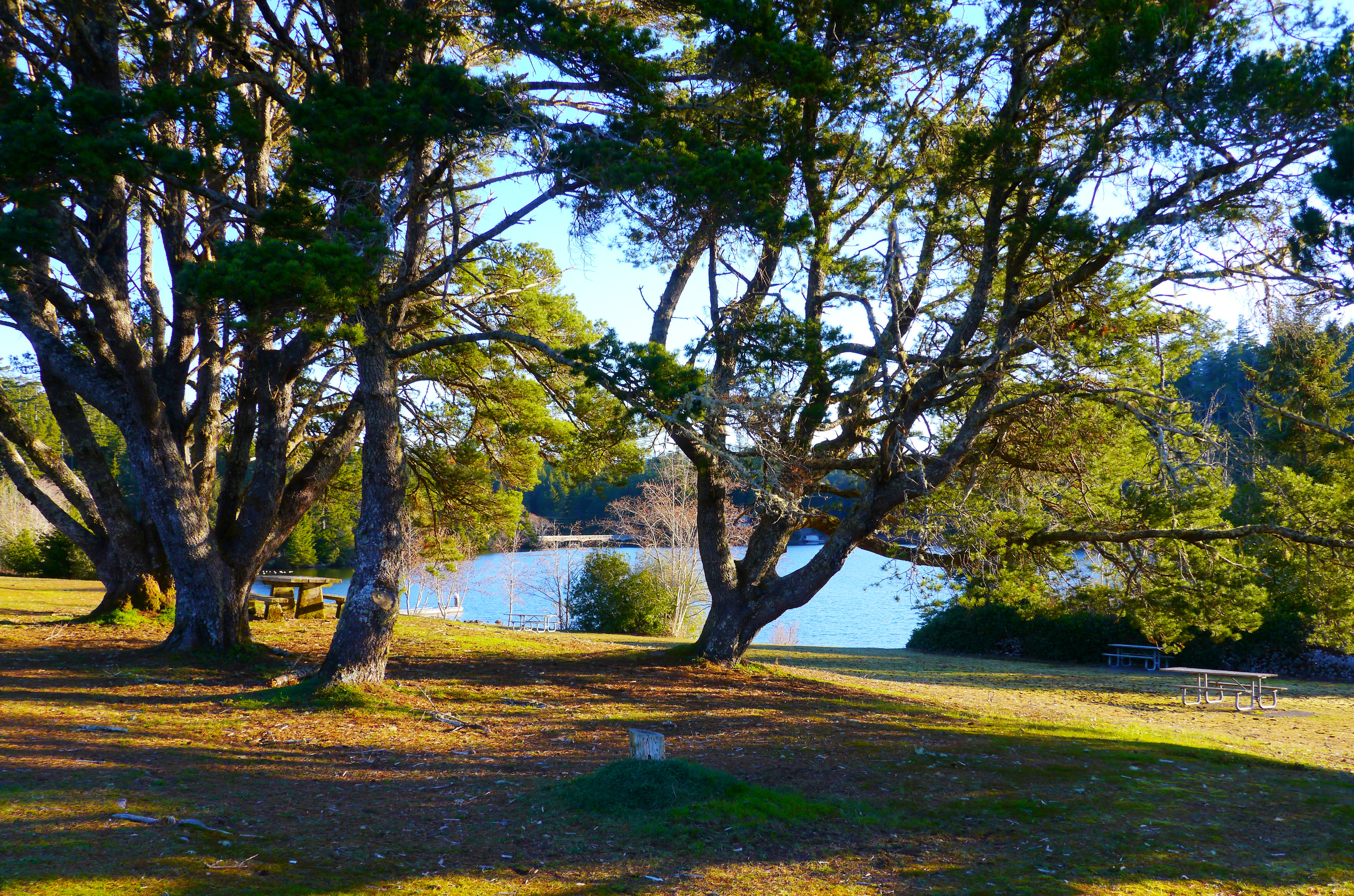
English: Woahink Lake (hō' hingk) extends further below sea level than any other lake dammed by sand dunes along the coast of the U.S. state of Oregon. The lake fills a depression in the Siltcoos River watershed about 3 miles (5 km) from the Pacific Ocean south of Florence along U.S. Route 101. The lowest point of the lake, which is up to 74 feet (23 m) deep, is about 36 feet (11 m) below sea level. The lake drains south to Siltcoos Lake via Woahink Creek. The lake's name may derive from the Siuslaw language. |
| Date | |
| Source | https://www.flickr.com/photos/46052415@N08/46529526365/ |
| Author | Only in Oregon |
Licensing
edit
This file is licensed under the Creative Commons Attribution 2.0 Generic license.
- You are free:
- to share – to copy, distribute and transmit the work
- to remix – to adapt the work
- Under the following conditions:
- attribution – You must give appropriate credit, provide a link to the license, and indicate if changes were made. You may do so in any reasonable manner, but not in any way that suggests the licensor endorses you or your use.
| This image was originally posted to Flickr by Only in Oregon at https://flickr.com/photos/46052415@N08/46529526365. It was reviewed on 10 March 2022 by FlickreviewR 2 and was confirmed to be licensed under the terms of the cc-by-2.0. |
File history
Click on a date/time to view the file as it appeared at that time.
| Date/Time | Thumbnail | Dimensions | User | Comment | |
|---|---|---|---|---|---|
| current | 21:58, 10 March 2022 | | 4,608 × 3,050 (5.97 MB) | Ser Amantio di Nicolao (talk | contribs) | Uploaded a work by Only in Oregon from https://www.flickr.com/photos/46052415@N08/46529526365/ with UploadWizard |
You cannot overwrite this file.
File usage on Commons
There are no pages that use this file.