File:The Green, Quainton - geograph.org.uk - 436572.jpg
No higher resolution available.
The_Green,_Quainton_-_geograph.org.uk_-_436572.jpg (640 × 480 pixels, file size: 143 KB, MIME type: image/jpeg)
Captions
Captions
Add a one-line explanation of what this file represents
Summary
edit
| Description |
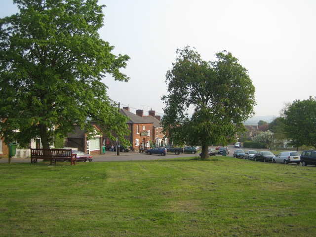
English: The Green, Quainton This view is from the top of The Green in Quainton which slopes south, with the famous windmill and stone cross behind the camera, to Lower Street at the bottom. On the east side of the green - just left of centre in the photograph - is the George & Dragon inn, with tables outside. The green originally had a pond, stocks and animal pound, but these have long since gone. Quainton is one of Buckinghamshire's ancient villages. It has a Roman road as a parish boundary and was given its name following the Anglo-Saxon invasion of this part of the country around 613AD. The name of Quainton derives from two Old English words - 'cwen', meaning queen, and 'tun' meaning farm - that is an estate of one of the Anglo-Saxon regional queens. Quainton has a population of about 1,260, compared with 1880 in 1900, when half of the principal householders listed their occupations as farmer or farm labourer. |
| Date | |
| Source | From geograph.org.uk |
| Author | Andy Gryce |
| Attribution (required by the license) | Andy Gryce / The Green, Quainton / |
| Camera location | | View this and other nearby images on: OpenStreetMap |
|---|
_heading:180.00&language=en)
| Object location | | View this and other nearby images on: OpenStreetMap |
|---|
_heading:180.00&language=en)
Licensing
edit

|
This image was taken from the Geograph project collection. See this photograph's page on the Geograph website for the photographer's contact details. The copyright on this image is owned by Andy Gryce and is licensed for reuse under the Creative Commons Attribution-ShareAlike 2.0 license.
|
This file is licensed under the Creative Commons Attribution-Share Alike 2.0 Generic license.
Attribution: Andy Gryce
- You are free:
- to share – to copy, distribute and transmit the work
- to remix – to adapt the work
- Under the following conditions:
- attribution – You must give appropriate credit, provide a link to the license, and indicate if changes were made. You may do so in any reasonable manner, but not in any way that suggests the licensor endorses you or your use.
- share alike – If you remix, transform, or build upon the material, you must distribute your contributions under the same or compatible license as the original.
File history
Click on a date/time to view the file as it appeared at that time.
| Date/Time | Thumbnail | Dimensions | User | Comment | |
|---|---|---|---|---|---|
| current | 09:13, 4 February 2011 | | 640 × 480 (143 KB) | GeographBot (talk | contribs) | == {{int:filedesc}} == {{Information |description={{en|1=The Green, Quainton This view is from the top of The Green in Quainton which slopes south, with the famous windmill and stone cross behind the camera, to Lower Street at the bottom. On the east side |
You cannot overwrite this file.
File usage on Commons
There are no pages that use this file.