File:The Mississippi River (MODIS 2020-06-03).jpg

Original file (6,442 × 5,700 pixels, file size: 4.89 MB, MIME type: image/jpeg)
Captions
Captions
Summary
edit.jpg&action=edit§ion=1)
| Description |
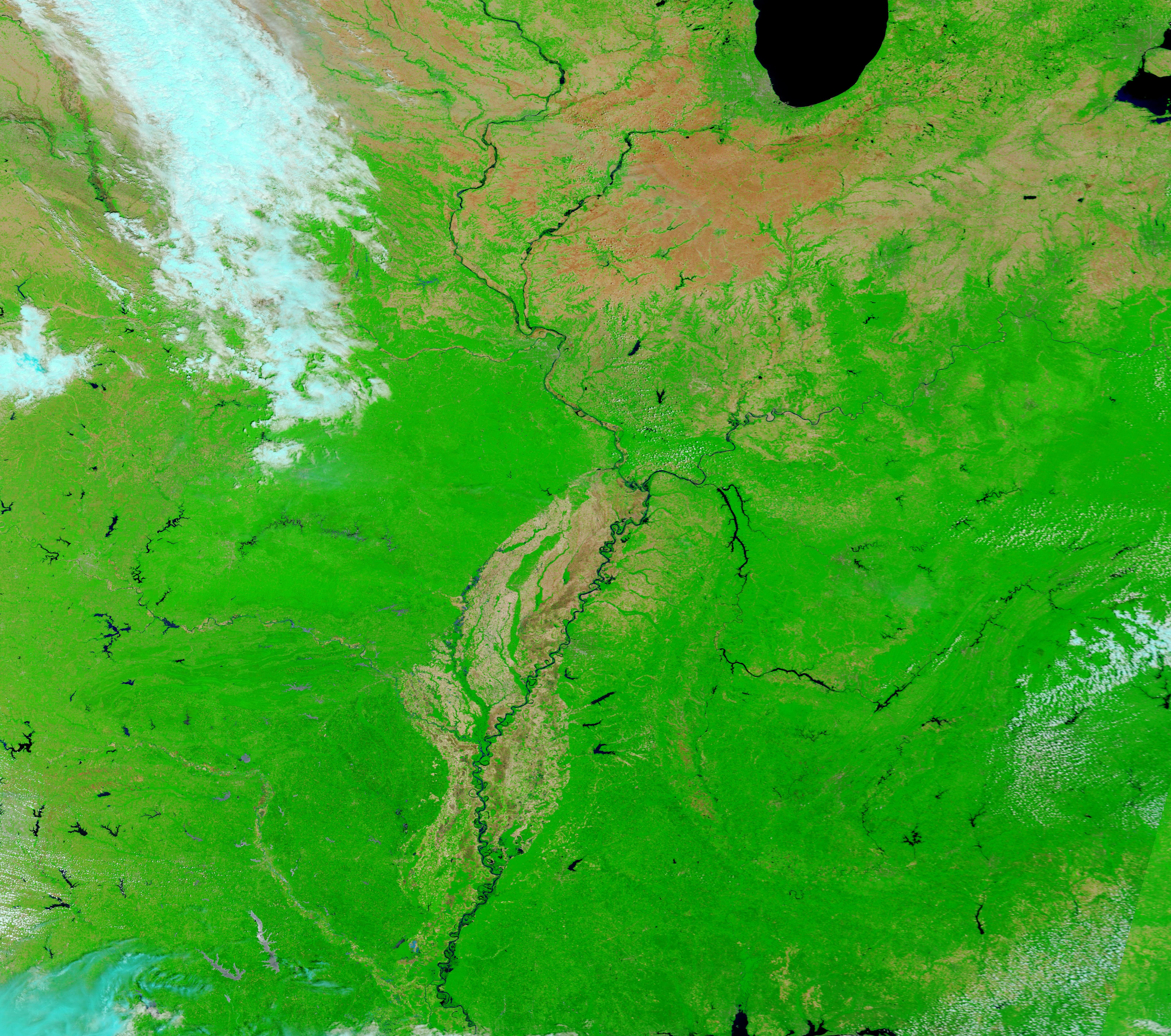
English: Each spring, the Mississippi River and its tributaries, including the Red, Ohio, and Missouri Rivers, receive large amounts of water from spring rains and snow melt, often causing flooding. Usually the swollen rivers reach peak by early June before floodwaters begin to recede.
On May 31, 2020, the Moderate Resolution Imaging Spectroradiometer (MODIS) on board NASA’s Terra satellite acquired a false-color image showing that the Mississippi and main tributaries remain swollen with copious amounts of water. This image shows a broad view of the Mississippi watershed, and stretches from Lake Michigan in the north to Mississippi and Louisiana in the south. By combining infrared with visible light (bands 7,2,1), water becomes very easily visible, appearing black or deep blue. Vegetation appears bright green and areas with open land appear tan. Cloud appears white. Every major river within the region appears very dark, indicating they are swollen with water. According to the National Weather Service on June 2, a flood warning continues for the Mississippi River at Louisiana until further notice. At 10:30 am on June 2, the stage was 15.3 feet, which is over the Flood stage of 15.0 feet. The river is forecast to crest near 15.4 feet by early on June 3, with minor flooding expected. The Mississippi River watershed is one of the largest in the world, consisting of more than a hundred tributaries. The watershed extends from the Appalachians to the Rocky Mountains and contributes to about 40 percent of the drainage in the continental United States. It drains water and sediment from 31 U.S. states, delivering both to the Gulf of Mexico via the Atchafalaya and Mississippi River deltas. |
||
| Date | Taken on 31 May 2020 | ||
| Source |
The Mississippi River (direct link)
|
||
| Author | MODIS Land Rapid Response Team, NASA GSFC |
| This media is a product of the Terra mission Credit and attribution belongs to the mission team, if not already specified in the "author" row |
Licensing
edit.jpg&action=edit§ion=2)
| This file is in the public domain in the United States because it was solely created by NASA. NASA copyright policy states that "NASA material is not protected by copyright unless noted". (See Template:PD-USGov, NASA copyright policy page or JPL Image Use Policy.) | ||
 |
Warnings:
|
File history
Click on a date/time to view the file as it appeared at that time.
| Date/Time | Thumbnail | Dimensions | User | Comment | |
|---|---|---|---|---|---|
| current | 03:04, 17 February 2024 | | 6,442 × 5,700 (4.89 MB) | OptimusPrimeBot (talk | contribs) | #Spacemedia - Upload of http://modis.gsfc.nasa.gov/gallery/images/image06032020_250m.jpg via Commons:Spacemedia |
You cannot overwrite this file.
File usage on Commons
There are no pages that use this file.
.jpg&oldid=852806541)