File:The Mourne Wall at the summit of Slieve Donard - geograph.org.uk - 1521858.jpg
No higher resolution available.
The_Mourne_Wall_at_the_summit_of_Slieve_Donard_-_geograph.org.uk_-_1521858.jpg (640 × 480 pixels, file size: 67 KB, MIME type: image/jpeg)
Captions
Captions
Add a one-line explanation of what this file represents
Summary edit
| Description |
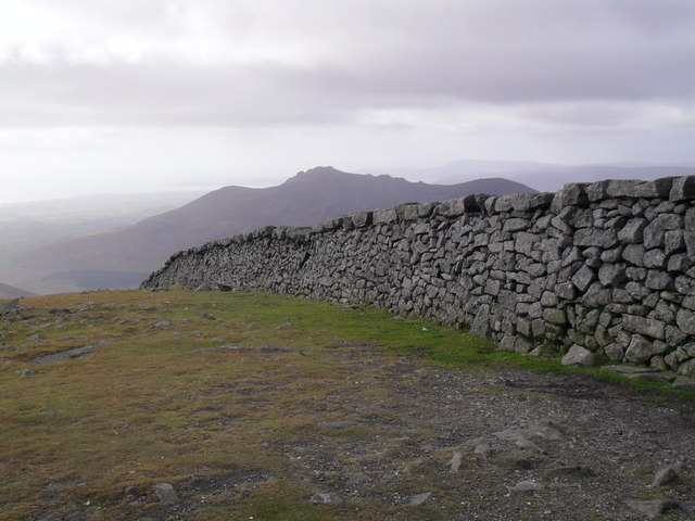
English: The Mourne Wall at the summit of Slieve Donard At 852 metres/2,795 feet, Slieve Donard is the highest peak in Northern Ireland as a Home Nation (Carrantoohil in County Kerry is the highest on the island).
The Mourne Wall, 26 miles in length, marks out the Mourne conservation area (farming prohibited). Construction started in 1904, with this section being completed in 1910. |
| Date | |
| Source | From geograph.org.uk |
| Author | Dean Molyneaux |
| Attribution (required by the license) | Dean Molyneaux / The Mourne Wall at the summit of Slieve Donard / |
| Camera location | | View this and other nearby images on: OpenStreetMap |
|---|
_heading:180.00&language=en)
| Object location | | View this and other nearby images on: OpenStreetMap |
|---|
_heading:180.00&language=en)
Licensing edit

|
This image was taken from the Geograph project collection. See this photograph's page on the Geograph website for the photographer's contact details. The copyright on this image is owned by Dean Molyneaux and is licensed for reuse under the Creative Commons Attribution-ShareAlike 2.0 license.
|
This file is licensed under the Creative Commons Attribution-Share Alike 2.0 Generic license.
Attribution: Dean Molyneaux
- You are free:
- to share – to copy, distribute and transmit the work
- to remix – to adapt the work
- Under the following conditions:
- attribution – You must give appropriate credit, provide a link to the license, and indicate if changes were made. You may do so in any reasonable manner, but not in any way that suggests the licensor endorses you or your use.
- share alike – If you remix, transform, or build upon the material, you must distribute your contributions under the same or compatible license as the original.
File history
Click on a date/time to view the file as it appeared at that time.
| Date/Time | Thumbnail | Dimensions | User | Comment | |
|---|---|---|---|---|---|
| current | 04:31, 3 March 2011 | | 640 × 480 (67 KB) | GeographBot (talk | contribs) | == {{int:filedesc}} == {{Information |description={{en|1=The Mourne Wall at the summit of Slieve Donard At 852 metres/2,795 feet, Slieve Donard is the highest peak in Northern Ireland as a Home Nation (Carrantoohil in County Kerry is the highest on the is |
You cannot overwrite this file.
File usage on Commons
There are no pages that use this file.