File:The Pentice Winchester.jpg

Size of this preview: 800 × 600 pixels. Other resolutions: 320 × 240 pixels | 640 × 480 pixels | 1,024 × 768 pixels | 1,280 × 960 pixels | 2,560 × 1,920 pixels | 4,000 × 3,000 pixels.
Original file (4,000 × 3,000 pixels, file size: 2.69 MB, MIME type: image/jpeg)
Captions
Captions
The Pentice Winchester
Summary
edit
| Description |
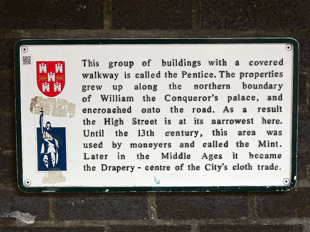
English: This group of buildings with a covered walkway is called the Pentice. The properties grew up along the northern boundary of William the Conqueror's palace, and encroached onto the road. As a result the High Street is at its narrowest here. Until the 13th century, this area was used by moneyers and called the Mint. Later in the Middle Ages it became the Drapery - centre of the City's cloth trade. |
| Date | |
| Source | Own work |
| Author | Spudgun67 |
| Camera location | | View this and other nearby images on: OpenStreetMap |
|---|
Licensing
edit
I, the copyright holder of this work, hereby publish it under the following license:
This file is licensed under the Creative Commons Attribution-Share Alike 4.0 International license.
- You are free:
- to share – to copy, distribute and transmit the work
- to remix – to adapt the work
- Under the following conditions:
- attribution – You must give appropriate credit, provide a link to the license, and indicate if changes were made. You may do so in any reasonable manner, but not in any way that suggests the licensor endorses you or your use.
- share alike – If you remix, transform, or build upon the material, you must distribute your contributions under the same or compatible license as the original.
File history
Click on a date/time to view the file as it appeared at that time.
| Date/Time | Thumbnail | Dimensions | User | Comment | |
|---|---|---|---|---|---|
| current | 16:40, 12 October 2020 | | 4,000 × 3,000 (2.69 MB) | Spudgun67 (talk | contribs) | Uploaded own work with UploadWizard |
You cannot overwrite this file.
File usage on Commons
There are no pages that use this file.