File:The Persian Gulf (MODIS 2021-03-10).jpg

Original file (4,504 × 3,321 pixels, file size: 1.11 MB, MIME type: image/jpeg)
Captions
Captions
Summary
edit.jpg&action=edit§ion=1)
| Description |
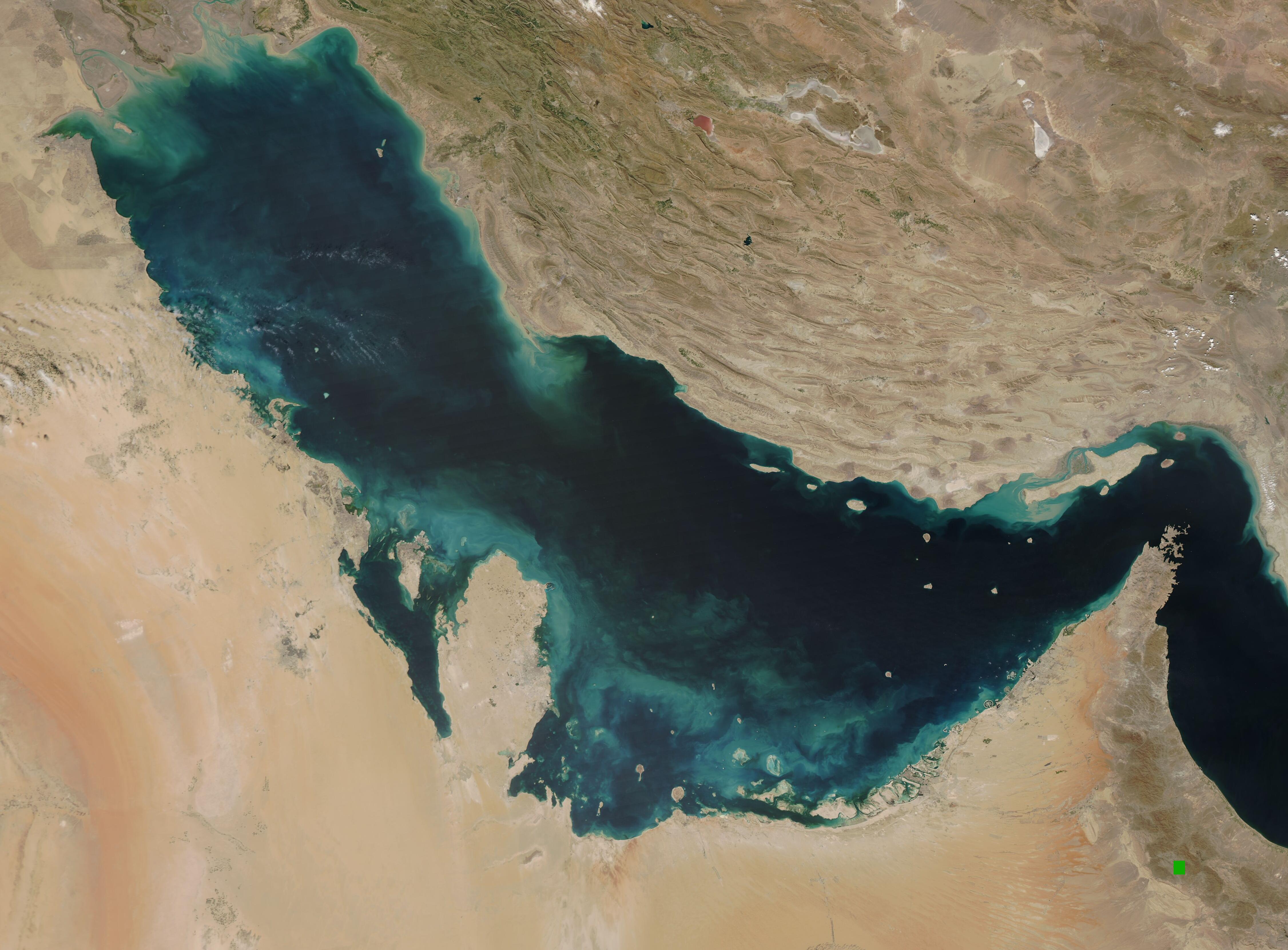
English: The blue waters of the Persian Gulf were colored with swirls of greens and teal in early March 2021. The Moderate Resolution Imaging Spectroradiometer (MODIS) on board NASA’s Aqua satellite acquired a true-color image of the scene on March 7.
Clouds of green swirling near the shore appears to be sediment that has been washed into the water from the land. Sediment can be carried by rain, washed from the shoreline or churned up from the bottom by tides or waves, or blown in by wind. Given the arid climate with nearly sand seas and deserts, at least some of the sediment is likely to have come from dust storms, but the location is suggestive of water action on relatively shallow bottoms. Along the northern edge of the Persian Gulf, the Shatt al Arab River spills large amounts of sediment into the waters. The sediment appears tan where it is close to the surface. As sediment sinks, the reflectivity changes and it then appears green. As it sinks further, sediment can leave just a faint stain in the waters. All of these color changes are visible from at mouth of the Shatt al Arab and stretch far into the Gulf. The Persian Gulf is flanked by the Arabian Peninsula with its vast tan, pink and white sand deserts in the south and west, and the dry mountains of Iran in the north. The pinch-point in the east is the Strait of Hormuz, a narrow constriction that connects the Persian Gulf with the Gulf of Oman. |
||
| Date | Taken on 7 March 2021 | ||
| Source |
The Persian Gulf (direct link)
|
||
| Author | MODIS Land Rapid Response Team, NASA GSFC |
| This media is a product of the Aqua mission Credit and attribution belongs to the mission team, if not already specified in the "author" row |
Licensing
edit.jpg&action=edit§ion=2)
| This file is in the public domain in the United States because it was solely created by NASA. NASA copyright policy states that "NASA material is not protected by copyright unless noted". (See Template:PD-USGov, NASA copyright policy page or JPL Image Use Policy.) | ||
 |
Warnings:
|
File history
Click on a date/time to view the file as it appeared at that time.
| Date/Time | Thumbnail | Dimensions | User | Comment | |
|---|---|---|---|---|---|
| current | 17:58, 30 January 2024 | | 4,504 × 3,321 (1.11 MB) | OptimusPrimeBot (talk | contribs) | #Spacemedia - Upload of http://modis.gsfc.nasa.gov/gallery/images/image03102021_250m.jpg via Commons:Spacemedia |
You cannot overwrite this file.
File usage on Commons
There are no pages that use this file.
.jpg&oldid=847282384)