File:The Saints' Way 1 - geograph.org.uk - 1129104.jpg
No higher resolution available.
The_Saints'_Way_1_-_geograph.org.uk_-_1129104.jpg (640 × 480 pixels, file size: 197 KB, MIME type: image/jpeg)
Captions
Captions
Add a one-line explanation of what this file represents
Summary
edit
| Description |
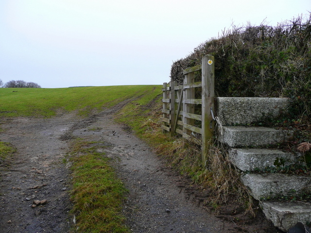
English: The Saints' Way 1 Looking west from the B3269; the Saints' Way Trail crosses mid-Cornwall from Padstow to Fowey covering 30 miles / 48 Km.
Although there is no historical evidence of a 'Saints' Way', sections of the trail are known ancient routes connecting shrines, standing stones, holy wells, chapels and churches. Linked together, the trail forms a fairly direct cross-county path which may have been used by Christian missionaries and pilgrims in the Dark and Middle Ages. The Saints' Way was also known as the Mariners' Way and used by traders from Ireland and Wales who wanted to avoid the dangerous waters around Lands End. Granite steps are provided but not needed if the gate is kept open. |
| Date | |
| Source | From geograph.org.uk |
| Author | Jonathan Billinger |
| Attribution (required by the license) | Jonathan Billinger / The Saints' Way 1 / |
| Camera location | | View this and other nearby images on: OpenStreetMap |
|---|
_heading:270.00&language=en)
| Object location | | View this and other nearby images on: OpenStreetMap |
|---|
_heading:270.00&language=en)
Licensing
edit

|
This image was taken from the Geograph project collection. See this photograph's page on the Geograph website for the photographer's contact details. The copyright on this image is owned by Jonathan Billinger and is licensed for reuse under the Creative Commons Attribution-ShareAlike 2.0 license.
|
This file is licensed under the Creative Commons Attribution-Share Alike 2.0 Generic license.
Attribution: Jonathan Billinger
- You are free:
- to share – to copy, distribute and transmit the work
- to remix – to adapt the work
- Under the following conditions:
- attribution – You must give appropriate credit, provide a link to the license, and indicate if changes were made. You may do so in any reasonable manner, but not in any way that suggests the licensor endorses you or your use.
- share alike – If you remix, transform, or build upon the material, you must distribute your contributions under the same or compatible license as the original.
File history
Click on a date/time to view the file as it appeared at that time.
| Date/Time | Thumbnail | Dimensions | User | Comment | |
|---|---|---|---|---|---|
| current | 01:50, 25 February 2011 | | 640 × 480 (197 KB) | GeographBot (talk | contribs) | == {{int:filedesc}} == {{Information |description={{en|1=The Saints' Way 1 Looking west from the B3269; the Saints' Way Trail crosses mid-Cornwall from Padstow to Fowey covering 30 miles / 48 Km. Although there is no historical evidence of a 'Saints' Way |
You cannot overwrite this file.
File usage on Commons
There are no pages that use this file.