File:The Solway Firth (31847858836).jpg

Original file (7,344 × 3,348 pixels, file size: 15.64 MB, MIME type: image/jpeg)
Captions
Captions
Summary
edit.jpg&action=edit§ion=1)
| Description |
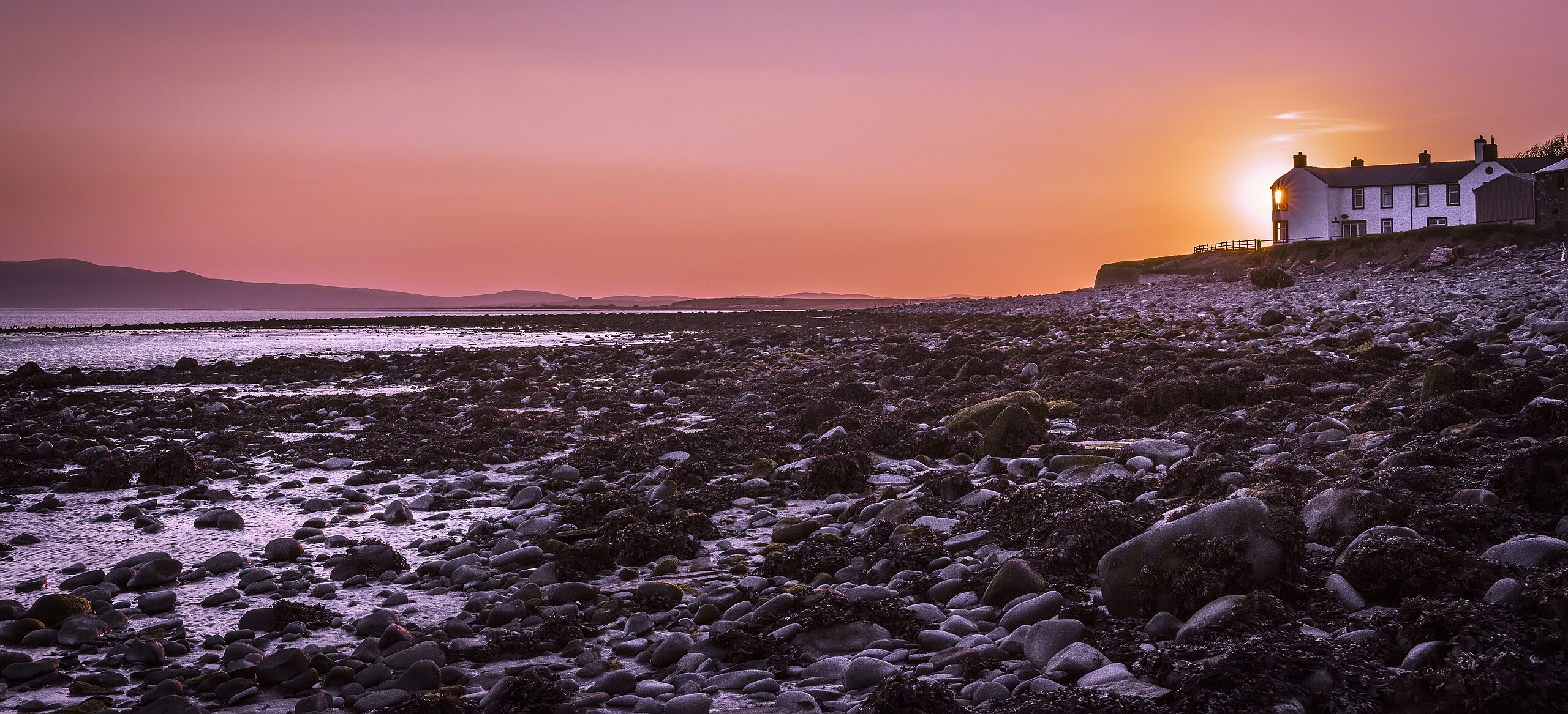
Looking down The Solway Firth from Newbie, near Annan, Dumfries & Galloway, Scotland. The Solway Firth is a firth that forms part of the border between England and Scotland, between Cumbria (including the Solway Plain) and Dumfries and Galloway. The coastline is characterised by lowland hills and small mountains. It is a mainly rural area with fishing and hill farming (as well as some arable farming) still playing a large part in the local economy. The Solway Coast was designated an Area of Outstanding Natural Beauty in 1964. Between 1869 and 1921, the estuary was crossed by the Solway Junction Railway on a 1780 m (5850 ft) iron viaduct. The line was built to carry iron ore from the Whitehaven area to Lanarkshire and was financed and operated by the Caledonian Railway of Scotland. The railway was not a financial success. After the railway ceased operating, the bridge provided a popular footpath for residents of Scotland (which was dry on a Sunday) to travel to England where alcoholic drink was available. The viaduct was demolished between 1931 and 1933. |
| Date | |
| Source | The Solway Firth |
| Author | James Johnstone from Ecclefechan, Scotland |
| Camera location | | View this and other nearby images on: OpenStreetMap |
|---|
.jpg¶ms=054.968705_N_-003.290314_E_globe:Earth_type:camera_source:Flickr_&language=en)
Licensing
edit.jpg&action=edit§ion=2)
- You are free:
- to share – to copy, distribute and transmit the work
- to remix – to adapt the work
- Under the following conditions:
- attribution – You must give appropriate credit, provide a link to the license, and indicate if changes were made. You may do so in any reasonable manner, but not in any way that suggests the licensor endorses you or your use.
| This image was originally posted to Flickr by TrotterFechan at https://flickr.com/photos/89786933@N02/31847858836. It was reviewed on 9 August 2023 by FlickreviewR 2 and was confirmed to be licensed under the terms of the cc-by-2.0. |
File history
Click on a date/time to view the file as it appeared at that time.
| Date/Time | Thumbnail | Dimensions | User | Comment | |
|---|---|---|---|---|---|
| current | 16:54, 9 August 2023 | | 7,344 × 3,348 (15.64 MB) | Юрий Д.К. (talk | contribs) | Transferred from Flickr via #flickr2commons |
You cannot overwrite this file.
File usage on Commons
There are no pages that use this file.
.jpg&oldid=894091109)