File:The Summit of Moel Morfydd and the View along Llantysilio Mountain - geograph.org.uk - 362748.jpg
Size of this preview: 450 × 600 pixels. Other resolutions: 180 × 240 pixels | 480 × 640 pixels.
Original file (480 × 640 pixels, file size: 166 KB, MIME type: image/jpeg)
Captions
Captions
Add a one-line explanation of what this file represents
Summary
edit
| Description |
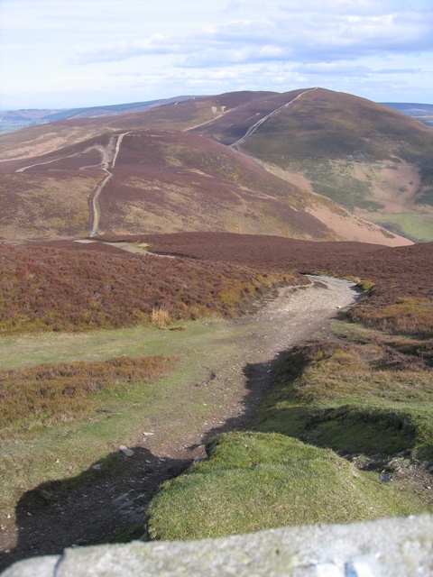
English: The Summit of Moel Morfydd and the View along Llantysilio Mountain From the trig pillar on the summit of Moel Morfydd the first 20 metres or so are still in the square. The track then continues along the ridge, first crossing the Moel y Gaer hill fort to the left, then Moel y Gamelin on the right, and finally Moel y Faen between them in the distance. On the far side of Moel y Faen is the A542 Horseshoe Pass road and the Ponderosa cafe. |
| Date | |
| Source | From geograph.org.uk |
| Author | John S Turner |
| Attribution (required by the license) | John S Turner / The Summit of Moel Morfydd and the View along Llantysilio Mountain / |
| Camera location | | View this and other nearby images on: OpenStreetMap |
|---|
_heading:45.00&language=en)
| Object location | | View this and other nearby images on: OpenStreetMap |
|---|
_heading:45.00&language=en)
Licensing
edit

|
This image was taken from the Geograph project collection. See this photograph's page on the Geograph website for the photographer's contact details. The copyright on this image is owned by John S Turner and is licensed for reuse under the Creative Commons Attribution-ShareAlike 2.0 license.
|
This file is licensed under the Creative Commons Attribution-Share Alike 2.0 Generic license.
Attribution: John S Turner
- You are free:
- to share – to copy, distribute and transmit the work
- to remix – to adapt the work
- Under the following conditions:
- attribution – You must give appropriate credit, provide a link to the license, and indicate if changes were made. You may do so in any reasonable manner, but not in any way that suggests the licensor endorses you or your use.
- share alike – If you remix, transform, or build upon the material, you must distribute your contributions under the same or compatible license as the original.
File history
Click on a date/time to view the file as it appeared at that time.
| Date/Time | Thumbnail | Dimensions | User | Comment | |
|---|---|---|---|---|---|
| current | 18:11, 4 January 2011 | | 480 × 640 (166 KB) | GeographBot (talk | contribs) | == {{int:filedesc}} == {{Information |description={{en|1=The Summit of Moel Morfydd and the View along Llantysilio Mountain From the trig pillar on the summit of Moel Morfydd the first 20 metres or so are still in the square. The track then continues alo |
You cannot overwrite this file.
File usage on Commons
There are no pages that use this file.