File:The dune ridge - geograph.org.uk - 995041.jpg
No higher resolution available.
The_dune_ridge_-_geograph.org.uk_-_995041.jpg (640 × 480 pixels, file size: 138 KB, MIME type: image/jpeg)
Captions
Captions
Add a one-line explanation of what this file represents
Summary edit
| Description |
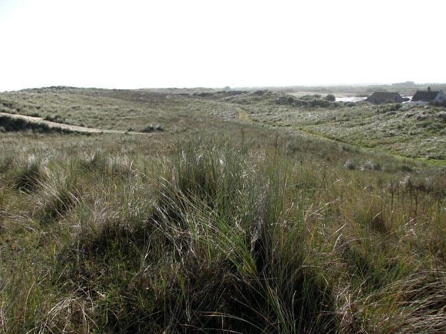
English: The dune ridge. A southeasterly view along the dune ridge; the roof of Warren Farm - situated at the southeastern corner of Waxham Sands Holiday Park > 994846 - 994983 can be seen at left. The park adjoins a Nature Reserve and nestles beneath the sand dunes. It comprises of office, small supermarket, hot food take-away, recreation area, flush toilets, fully tiled showers, laundry and ample water points and has access to its own half mile of sandy beach. |
| Date | |
| Source | From geograph.org.uk |
| Author | Evelyn Simak |
| Attribution (required by the license) | Evelyn Simak / The dune ridge / |
| Camera location | | View this and other nearby images on: OpenStreetMap |
|---|
_heading:135.00&language=en)
| Object location | | View this and other nearby images on: OpenStreetMap |
|---|
_heading:135.00&language=en)
Licensing edit

|
This image was taken from the Geograph project collection. See this photograph's page on the Geograph website for the photographer's contact details. The copyright on this image is owned by Evelyn Simak and is licensed for reuse under the Creative Commons Attribution-ShareAlike 2.0 license.
|
This file is licensed under the Creative Commons Attribution-Share Alike 2.0 Generic license.
Attribution: Evelyn Simak
- You are free:
- to share – to copy, distribute and transmit the work
- to remix – to adapt the work
- Under the following conditions:
- attribution – You must give appropriate credit, provide a link to the license, and indicate if changes were made. You may do so in any reasonable manner, but not in any way that suggests the licensor endorses you or your use.
- share alike – If you remix, transform, or build upon the material, you must distribute your contributions under the same or compatible license as the original.
File history
Click on a date/time to view the file as it appeared at that time.
| Date/Time | Thumbnail | Dimensions | User | Comment | |
|---|---|---|---|---|---|
| current | 05:28, 23 February 2011 | | 640 × 480 (138 KB) | GeographBot (talk | contribs) | == {{int:filedesc}} == {{Information |description={{en|1=The dune ridge A southeasterly view along the dune ridge; the roof of Warren Farm - situated at the southeastern corner of Waxham Sands Holiday Park > http://www.geograph.org.uk/photo/994846 - http: |
You cannot overwrite this file.
File usage on Commons
There are no pages that use this file.