File:The end Lofoten.jpg

Size of this preview: 800 × 530 pixels. Other resolutions: 320 × 212 pixels | 640 × 424 pixels | 1,024 × 678 pixels | 1,280 × 848 pixels | 2,560 × 1,696 pixels | 4,928 × 3,264 pixels.
Original file (4,928 × 3,264 pixels, file size: 2.12 MB, MIME type: image/jpeg)
Captions
Captions
Add a one-line explanation of what this file represents
Summary edit
| Description |
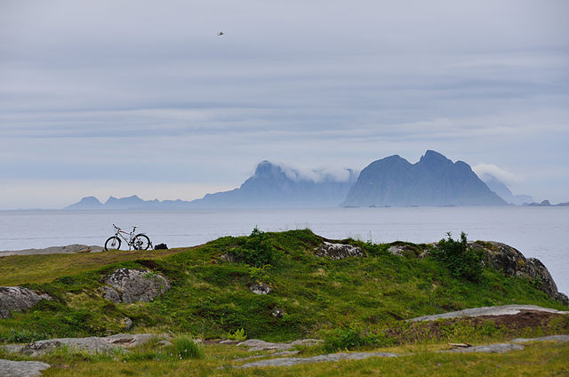
English: From Å, Moskenes towards Mosken and Værøy islands. Original description: Top South of the Lofoten reachable by land |
| Date | |
| Source | The end |
| Author | Tristan Schmurr from Luxembourg, Luxembourg |
| Camera location | | View this and other nearby images on: OpenStreetMap |
|---|
Licensing edit
This file is licensed under the Creative Commons Attribution 2.0 Generic license.
- You are free:
- to share – to copy, distribute and transmit the work
- to remix – to adapt the work
- Under the following conditions:
- attribution – You must give appropriate credit, provide a link to the license, and indicate if changes were made. You may do so in any reasonable manner, but not in any way that suggests the licensor endorses you or your use.
| This image was originally posted to Flickr by kewl at https://www.flickr.com/photos/58411470@N00/6348808220. It was reviewed on 18 February 2012 by FlickreviewR and was confirmed to be licensed under the terms of the cc-by-2.0. |
File history
Click on a date/time to view the file as it appeared at that time.
| Date/Time | Thumbnail | Dimensions | User | Comment | |
|---|---|---|---|---|---|
| current | 17:15, 18 February 2012 | | 4,928 × 3,264 (2.12 MB) | Blue Elf (talk | contribs) | {{Information |Description=From Å towards Mosken and Værøy islands. Original description: Top South of the Lofoten reachable by land |Source=[http://www.flickr.com/photos/kewl/6348808220/ The end] |Date=2011-06-29 16:14 |Author=[http://www.flickr.com/p |
You cannot overwrite this file.
File usage on Commons
There are no pages that use this file.
File usage on other wikis
The following other wikis use this file:
- Usage on it.wikivoyage.org