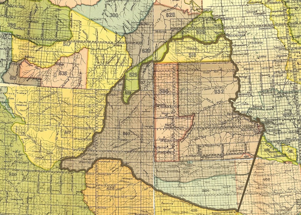
File:The outline of the 1851 Sioux territory. Crow 1851 territory (yellow 517, grey 619 and pink 635).jpg

Size of this preview: 800 × 571 pixels. Other resolutions: 320 × 228 pixels | 640 × 457 pixels | 1,024 × 731 pixels | 1,280 × 913 pixels | 2,200 × 1,570 pixels.
Original file (2,200 × 1,570 pixels, file size: 2.02 MB, MIME type: image/jpeg)
Captions
Captions
Add a one-line explanation of what this file represents
Summary
edit.jpg&action=edit§ion=1)
| Description |
English: The outline of the 1851 Sioux territory as defined in the Fort Laramie treaty (1851). Also the Crow 1851 territory and parts of other adjoining Indian territories. The map covers parts of present-day Montana, North Dakota, South Dakota, Wyoming and Nebraska |
| Date | |
| Source | Smithsonian Institution. 18th Annual Report of the Bureau of American Ethnology, 1896-'97. Washington, GPO 1899 |
| Author | Unknown author |
North America, U.S., North Dakota, South Dakota, Montana, Wyoming, Nebraska
Licensing
edit.jpg&action=edit§ion=2)
This work is in the public domain in the United States because it was published (or registered with the U.S. Copyright Office) before January 1, 1929.
Public domain works must be out of copyright in both the United States and in the source country of the work in order to be hosted on the Commons. If the work is not a U.S. work, the file must have an additional copyright tag indicating the copyright status in the source country.
Note: This tag should not be used for sound recordings. |
File history
Click on a date/time to view the file as it appeared at that time.
| Date/Time | Thumbnail | Dimensions | User | Comment | |
|---|---|---|---|---|---|
| current | 06:43, 21 April 2018 | | 2,200 × 1,570 (2.02 MB) | Naawada2016 (talk | contribs) | User created page with UploadWizard |
You cannot overwrite this file.
File usage on Commons
There are no pages that use this file.
File usage on other wikis
The following other wikis use this file:
- Usage on en.wikipedia.org
- Usage on fr.wikipedia.org
.jpg&oldid=450848872)