File:Thor's Stone at Thursley Common.JPG
Size of this preview: 800 × 450 pixels. Other resolutions: 320 × 180 pixels | 640 × 360 pixels | 1,024 × 575 pixels | 1,280 × 719 pixels | 2,560 × 1,439 pixels | 4,000 × 2,248 pixels.
Original file (4,000 × 2,248 pixels, file size: 4.17 MB, MIME type: image/jpeg)
Captions
Captions
Add a one-line explanation of what this file represents
Summary edit
| Camera location | | View this and other nearby images on: OpenStreetMap |
|---|
| Description |
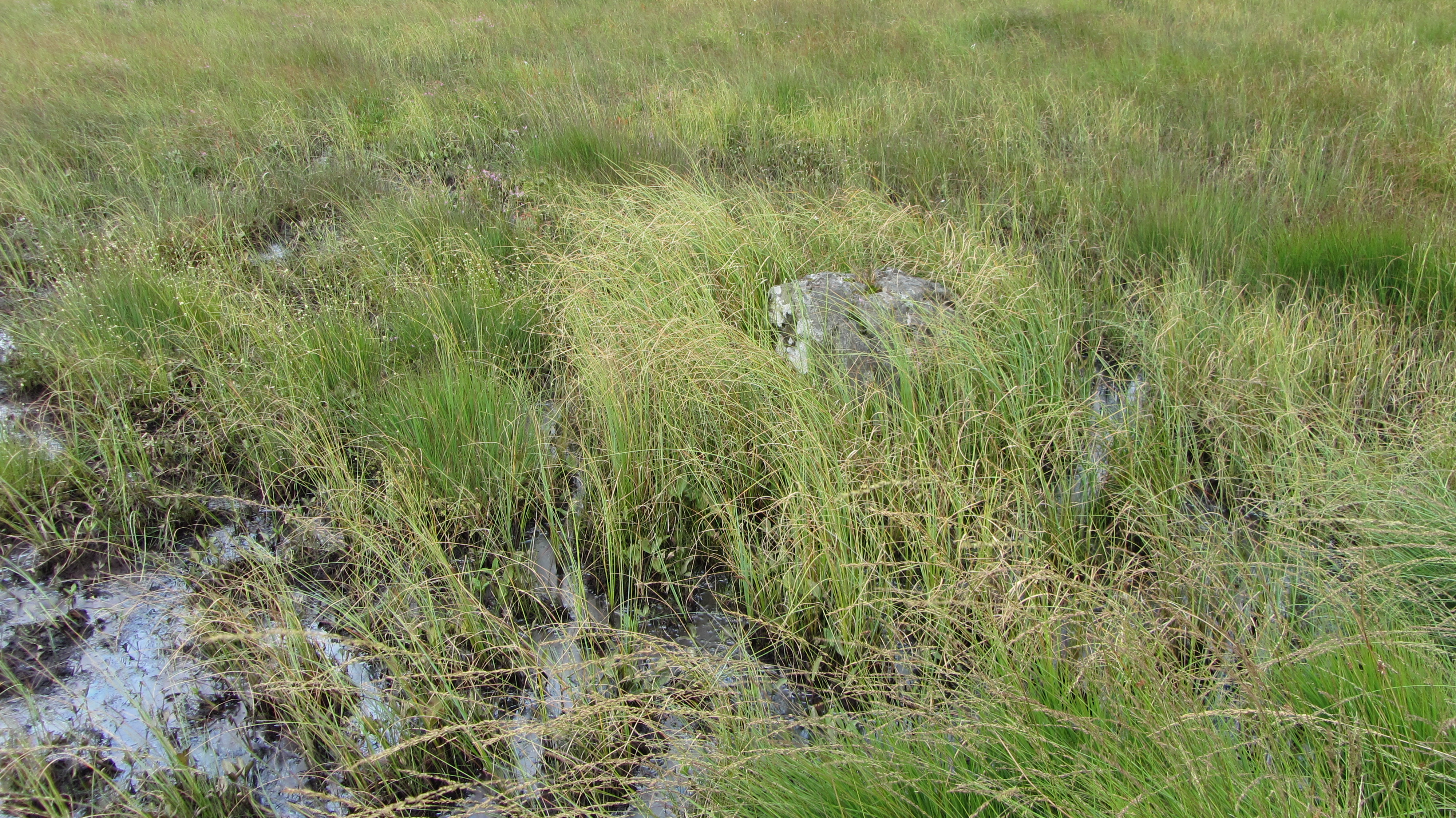
English: Closeup of a large stone known as "Thor's Stone" or the "Cricklestone" in the marsh by edge of Pudmore Pond, on Thursley Common, Surrey. It is reputed to be an ancient Celtic boundary stone, but may merely be of one of several (possibly late 18th century) boundary marker stones, marking the southern extent of Peper Harow. An outcrop of sandstone to the north-east of Pudmore Pond is thought by some to be the original "Thor's Stone", and it has been suggested that the name of "Thor's Stone" was transferred from the sandstone outcrop to the stone by Pudmore Pond in the late 19th century. The stone is mentioned by Arthur Conan Doyle in his historical novel Sir Nigel: "He had ridden over Thursley Ridge past the old stone where in days gone by at the place of Thor the wild Saxons worshiped their war-god. Nigel looked at it with a wary eye and spurred Pommers onward as he passed it, for still it was said that wild fires danced round it on the moonless nights, and they who had ears for such things could hear the scream and sob of those whose lives had been ripped from them that the fiend might be honored. Thor's stone, Thor's jumps, Thor's punch-bowl—the whole country-side was one grim monument to the God of Battles, though the pious monks had changed his uncouth name for that of the Devil his father, so that it was the Devil's jumps and the Devil's punch-bowl of which they spoke." (ch.11). |
| Date | |
| Source | Own work |
| Author | BabelStone |
| Other versions | File:Closeup of Thor's Stone at Thursley Common.JPG |
Licensing edit
I, the copyright holder of this work, hereby publish it under the following license:
This file is licensed under the Creative Commons Attribution-Share Alike 3.0 Unported license.
- You are free:
- to share – to copy, distribute and transmit the work
- to remix – to adapt the work
- Under the following conditions:
- attribution – You must give appropriate credit, provide a link to the license, and indicate if changes were made. You may do so in any reasonable manner, but not in any way that suggests the licensor endorses you or your use.
- share alike – If you remix, transform, or build upon the material, you must distribute your contributions under the same or compatible license as the original.
File history
Click on a date/time to view the file as it appeared at that time.
| Date/Time | Thumbnail | Dimensions | User | Comment | |
|---|---|---|---|---|---|
| current | 15:02, 27 August 2012 | | 4,000 × 2,248 (4.17 MB) | BabelStone (talk | contribs) | User created page with UploadWizard |
You cannot overwrite this file.
File usage on Commons
The following page uses this file: