File:Tillyfourie railway station.pdf

Size of this JPG preview of this PDF file: 800 × 565 pixels. Other resolutions: 320 × 226 pixels | 640 × 452 pixels | 1,024 × 724 pixels | 1,280 × 905 pixels | 2,479 × 1,752 pixels.
Original file (2,479 × 1,752 pixels, file size: 497 KB, MIME type: application/pdf)
Captions
Captions
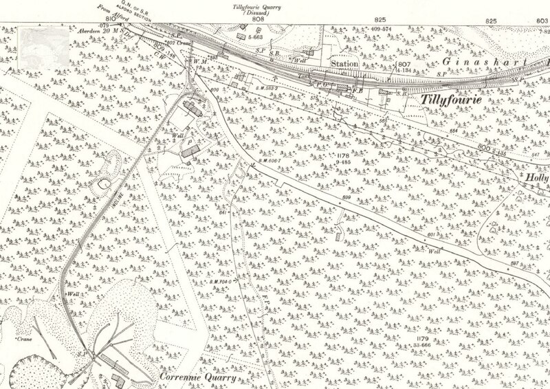
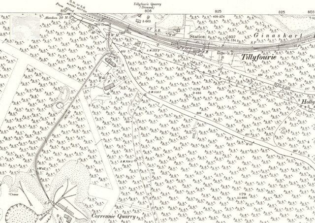
Tillyfourie railway station and Corrennie Quarry inclined plane
Summary
edit| Description |
English: Tillyfourie railway station on Ordnance Survey 25 inch map Aberdeenshire LXIII.15 (Cluny; Monymusk; Tough)
Revised: 1899, Publication date: 1900 |
| Date | |
| Source | https://maps.nls.uk/view/82860390 |
| Author | Ordnance Survey |
| Camera location | | View this and other nearby images on: OpenStreetMap |
|---|
Licensing
editThis file is licensed under the Creative Commons Attribution 4.0 International license.
- You are free:
- to share – to copy, distribute and transmit the work
- to remix – to adapt the work
- Under the following conditions:
- attribution – You must give appropriate credit, provide a link to the license, and indicate if changes were made. You may do so in any reasonable manner, but not in any way that suggests the licensor endorses you or your use.
File history
Click on a date/time to view the file as it appeared at that time.
| Date/Time | Thumbnail | Dimensions | User | Comment | |
|---|---|---|---|---|---|
| current | 19:15, 4 June 2021 |  | 2,479 × 1,752 (497 KB) | Nempnet (talk | contribs) | Uploaded a work by Ordnance Survey from https://maps.nls.uk/view/82860390 with UploadWizard |
You cannot overwrite this file.
File usage on Commons
There are no pages that use this file.
File usage on other wikis
The following other wikis use this file:
- Usage on en.wikipedia.org