File:Tischbein Plan de Berlin 1748.jpg
Size of this preview: 409 × 599 pixels. Other resolutions: 164 × 240 pixels | 327 × 480 pixels | 524 × 768 pixels | 698 × 1,024 pixels | 1,397 × 2,048 pixels | 2,871 × 4,208 pixels.
Original file (2,871 × 4,208 pixels, file size: 4.29 MB, MIME type: image/jpeg)
Captions
Captions
Add a one-line explanation of what this file represents
Summary
edit
| Description |
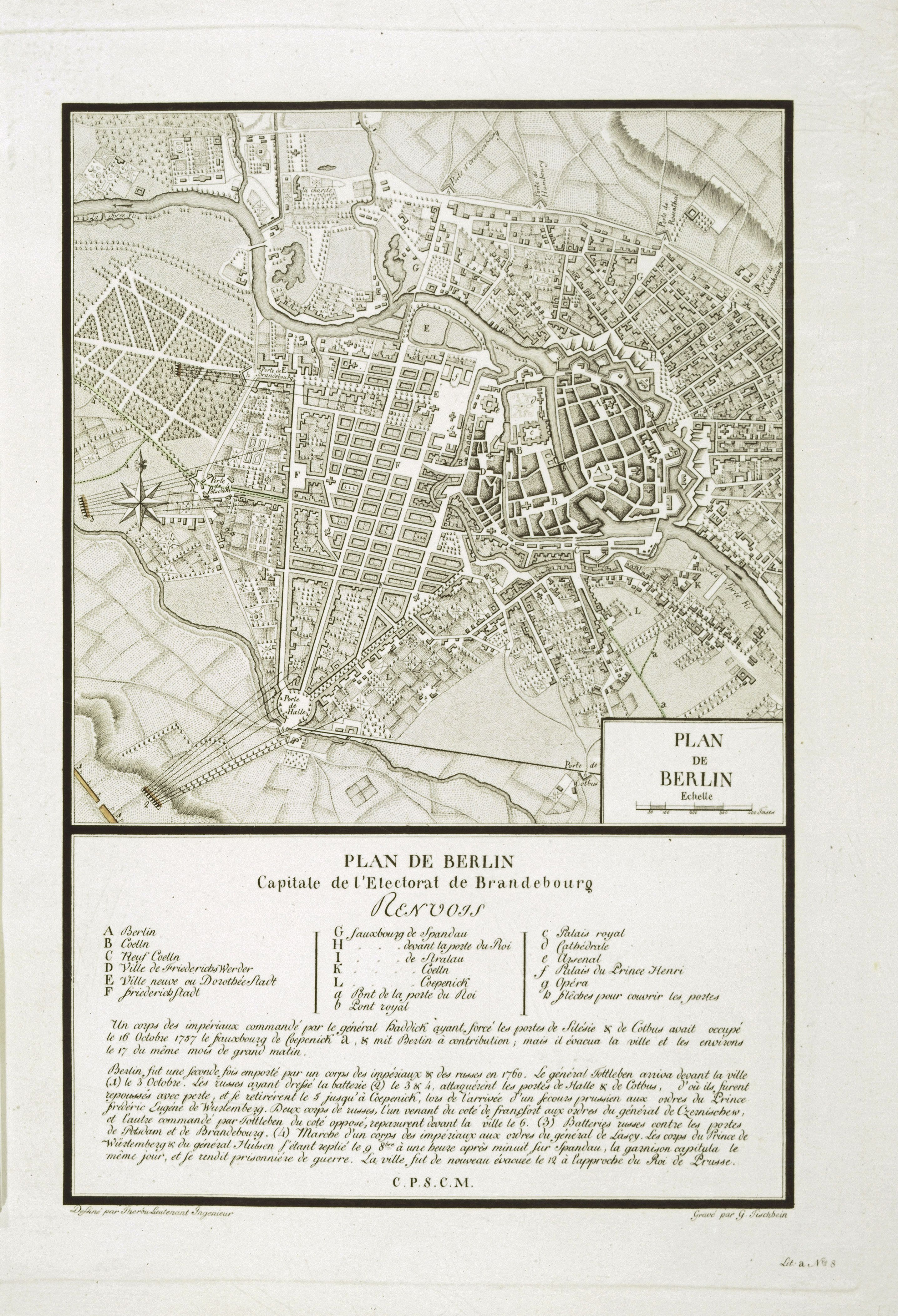
Plan de Berlin. Plan de Berlin capitale de l’electorat de Brandebourg.
|
| Date | |
| Source | The Ryhiner Map Collection - Universitätsbibliothek Bern (online) |
| Author | G. Tischbein, Therbu, L. |
Licensing
edit
|
This is a faithful photographic reproduction of a two-dimensional, public domain work of art. The work of art itself is in the public domain for the following reason:
The official position taken by the Wikimedia Foundation is that "faithful reproductions of two-dimensional public domain works of art are public domain".
This photographic reproduction is therefore also considered to be in the public domain in the United States. In other jurisdictions, re-use of this content may be restricted; see Reuse of PD-Art photographs for details. | ||||
File history
Click on a date/time to view the file as it appeared at that time.
| Date/Time | Thumbnail | Dimensions | User | Comment | |
|---|---|---|---|---|---|
| current | 21:35, 6 April 2014 | | 2,871 × 4,208 (4.29 MB) | Alexrk2 (talk | contribs) | == {{int:description}} == {{InteractiveViewer}} {{Information |Description='''Plan de Berlin.''' Plan de Berlin capitale de l’electorat de Brandebourg. * Format: 23,5 x 36,0 cm (23,0 x 23,0 nur der Plan) * Maßstab: 1: 18 400 * Orientie... |
You cannot overwrite this file.
File usage on Commons
There are no pages that use this file.