File:Todd brook 077820 71f5b3dc.jpg
Size of this preview: 800 × 600 pixels. Other resolutions: 320 × 240 pixels | 640 × 480 pixels | 1,024 × 768 pixels | 1,280 × 960 pixels.
Original file (1,280 × 960 pixels, file size: 290 KB, MIME type: image/jpeg)
Captions
Captions
Add a one-line explanation of what this file represents
| Camera location | | View this and other nearby images on: OpenStreetMap |
|---|
| Object location | | View this and other nearby images on: OpenStreetMap |
|---|
_region:GB-EAW_heading:225.00&language=en)
| Description |
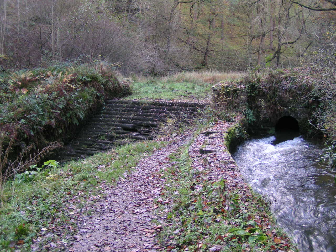
Todd Brook Derbyshire. Near w:Whaley Bridge. Weir and conduit, Todd Brook. At this point above w:Toddbrook Reservoir, water from Todd Brook flows either through a sluice into a conduit (right) or over a weir (left) and into the Reservoir. OSGB36: geotagged! SJ 998 805 [100m precision] WGS84: 53:19.2855N 2:0.2678W |
| Date | |
| Source | Own work |
| Author | Dave Dunford |
| Permission (Reusing this file) |
Creative Commons Attribution Share-alike license 2.0 |
| Other versions |
This file is licensed under the Creative Commons Attribution-Share Alike 2.0 Generic license.
Attribution: Dave Dunford
- You are free:
- to share – to copy, distribute and transmit the work
- to remix – to adapt the work
- Under the following conditions:
- attribution – You must give appropriate credit, provide a link to the license, and indicate if changes were made. You may do so in any reasonable manner, but not in any way that suggests the licensor endorses you or your use.
- share alike – If you remix, transform, or build upon the material, you must distribute your contributions under the same or compatible license as the original.
File history
Click on a date/time to view the file as it appeared at that time.
| Date/Time | Thumbnail | Dimensions | User | Comment | |
|---|---|---|---|---|---|
| current | 11:24, 2 January 2011 | | 1,280 × 960 (290 KB) | Dave.Dunford (talk | contribs) | Larger (original) version |
| 17:34, 16 May 2008 |  | 640 × 480 (171 KB) | Victuallers (talk | contribs) | {{Information |Description=Todd Brook Derbyshire. Near w:Whaley Bridge. Weir and conduit, Todd Brook. At this point above w:Toddbrook Reservoir, water from Todd Brook flows either through a sluice into a conduit (right) or over a |
You cannot overwrite this file.
File usage on Commons
The following page uses this file:
File usage on other wikis
The following other wikis use this file:
- Usage on en.wikipedia.org
- Usage on fa.wikipedia.org
- Usage on www.wikidata.org